
Those more challenging sections of the walk have now been completed and I am back at Winchcombe, but this time Rosalind isn’t with me. In 2014 she was diagnosed with myeloma and can no longer walk very far or carry a pack on her back. I am on my own for the final sections of the Land’s End to John O’Groats epic.
Earlier in the year I had walked from Buxton to Hebden Bridge encountering all sorts of problems, ranging from a misbehaving hip to high temperatures, thunder storms, flash floods, mist and diverted paths, not to mention getting lost. Hopefully, this time I would fare better.
I had been staying in Winchcombe for a couple of nights with my husband, Dave and our little dog, Tyson. We had visited Rosalind and Verney at their home in Wotton-under-Edge the previous day, chatting about old times and the various adventures we had had over the years. Rosalind wished me well and would be following my progress.
It was going to be a hot day with thunderstorms forecast for later in the week. Would this trek be a repeat of the earlier one? Surely not.
I went out first thing to buy freshly baked pasties for lunch at the delicatessen across the road from the hotel. Dave and Tyson were going to accompany me for the start of the walk, so after breakfast we all set off through the churchyard on the Winchcombe Way. We were so used to following Tyson, who usually leads his walks, that we missed the turning, going about half a mile up the road before realising our error.
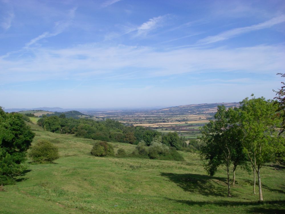
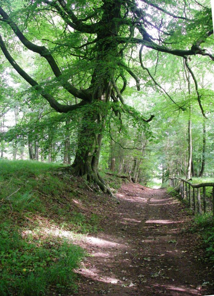
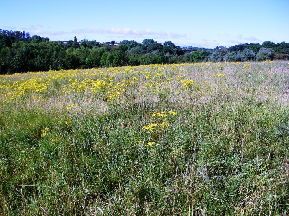
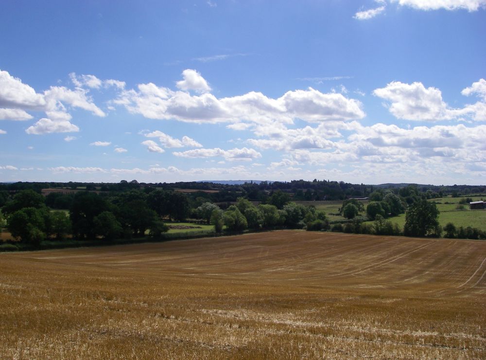
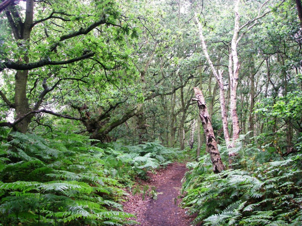
The first field on the correct route was occupied by cows with their calves and BIG DADDY, but none of them paid any attention to us as we climbed up to the top of the ridge. It was a clear day with far-reaching views across the valley towards my destination. As Dave was using his GPS I didn’t get out my map. Soon we were heading down to Gretton on an indistinct path instead of keeping to the high ground as originally planned. We tried to rectify the error, but when the GPS gave up altogether I sent Dave and Tyson packing, taking the shorter way through Gretton just using the map. I continued to Alderton where I had a cup of coffee in the Gardeners Arms before deciding to make another variation, preferring to follow a bridleway up the hill into cool Dumbleton Wood.
After meandering through the trees at the top of Perretts Hill the path descended steeply, passing Didcot Farm then continuing past Didcot Cottages to cross the main road. From there it wasn’t far to Ashton under Hill where I would be spending the night.
A few lunchtime customers were still drinking up at the Star Inn when I went in to order a pot of tea. Despite the initial delays in finding the path I had covered the ground quickly.
Suitably refreshed I wandered up the main street with its pretty timber and stone cottages, the 17th century stone manor house, 15th century black and white farmhouse and other interesting grade II listed buildings. Reaching Holloway Farmhouse where I was staying I was given the run of the kitchen and shown where the key was hidden. My hosts were going on holiday that evening; I was to get my own breakfast.
After I had settled in I went back down to the Star for a surprisingly large ‘small’ helping of fish and chips which was delicious.
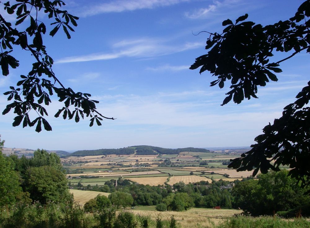
The village church of St Barbara dates from Norman times. The church bells were ringing as I left the inn and walked through the churchyard, now on the Wychavon Way. The route has been altered, now finishing in Broadway, not Winchcombe. Climbing the hillside, I sat on a seat overlooking the surrounding countryside. The view was superb; the evening sunlight was casting a golden glow on the little cottages and homesteads in the scattered villages. Everything was peaceful, a fitting end to the day.
Turning off the Wychavon Way into Baker’s Lane I returned to the farmhouse.
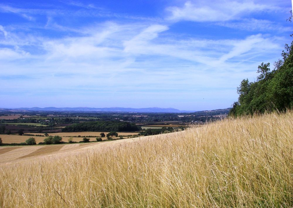
After a basic breakfast next morning I was on my way again by 8 am, going up Baker’s Lane to pick up the Wychavon Way across the rough pastures on Bredon Little Hill. The last of the summer flowers were in bloom, poppies, thistles, the common willow herb and loosestrife adding colour to the hillside. The hawthorn berries were still ripening but the first blackberries were firm and juicy, making a tasty contribution to my ‘five a day’.
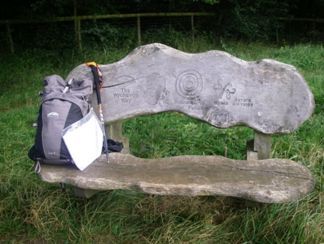
A seat at the top of the hill was engraved, ‘Wychavon Way – Welcome to our Future – Severn Waste Services’, which was rather perplexing. I found out later that ‘Welcome to our Future’ was a charity. Evidently Severn Waste Services had provided the money and ‘Welcome to our Future’ had facilitated the placing of several of these seats at viewpoints or picnic areas along the route of the Wychavon Way.
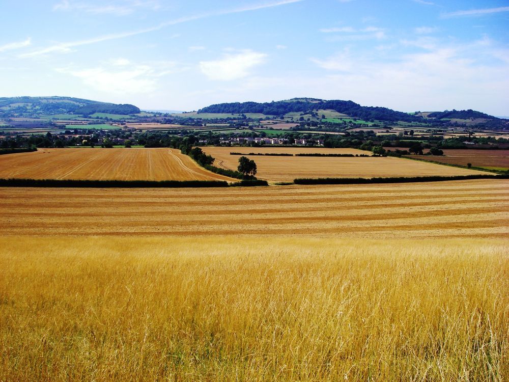
Bredon Hill, 961ft in height, was once an Iron Age hill fort before being superseded by a Roman encampment. It is in the Cotswolds area of outstanding natural beauty and is a prominent feature on the landscape. On the high point is Parsons Folly, a summer house built by John Parsons, a local landowner, in the 18th century. The height of the folly is 39ft, bringing the total height of hill plus folly to 1,000ft.
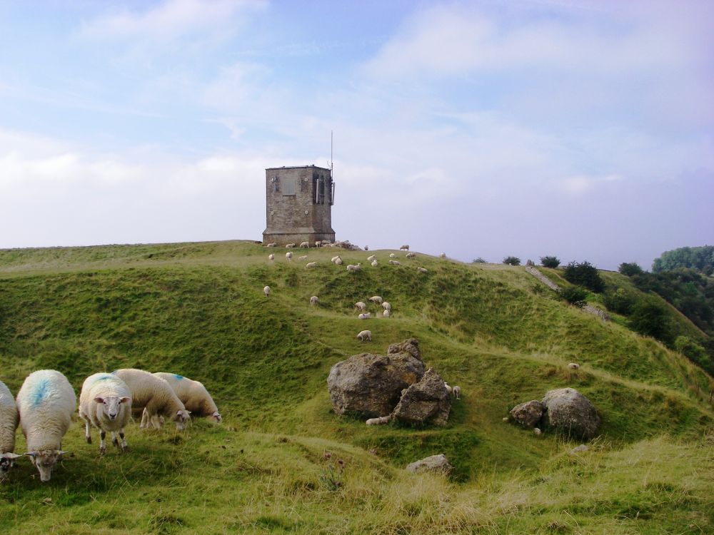
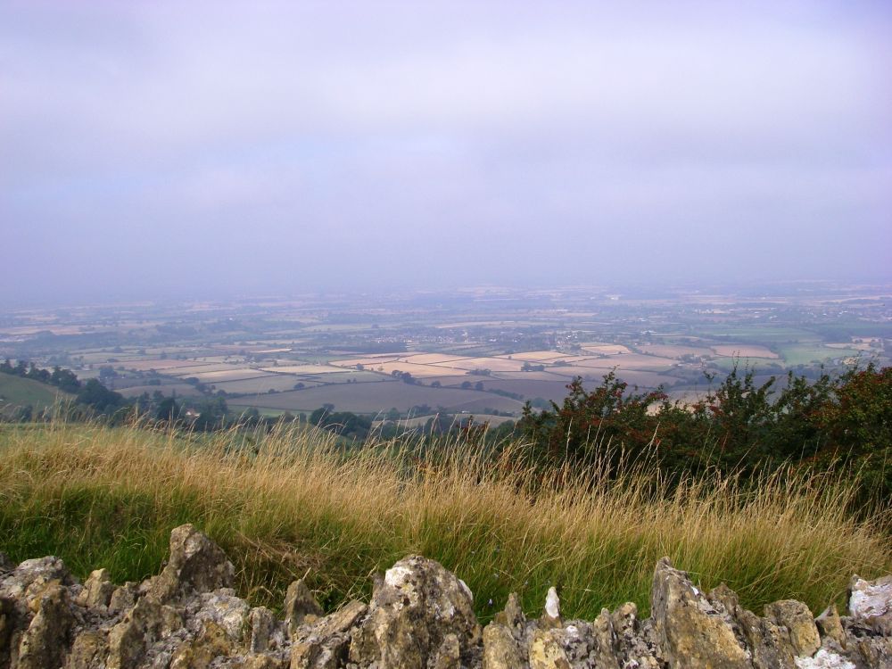
Below the tower is the Banbury Stone, the name deriving from ‘Baenintesbury’ as the fort was known in the 8th century. The views from the top were far-reaching but rather hazy. On a clear day they would have been stunning.
Whilst exploring the fort I got rather disorientated, missing the footpath which descended from the main track. The Wychavon Way is signed as if walking from Droitwich Spa to Broadway and is not well marked if coming from the opposite direction. When I finally found the path the descent down the grassy hillside to Great Comberton was very pretty. Soon I was walking beside the River Avon, a tributary of the River Severn.
After the path left the river bank navigation became more difficult. The Wychavon Way was not shown on the map, signs were vague or misleading and some had been defaced. This gave me the feeling that walkers weren’t welcome. Reaching Pensham I walked up the lane to the picnic place at Pershore Bridge where there was another of the seats paid for by Severn Waste Services.
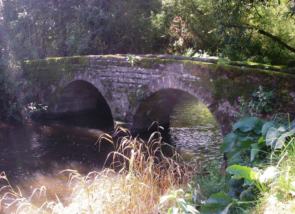
The story goes that the original bridge across the River Avon at Pershore was built in the 15th century when the abbot drowned by falling off the stepping stones. It was rebuilt several times over the centuries but is now a footbridge only. A new bridge carries the traffic across the river.
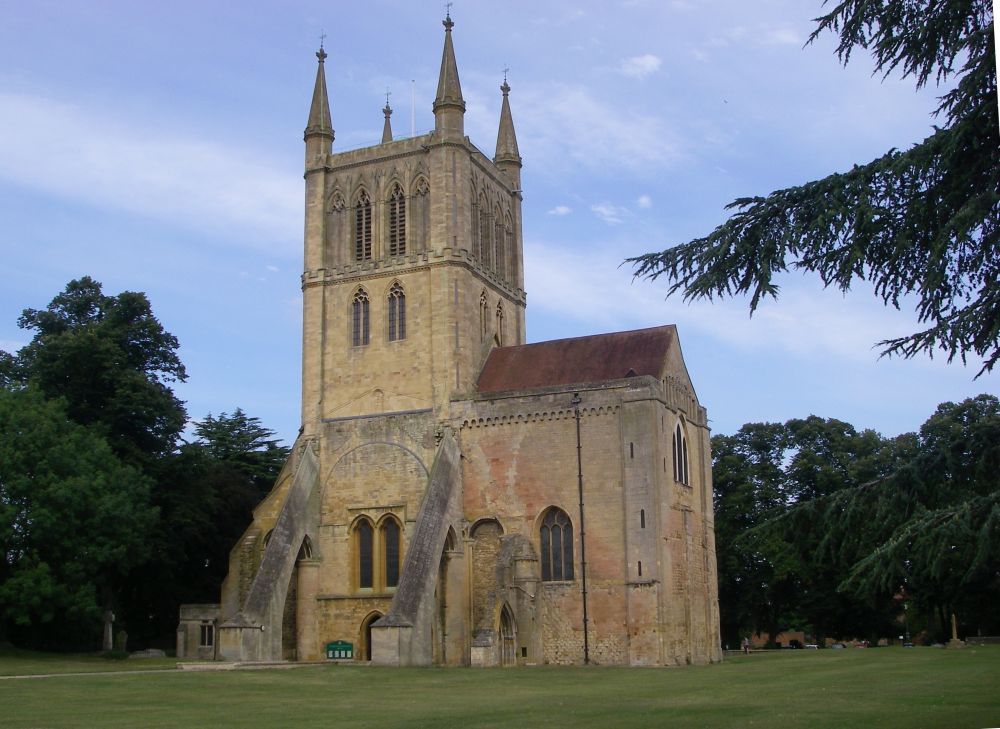
In Pershore I had a baked potato with cheese and beans on the riverside terrace of the Brandy Cask before wandering through Abbey Park and taking a photo of the abbey, which dates from the 11th century. There is evidence that there had been a monastery on the site as far back as the 7th century.
The Wychavon Way then took me down to the water meadows along the river. A large group of children were making the most of the hot weather, messing about on the bank, jumping into the water and generally enjoying themselves.
Coming into Wyre Piddle I met my hostess who was returning to Arbour House from a W.I. meeting at the church. She accompanied me to my lodgings and showed me to my room. After a rest I went for a walk to admire the black and white cottages along Church Road. A little old lady (who turned out to be three years older than me) invited me into one of them for a cup of coffee. It was compact without being cramped and she shared the space with a thirty-year old parrot. A steeply terraced garden led down to the river. We spent a pleasant half hour having a nostalgic chat about the ‘good old days’, leaving out the not so good bits, of course.
Wyre Piddle got its name from the Piddle Brook, a marshy streamlet that meanders through the village before joining the River Avon. Settlements going back to the Bronze Age have been excavated here and in 1967 a cache of silver coins was found, none of the coins dating from after 1467.
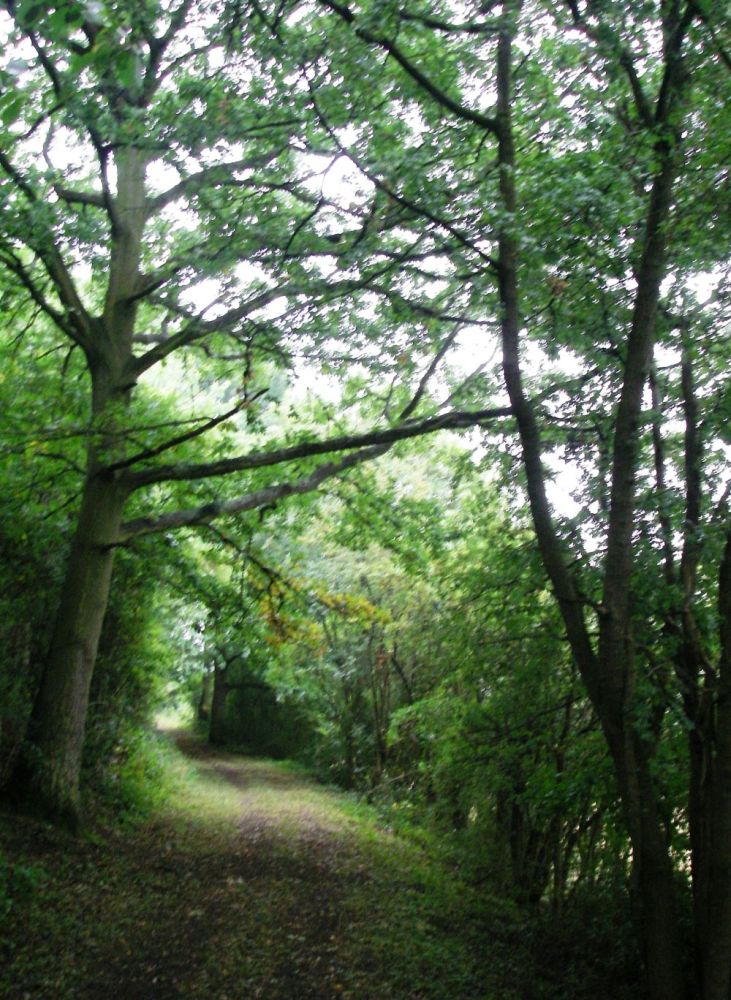
Next day it was dull; thunderstorms had been forecast. After an excellent breakfast I set off at about 8.45 am. The Wychavon Way was not marked on my map, but I followed the signs when they were clear, picking my own route when they weren’t. There was a pleasant terraced path through Craycombe Coppice with good views across the river.
Just after Sheriff’s Lench the Wychavon Way appeared on the map again, going across a field but blocked by crops. The signs pointed me in another direction, but I wasn’t convinced so I kept to the road as far as Church Lench. Map and signing coincided after that but I still missed a turn at Rous Lench and went half a mile in the wrong direction. The word ‘Lench’ means ‘rising ground’ or ‘hill’ and certainly the five local villages with Lench in their names are on higher ground.
This is an area of many traditionally managed orchards and I passed through several of them. Many of the apples, plums and damsons were ready for harvesting. Ripe plums had fallen to the ground which made a tasty alternative to blackberries.
It started to rain, but it only lasted three quarters of an hour. I heard a few rumblings of thunder in the distance which soon faded away. The rain was enough to make it unpleasant pushing along the overgrown paths. A bramble wound itself round my foot and trying to free myself I pricked my finger. There was blood diluted by rain everywhere.
The next little village was Abberton. Its church, St Edburga’s, once had a spire which was a local landmark. However, it was thought to be a hazard for aircraft using RAF Pershore and the request to remove it had been granted.
Despite more problems with navigation I had made good progress, arriving at the Boot Inn at Flyford Flavell by 2.30 pm, in time for a cup of tea before being shown to my room. I was in time to watch ‘Countdown’!
The pub had a very good evening menu and was very busy. I boringly opted for liver and bacon which I ate surrounded by ornamental boots of every size and description. That night I dreamt that I was going to a wedding in my walking boots as I’d forgotten to pack any shoes.
For a change I opted for fried bread to go with my bacon for breakfast. It didn’t taste nearly as good as I remember, probably because it wasn’t fried in beef dripping. I purloined a rasher of bacon to eat later (I must keep my salt intake up in this hot weather) and bought some provisions at the garage as the village shop and post office had recently closed.
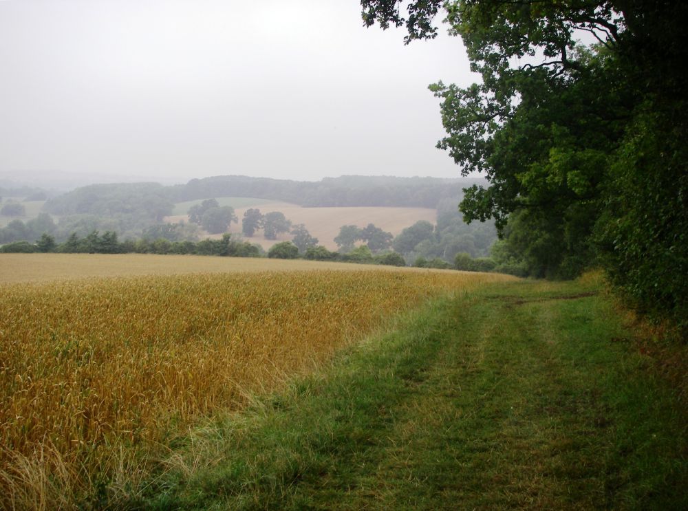
It was a lovely day with clear views. The path went pleasantly along the edge of Grafton wood then diagonally across a ploughed field, the large black clods of fertile soil forming an effective barrier. Luckily it was easy to walk around the edge.
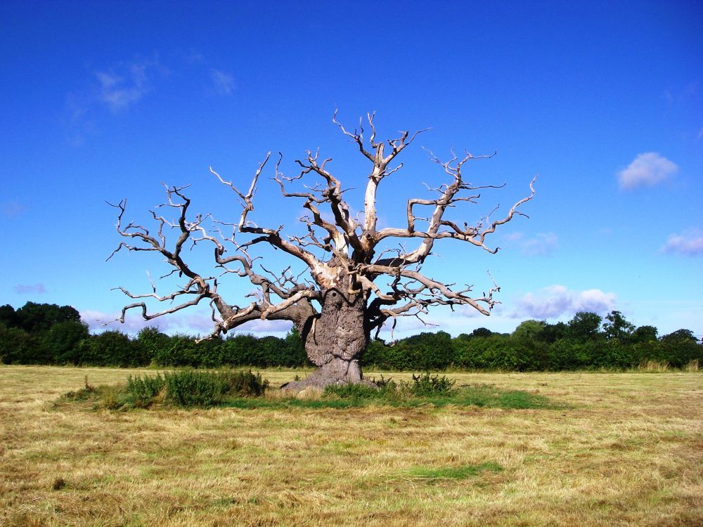
I crossed several more fields, in one of which a massive dead tree was standing sentinel over its surroundings. Coming to a minor road I decided to keep to it rather than tackle a deep ditch and a dense crop. After half a mile I tried to get back on route by following footpaths marked on the map, but ended up underneath a ‘Private Woodland Keep Out’ sign. I tried another footpath which did reach the road further ahead, although I had to negotiate two almost impossible barriers masquerading as stiles.
I was reunited with the Wychavon Way at Earl’s Common and together we continued down the road to the picnic area next to Shell Brook, with its ford and double-arched packhorse bridge. It is believed that from ancient times a minor salt road from Droitwich to Alcester passed through Shell village. The packhorse bridge would have made the journey easier for the laden pack animals carrying the salt.
While I was having my lunch at the picnic table three horses with their riders walked upstream for a little way to have a drink and to cool down. A photographer stood in the ford with bare feet taking romantic pictures of a young couple posing on the bridge. They were due to get married at the weekend.
From the little hamlet of Shell, it was a short climb to the top of Puck Hill from where there was a panoramic view encompassing Bredon Hill in the south east and the Malvern Hills in the south west. The sun was warm, and I had plenty of time. What better place to have a little doze?
Thoroughly rested, I continued along the ridge behind the farm where I was to spend the night, then came down to join a path which led across the farmer’s land. The path was indistinct, in fact non-existent. Cows with their calves were in the next field so coming to a gap in the hedge, I stopped to check the direction with my compass. Suddenly a large shape appeared from the other side of the hedge. BIG DADDY had come to see what was going on. Discretion being the greater part of valour, I nonchalantly went back on myself, taking another ‘path’ from which I managed to come out on a quiet side road. This joined a much busier road, so I was glad to reach the farm in one piece. The welcome was warm, however, and I had a pleasant room.
In the evening I tried to find the path to the farm from the opposite end, but it disappeared into a marshy area with high rushes. Even without the bull I wouldn’t have been able to get through. The farmer was quite unconcerned, although the farm was supposed to be walker-friendly.
Next morning the farmhouse breakfast was the best yet. There was some light rain as I left so I was content to retrace my steps along the lanes, not ploughing through wet undergrowth in the water meadows. After crossing the railway, I risked taking a footpath which went past Tunnel Farm. It was passable, although it would probably have been quicker to stay in the lane. At Shernal Green I re-joined the Wychavon Way at the bridge and continued to the picturesque village of Hadzor.
In 1533 Henry VIII gave the village to Katherine of Aragon as part of their divorce settlement. Today, the queen pays frequent visits to Hadzor Hall. In 2011 she stayed there with the princes Philip and Charles for the maiden voyage along the canal to mark the opening of the canal network.
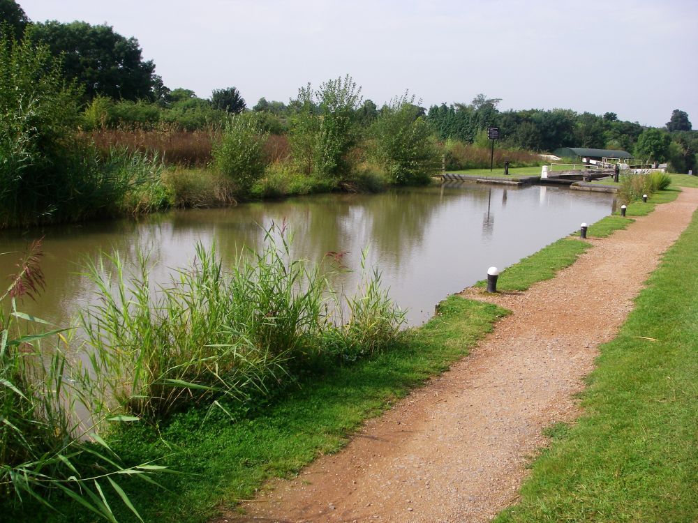
After Hanbury Wharf the route followed the Droitwich Canal to Vines Park in the centre of Droitwich Spa.
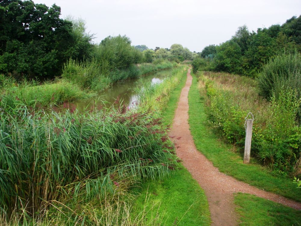
The natural brine at Droitwich is ten times saltier than sea water and has been in demand from prehistoric times. The Romans settled at Droitwich (Salinae), specifically for the salt. They used it to pay their soldiers. Many ‘Salt Ways’ radiated from Droitwich, the most important one going east through Alcester to Stratford-upon-Avon.
My journey was nearly complete. I continued along the Gloucester Canal for a short distance then went up Kidderminster Road to the station, in time to catch the 11.30 am train to Shrub Hill with connections to Reading and Twyford, where Dave and Tyson had come to meet me.
Of course, it wasn’t the same without Rosalind, but I had enjoyed being on my own. I now have 150 miles still to do. With luck I should complete the odyssey next year.
Fourteen months later I’m back on the trail again. There has been another source of sadness for Rosalind. Verney, her husband for over fifty years, died just before Christmas last year, leaving a large vacuum in her life. Time is running out for all of us, so I’m more determined than ever to finish ‘Land’s End to John O’Groats the Pretty Way’ this year, two years ahead of schedule.
The train journey from Reading to Droitwich was straight forward with a quick change at Worcester Shrub Hill. I found my way out of the town centre without too much trouble, then followed the signed footpath through the allotments – to the compost heap. One of the gardeners directed me to the diverted footpath: the sign had not been repositioned.
My next objective was Westwood Park, now agricultural land planted with oilseed rape. It was heavy going ploughing through the crop with the imposing Jacobean edifice of Westwood House looking down at me from its prominent position on the high ground. Half a mile further on was Gardner’s Grove where I took the only path vaguely in the right direction. This led me into a wood. A pleasant sign apologised for any inconvenience caused by tree-felling operations.
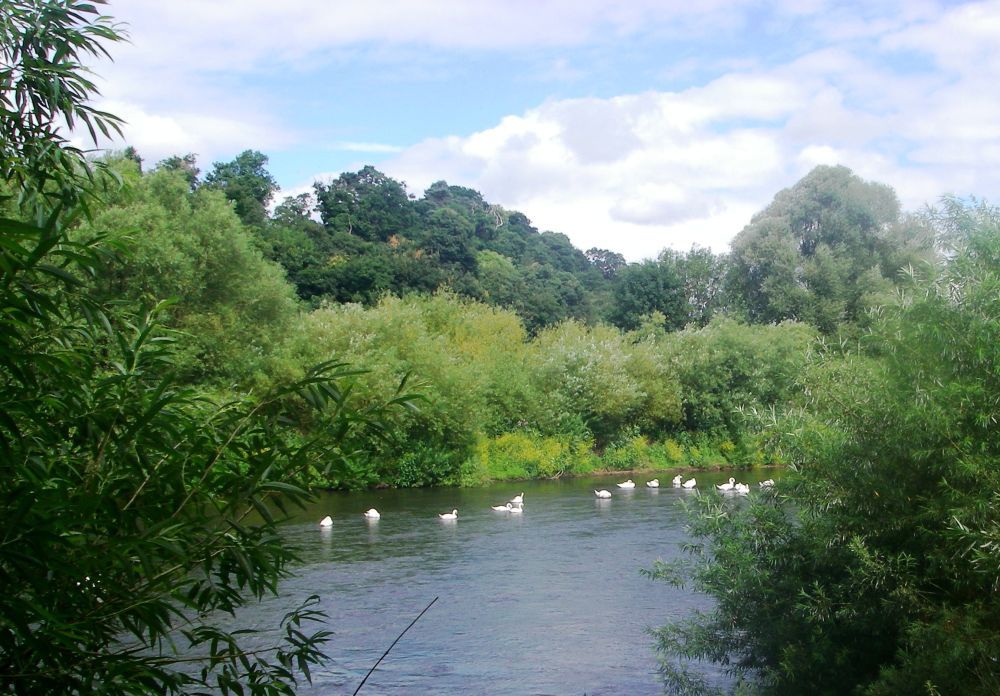
After a little while I noticed that the sun was in the wrong place. Either a cataclysm had occurred while I was day-dreaming, or I’d gone the wrong way. A convenient log provided a perch while I perused the map. Yes, it was of course the latter. I was in Knight’s Grove, well to the south of my intended route. Never mind, the track led to a lane which quickly took me back on course. After a brief battle with brambles, nettles and path diversions I was soon on the banks of the River Severn.
The wildlife included two buzzards, a heron, fishermen waiting patiently for a catch and holiday-makers from the numerous caravan parks along the riverside. A horsefly bit me as did a couple of midges; at the end of every field there was a stile to climb over, not so easy these days.
Just below Lincomb lock two familiar figures waved to me as they approached, my niece Caz and her husband, Charlie with their three dogs, Sam, Martha and little Nellie. Accommodation was almost non-existent on this section of my trek, but they lived close to the river in Stourport and had kindly offered me a bed and a taxi service. We wandered up to the Basins, where the River Stour joins the River Severn, to have a drink at the Angel before returning to their house which backs onto Hartlebury Common.
After a wash and brush up, Caz’s mother Maggie with her husband Dick arrived to take us to their favourite Indian restaurant where we had a tasty meal. We then came back for drinks and to catch up on all the family news.
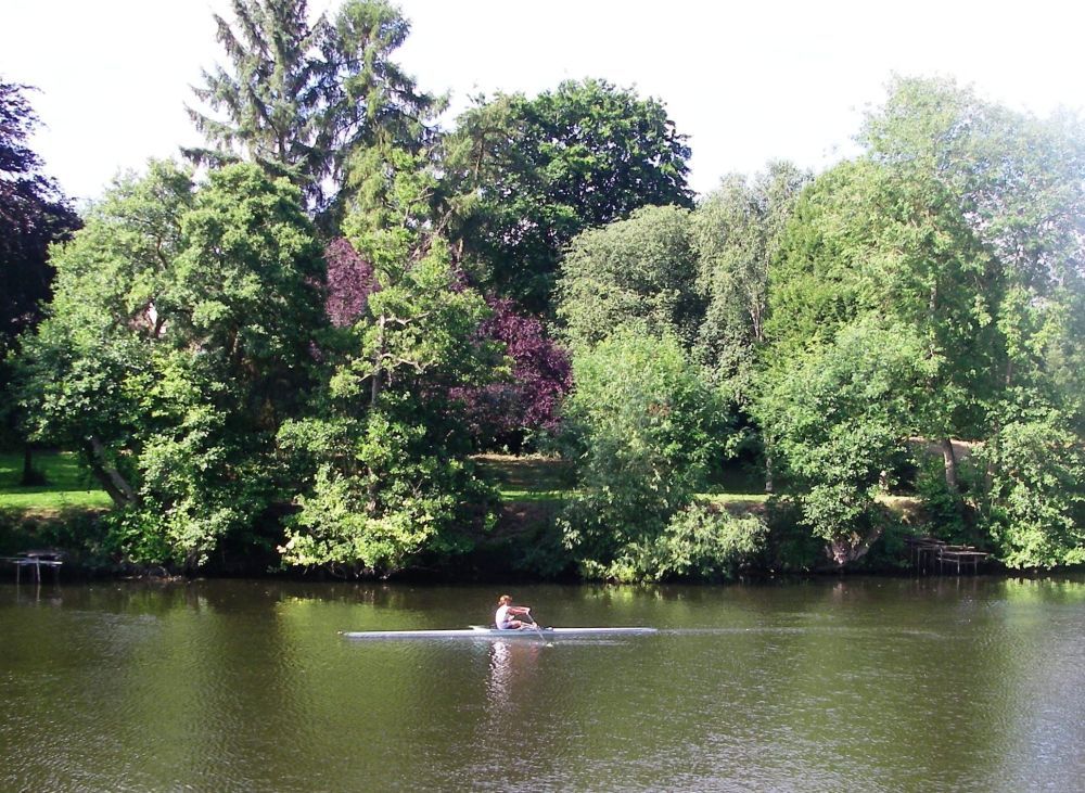
Caz was joining me for the day, so after bacon sandwiches for breakfast we said ‘goodbye’ to Charlie and the dogs, making our way to the river bank. There were many rowers out on the water practising for local regattas, more caravan sites and the ever-present fishermen.
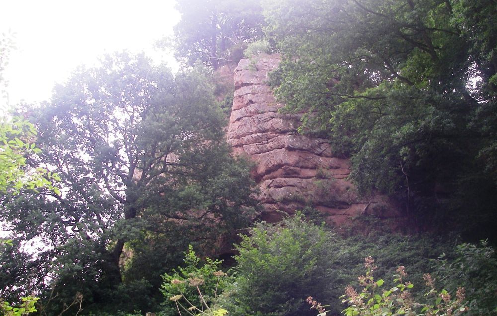
Before reaching Bewdley we passed Blackstone Rock, the first of the sandstone outcrops common in this area. There is a cave system at the base of the rock but not much information about it. There used to be a ford nearby, so it may have provided shelter for travellers unable to cross because of high water levels. It would have made a useful storage place for smugglers and was probably a popular place for beachcombers (or should that be cavecombers?) because when the river was in spate everything that was washed downstream ended up in the cave.
At Bewdley we stopped at a riverside café for a cup of coffee. The terrace was well above normal water level, but flood barriers had been installed to protect the properties from the ever-increasing threat of flooding.
Our path left the riverside by the smaller of the Trimpley reservoirs, where a convenient seat gave us an excuse to stop for another drink. It was a very hot day.
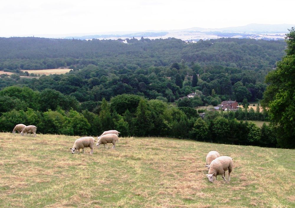
After crossing the Severn Valley Steam Railway, we took the direct path up to the car park in Eymore wood. This was a mistake as we couldn’t pick up our route, the North Worcestershire Path, from the lane as suggested by the map. We decided to cut our losses by keeping to the lane, stopping for lunch perched on a nearby stile. Approaching Trimpley we cut the corner off by going through the churchyard then along an overgrown footpath for a short distance to Trimpley Lane. From the highpoint at 660ft there was an extensive view across to the Malvern Hills and the Black Mountains in Wales.
It wasn’t long before we were replenishing our liquids at the Bellman’s Cross Inn at Shatterford. Charlie joined us for a pint before taking us to Habberley Valley, between Trimpley and Kidderminster. This was a nostalgic trip for me as I had spent many happy holiday hours as a child with Rex, my aunt’s Alsatian, exploring the valley, playing on the sandstone outcrops and climbing Jacob’s Ladder up the very steep slopes to the road above.
Back in Stourport I joined Charlie on his walk with the dogs on sandy Hartlebury Common before ‘dressing for dinner’ which was a very tasty chicken casserole. Afterwards we watched ‘Poldark’, but Aidan Turner didn’t take his shirt off.
The next day was a Monday. Caz was busy working from home, so Charlie took me to Shatterford to resume my walk. Entering a field of sheep at the top of a hill, a friendly notice requested me to ‘Please shut the gate, keep dogs on a lead and enjoy the view’. I happily complied with the first and last instructions.
The North Worcestershire Path was well-marked but the footpaths across agricultural land were overgrown. Some broken stiles were difficult to negotiate. At Drakelow the route went through the middle of a static caravan park to Blakeshall. Here, I missed out Blakeshall Common, continuing along the road to Kingsford Forest Park then Kinver Edge.
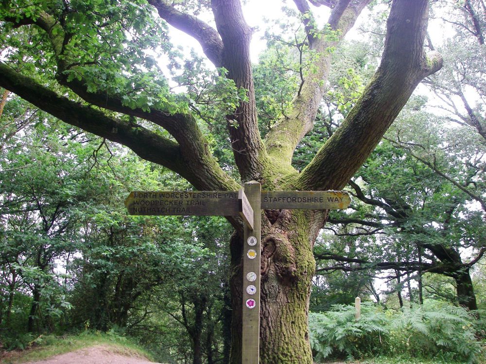
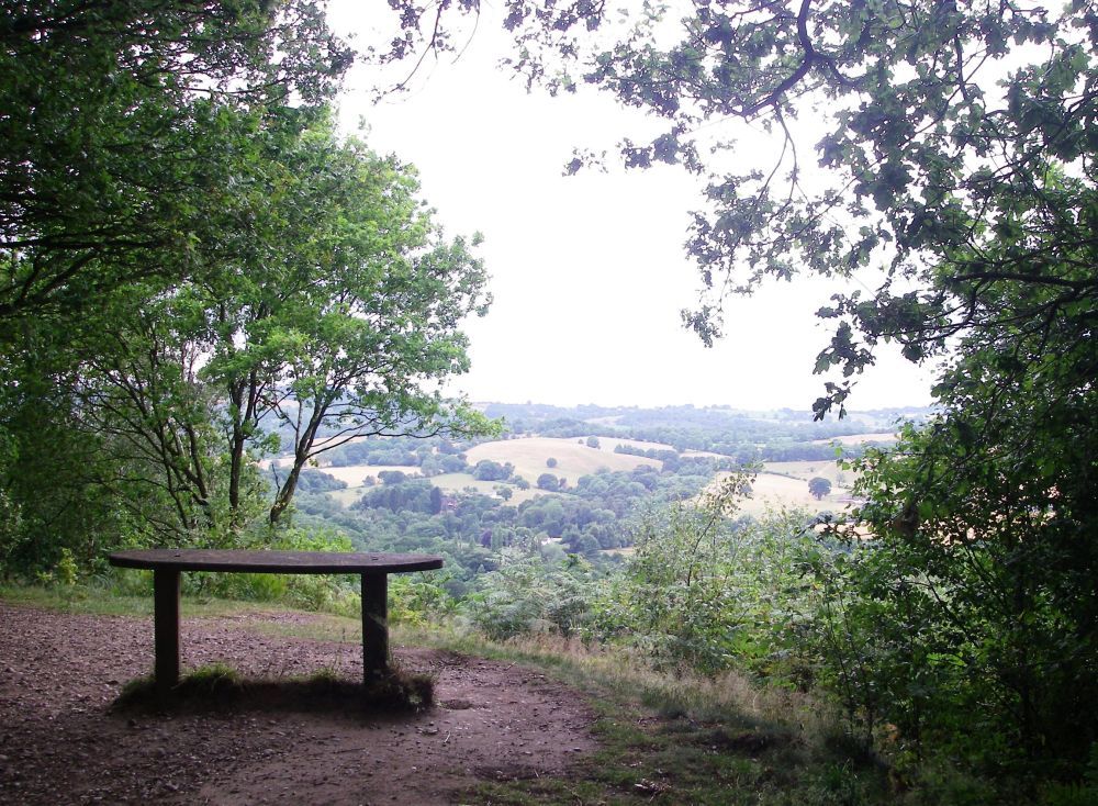
Very soon the North Worcestershire Path left the ridge for the valley and the Staffordshire Way took over. There were excellent views all along the edge, to the west at first then on both sides, with plenty of seats, well-placed to take advantage of the best viewpoints. At the north-east end of the ridge there are the remains of a large Iron Age hillfort, the raised ground providing a secure defensive position.
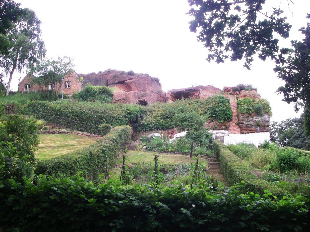
Coming down off the edge I passed the Holy Austin Rock houses. These cave dwellings had been fashioned out of the sandstone at least 700 years ago and possibly long before that. Solid, secure and dry they provided comfortable accommodation for the occupants until the 1950s when the last inhabitant left.
In the late 19th and early 20th centuries a thriving tourist industry grew up around the people who had made their homes in the sandstone outcrops that are a feature in this area. Excursions to see the ‘troglodytes’ of Holy Austin Rock were very popular. It has been suggested that these inhabited caves may have been the inspiration for the hobbit holes of Middle-Earth, occupied by Bilbo and Frodo Baggins in J.R.R. Tolkien’s classic works, The Hobbit and The Lord of the Rings.
The rock houses are now owned by the National Trust and the cottage gardens are being restored.
I had the usual difficulty finding my way out of Kinver but after that a straightforward track took me through the grounds of 18th century Home Farm then past the estate of Enville Hall.
A minor branch of the Grey family acquired the manor of Enville and moved from Leicester in the late 15th century. Despite several of the Leicester Greys being executed in the 16th century, the most famous of whom was Lady Jane Grey, the branch survived and through marriage inherited the Stamford Estate early in the 17th century. The title ‘Earl of Stamford’ eventually passed to cousin Harry at Enville. His son, the 4th Earl, created a beautiful landscape garden in the park, which was a great tourist attraction. The 5th Earl turned his attention to modernising the hall. Eventually, in 1883 the gardens were closed to the public because of vandalism. When the 10th Earl died in 1976 the title died with him.
Enville Hall is now the Grey’s private family home, but the tradition of breeding racehorses, started in 1751, continues to this day.
Reaching the little village of Enville I was looking forward to a drink at the pub. The good news was that, according to CAMRA, the Cat had been voted the best pub in South Staffordshire for cask ales every year since 2013. The bad news was that it wasn’t open at lunchtime on Mondays. The post office was, however, so I bought a newspaper to read while sitting on the bench on the small green waiting for Caz to pick me up.
Back home, Caz resumed her work while I had a very lazy afternoon watching the tennis at Wimbledon. First Andy Murray won his match then Federer cruised into the next round. Finally, there was a marathon between Nadal and Muller, eventually won by Muller who had nerves of steel.
Charlie arrived home having been to Cheltenham, Swindon and Newbury amongst other places. All in a day’s work. Caz went for a run in the evening leaving Charlie the important task of heating up the spaghetti bolognaise to have when Caz returned. She bought us all a magnum ice-cream to have as a treat for ‘pudding’.
Caz left for work soon after 6 am. Charlie got up at the same time to take the dogs for a walk, organise breakfast and provide sandwich ingredients. We were on the road by 8 am, Charlie dropping me off in Enville where we said our fond ‘goodbyes’ before he drove off to his next port of call in Hereford.
It was a damp start to the day with some rain. I passed the church of St Mary, the ‘12th century church with the 21st century welcome’ before turning off the road to descend through nettles, brambles and fallen tree branches to a stream hidden in undergrowth. I gingerly crossed the decrepit bridge hoping for better things to come. Unfortunately, the paths continued to be overgrown, so reaching Lutley I decided to keep to a firm surface for a while. Mere Lane was parallel to the Staffordshire Way so was the obvious choice.
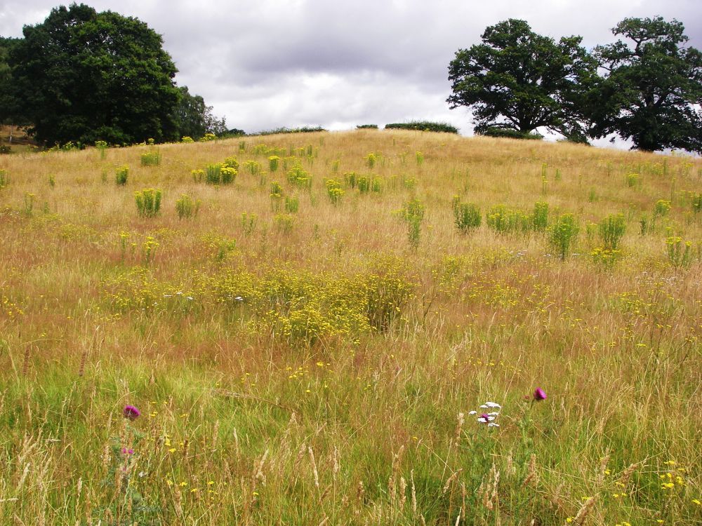
After about a mile and a half I came to Highgate Common, a wildlife reserve with many rare creepy crawlies. The holes of the solitary bees that had made their homes in the sandy soil could clearly be seen. Several people were taking advantage of a break in the weather to let their dogs have a run off the lead on the open heathland. A handy seat prompted me to stop for a few minutes to enjoy the scenery.
On the move again, I crossed the common to re-join the Staffordshire Way just as there was a heavy burst of rain. I was soon up to my eyes in wet bracken which was not pleasant. Returning to the road I checked the map to see my options. Again, there was a parallel track which skirted the forest just inside the trees. It had the added advantage of providing shelter from the rain. A little further on my track joined the Staffordshire Way, so together we went along New Road past Swindon Golf Club. The regulars were out on the course, impervious to the rain, sporting their uniform black waterproofs.
Reaching a road junction, the Staffordshire Way crossed into a fly-tipping area past numerous ‘DANGER, KEEP OUT’ signs. There was an obnoxious smell coming from the gravel workings that were off limits. It is unlikely that anyone in their right mind would have wanted to enter unless forced to.
The aspect improved somewhat as I passed a newly-planted grove of mixed ornamental trees, then the path turned right to cross the busy B4176 and became a bridleway. This was much better. There was bracken among the trees lining the path, but it didn’t impede progress and looked quite pretty.
After about a mile I turned off the Staffordshire Way again on a pleasant track which led to the rather uninteresting village of Seisdon. Not finding any reason to stop I re-joined the path up a track with a large conifer hedge on one side. The ground underneath was dry, so I took the opportunity to have my lunch in relative comfort. The detested Leylandii trees can serve a useful purpose.
When the track made a sharp right turn, the Staffordshire Way continued ahead into the unknown. I’m afraid I followed the track to the Ebstree Road. There was a pub on the corner which looked rather posh, so I gave it a miss, taking the turn towards Trescott.
I should have continued up the lane to the main road, but decided to give the Staffordshire Way one last chance. This proved to be a mistake. As I was standing in a farmyard looking in dismay at the route, or where it should have been, a farm-worker advised me to go up the track to the main road then keep to the field edge into Trescott. This is what I’d already decided to do. My bus to Wolverhampton sped past as I was approaching the few houses which comprised the village. The bus stop was opposite the lane I should have come along. If I’d gone that way I would have caught the bus with time to spare.
The rain was light but persistent. Looking for a tree to shelter beneath but not finding one, I walked down the lane to a ford. Standing on the slime-covered footbridge I watched the water rushing underneath. Two hours before it would have been a gentle flow.
The next bus came at last, quickly covering the distance to Wolverhampton town centre. The Hungry Horse was well-positioned between the bus and train stations, so I went in to find a cosy corner in which to dry out. A baked potato filled with beans and cheese accompanied by a large mug of steaming hot chocolate worked wonders. I followed that with golden syrup sponge and a cup of tea. Replete, warm and dry, it was a happy horse who trotted (tottered?) along the walkway to the station, in good time to catch the next train home.