
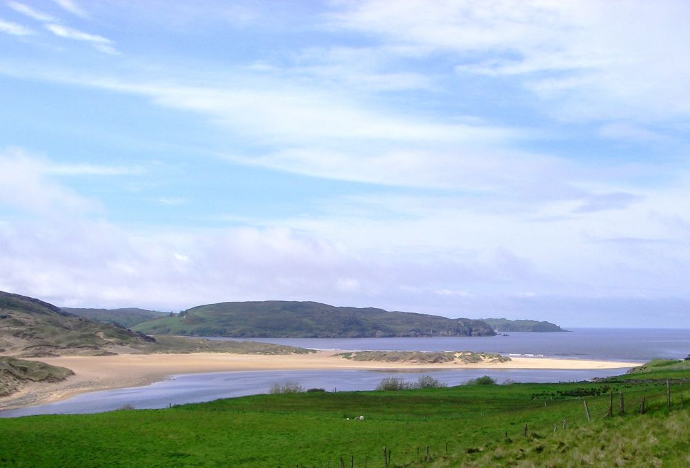
Inverness to Tongue:
Tongue to John O'Groats:
The big question was:– Would an umbrella be more useful than walking poles? It has been known to rain in Scotland and as we would be following a cycle route most of the way it wouldn’t be too rough underfoot. I bought a large, windproof umbrella with a curved handle which would double up as a walking stick if necessary. However, as departure day approached the long-range weather forecast wasn’t too bad for the north of Scotland, so I reluctantly decided against taking it.
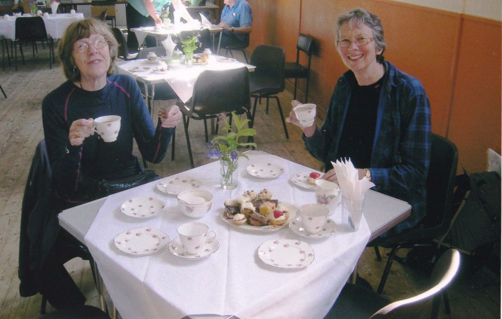
I had a fifteen-minute connection time at York Station to change trains before continuing the journey to Inverness. My train was held up for about fifteen minutes at the station before York, so I was in a rush to find the right platform, where a train was about to depart. Luckily Rosalind was there first and didn’t let me leap on board. The train was going to Penzance! Our train left five minutes later, and we passed away the six-hour journey by catching up with all the news. As it would be quite late by the time we arrived in Inverness we had our evening meal on the train, an Asian dish of tasty beef noodles.
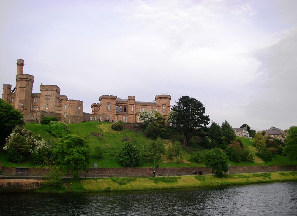
Our B&B was at Castle View where we had stayed when completing the Great Glen Way in 2006. On the banks of the River Ness it did command a very good view of the castle. Our room was comfortable, and we had our own bathroom.
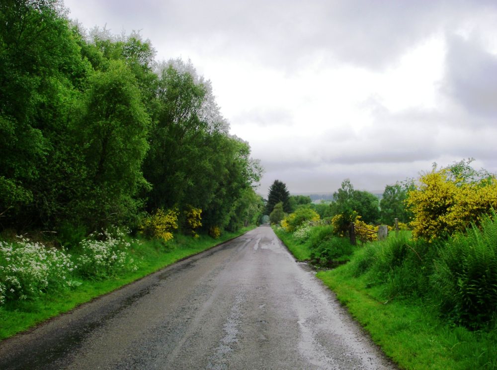
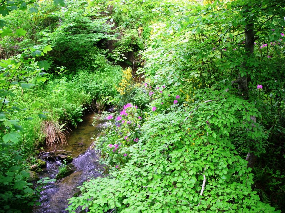
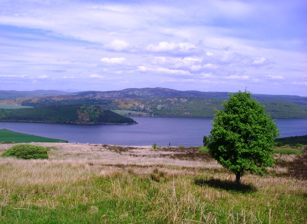
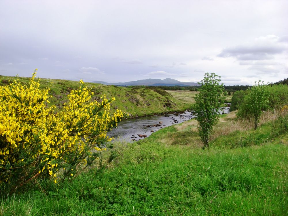
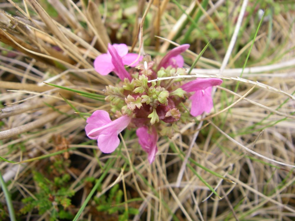
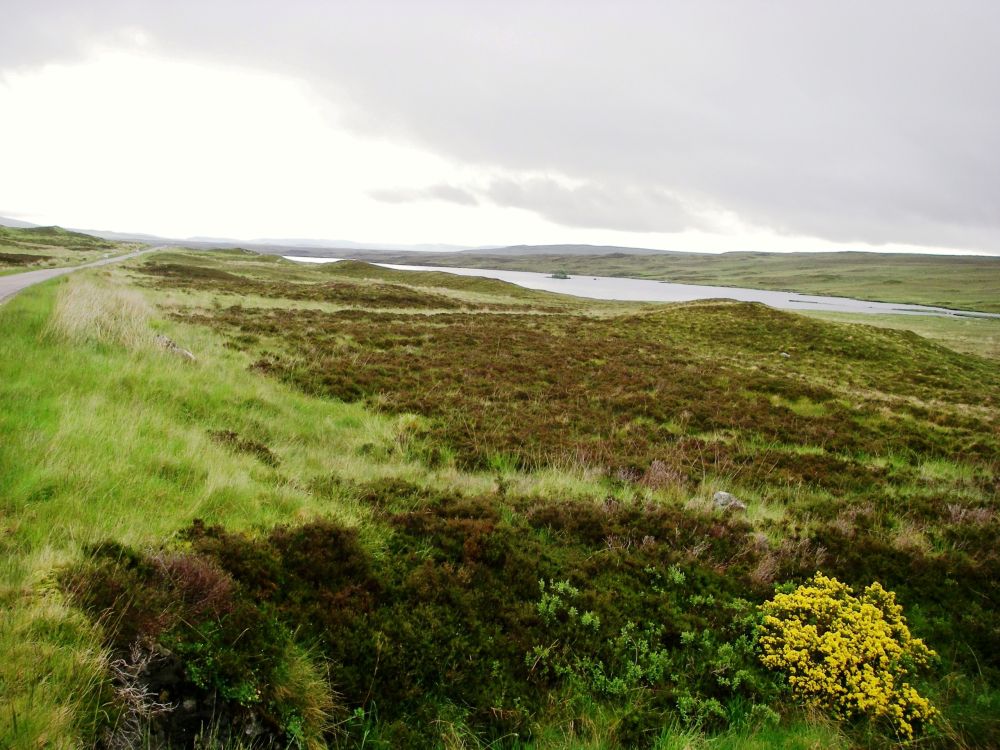
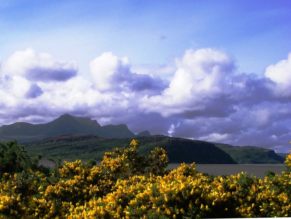
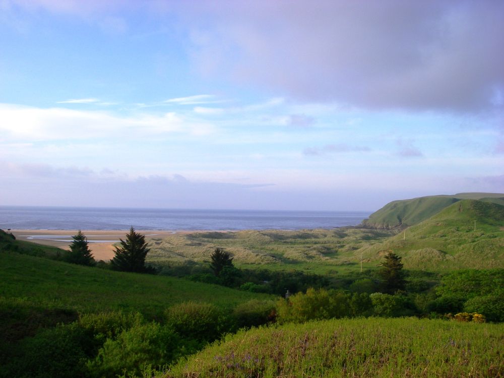
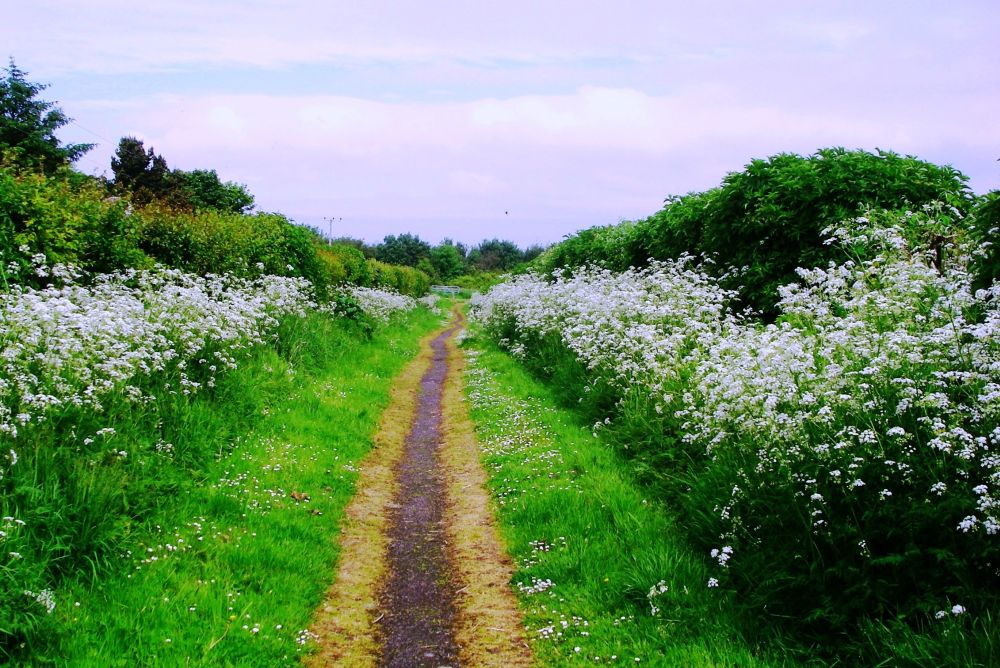
In the morning two bowls of creamy porridge for breakfast fortified us for the road ahead. As we had already walked to the estuary at the end of the Great Glen Way we caught a bus to the other side of the Beauly Firth. There wasn’t a way down to North Kessock, so we had to follow the cycle way alongside the A9 until it deviated from the main road. After that the route avoided busy roads as much as possible, following quiet lanes. Gorse, broom and cow parsley were in bloom along the way and the May blossom was giving off a strong scent.
At Tore the service station had a convenient shop/café so we stopped for a cup of coffee and bought some provisions for lunch. It rained a little as we left the village and a woman waiting at the bus stop stated that ‘It always rains in Tore’. Luckily, we weren’t confined to the environs of Tore and the rain soon stopped as we continued to Corntown and across the Conon Bridge.
Not having found anywhere to stop en route we ate our sandwiches at Dingwall station, arriving there at two pm after walking twelve miles. We caught the train to Alness, found our lodgings for the next two nights and after a rest walked up the Alness River through the woods then back along the golf course. After a large meal at the Commercial Hotel we sauntered back to our digs. I phoned Dave who reported that it had been pouring with rain all day in Reading and our son’s little dog who was staying with us was bored. Again, Roswenda had done us proud.
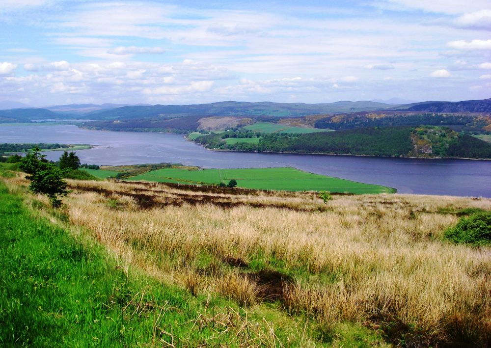
Next morning, we awoke quite early but nattered so much while drinking our tea that we were nearly late for breakfast. That wouldn’t do as our porridge would be cold. The breakfasts were huge, with three rashers of bacon apiece, one of which together with a couple of pieces of bread would do for lunch. We caught the train back to Dingwall and left the town on a back road, crossing the short length of canal which ran from the town to the Cromarty Firth. Built to give better access to the town, the canal was never commercially viable, going into decline with the arrival of the railway.
It wasn’t until we’d climbed out of the town that I realised I’d left my walking poles on the train. Well, it had been a toss-up whether to bring them or a large umbrella so now it didn’t matter if I’d made the wrong choice.
There was little traffic other than a few cyclists on the old road to Elvaston. The elevated position afforded good views over the Cromarty Firth. Flocks of goldfinch were busy in the hedgerows and there were early summer flowers blooming by the wayside.
Reaching Elvaston we stopped at the Christian community café. Run by volunteers it had a relaxed atmosphere and with a large play area for children it was the place where the villagers met up during the day, as well as producing tasty home-made soup for passing visitors.
After Elvaston 1,486ft high Cnoc Fyrish, loomed up on our left. It was covered by a conifer plantation and had an elaborate monument on the summit. Apparently, the brigadier landowner had paid unemployed labourers to erect it after the war. Slightly more interesting than digging a hole and filling it in again, I suppose.
A new section of cycleway had just been completed. It ran beside the railway, crossing and re-crossing the road several times. As we neared the end we had our photos taken by a Sustrans employer ‘to be stored away in the archive’. He must have been desperate as the cyclists were continuing to use the road as before.
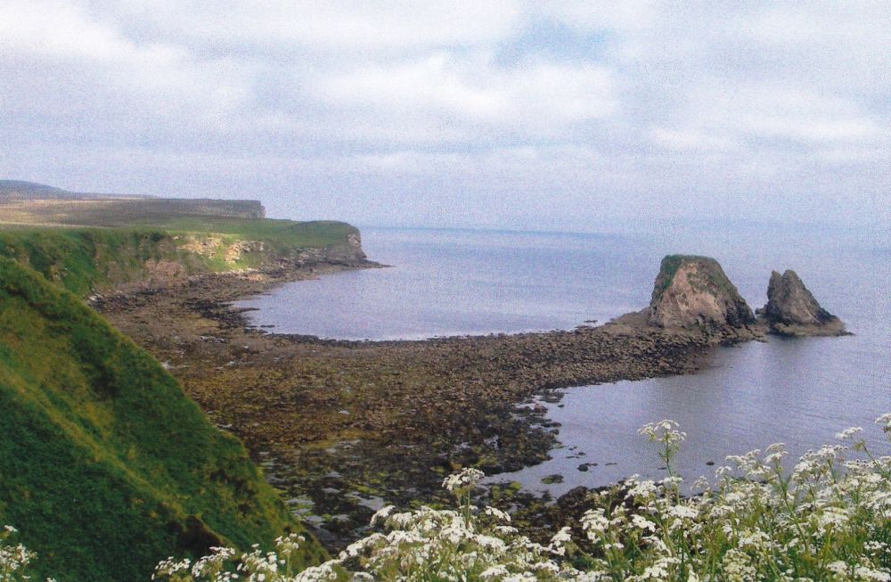
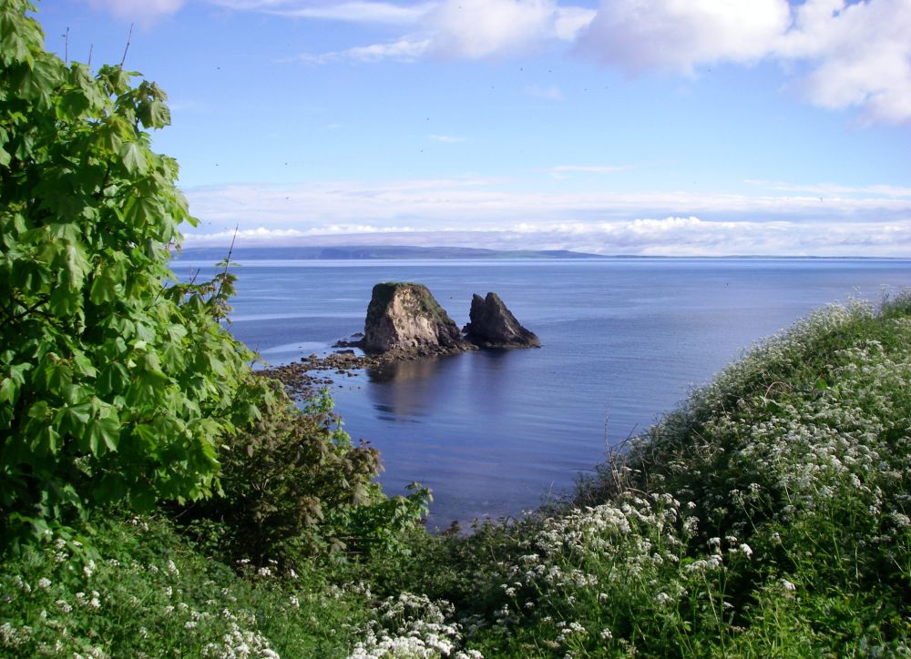
At Alness we had a rest before walking a scenic mile and a half along the river to the nature reserve at Alness Point, passing a weir where bunches of fresh flowers were attached to a fence. According to the notice beneath a photograph of a pretty girl, she had died here, and a funeral had been held earlier in the day. Tragedies can happen in tranquil places.
It was a lovely evening. Many sea and marsh birds were out and about looking for food. Ones we could identify included oyster catchers and terns as well as the more common gulls, eider ducks and Canada geese. One of the terns was noisily telling a heron to get off its patch and the heron clumsily retreated to the edge of the feeding area, looking forlorn. Leaving the birds to their squabbling we walked back along the river to the hotel for our evening meal where we were greeted like old friends. Several younger people in dark clothes were still milling around after the funeral.
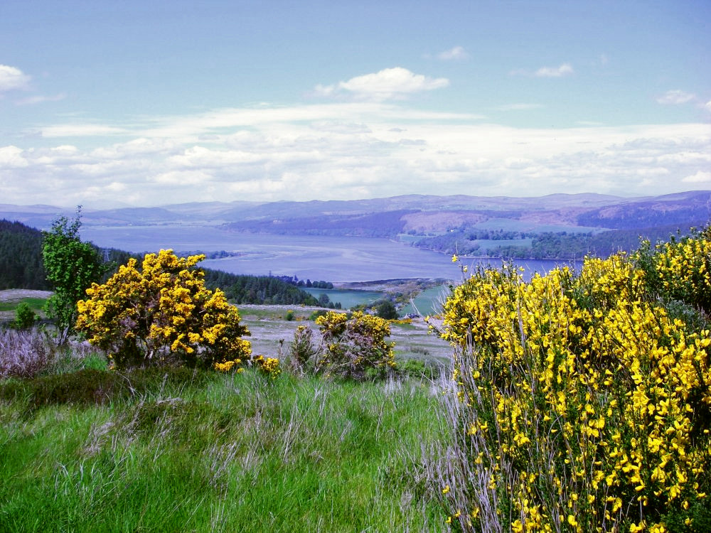
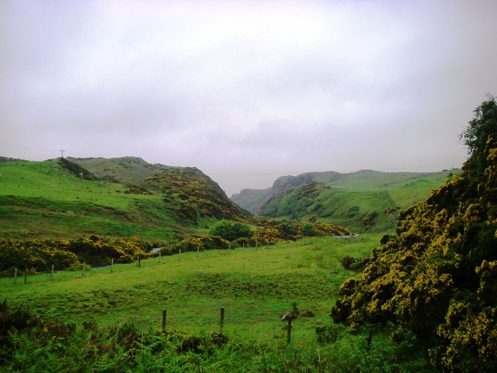
A clear blue sky greeted us next morning when we woke up. After breakfast we bought rolls from the bakers for lunch before setting off towards the Strathrory Bridge along the quiet lane beside the golf course, passing a show of bright pink and red rhododendrons by the wayside. We joined a busier road, but all things are relative, and apart from the occasional forestry lorry the traffic was light as we left the meandering Strathrory River behind to continue the scenic route over the hills.
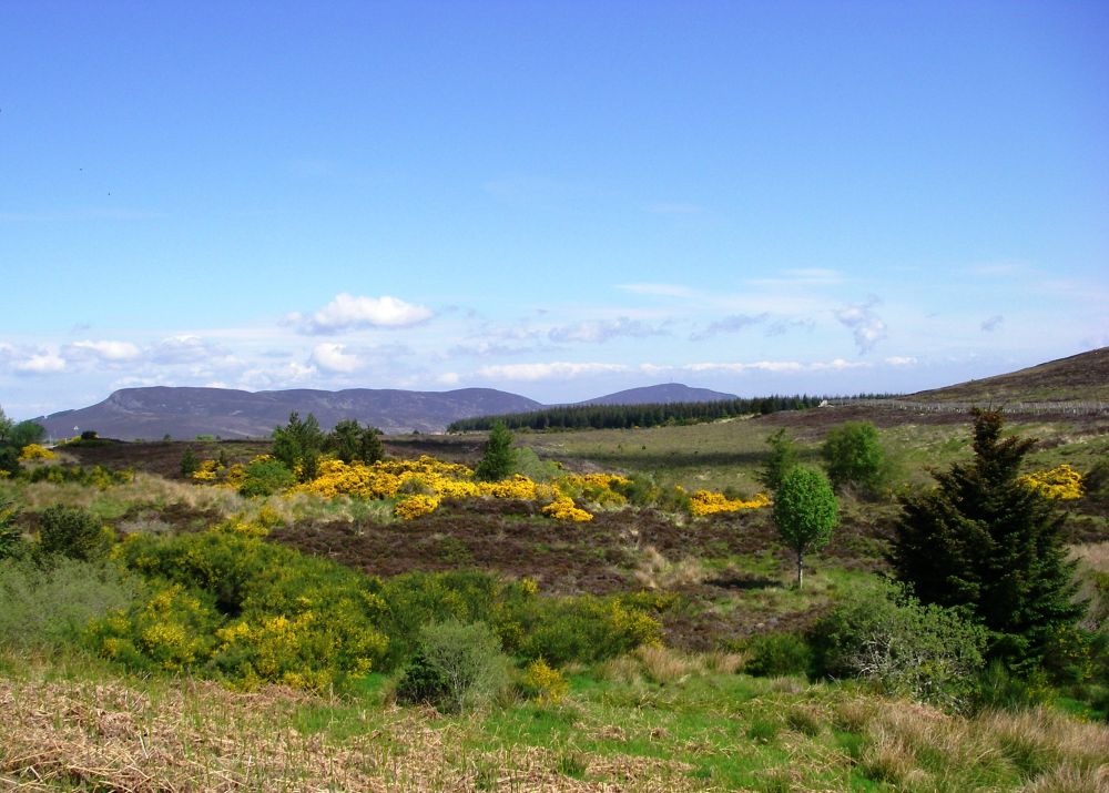
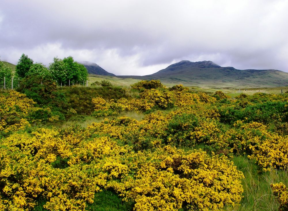
Much of the forest had been cut down which opened the aspect. The gorse and broom looked even brighter in the sunlight, adding splashes of gold to the panorama. Elderly bikers were out enjoying the feel of the wind in their faces, but taking time to acknowledge our existence. In contrast, one rude motorist’s gesture suggested we shouldn’t be on the road at all, but he was the exception.
There were two viewpoints, one overlooking the Dornoch Firth and a second one after the rocky outcrop of Struie looking further up the estuary towards Bonar Bridge. We stopped here to have our lunch. Afterwards a light breeze stopped it getting too hot as we gently descended, crossing Easter Fearn Burn to join the A9 in the valley. There still wasn’t a great deal of traffic but it was travelling a lot faster. The cycle route had gone the long way around through Tain then back along the estuary, but our alternative had worked out well.
Near Kincardine we talked to a lady weeding in her front garden as we made a fuss of her ‘rescue’ sheepdog. She was very vocal about the coming referendum. ‘If Scotland goes independent then I’m moving to England.’ She was also concerned about the ‘wind turrrrbines’ which were beginning to colonise the hills. The money was all going to the landowners and not to the local community.
The little village of Ardgay had a run-down feel to it. The hotel had closed but there was a café/store open where we had a cup of tea and bought something for our evening meal. We proceeded to Lower Gledfield where we were to spend the night at Oriole Cottage. Negotiating the piles of junk, we were shown to our rooms (one each) and weren’t too concerned that one of the loos was out of action and the telly wasn’t working. Rosalind had backache and collapsed on a bed while I pottered about. Then to our consternation two other women arrived and it was discovered that we weren’t booked in! After further investigation it was evident that we should have been at Kyle House in Bonar Bridge, the other side of the estuary. The telephone number was only one digit different and somehow, I’d rung the wrong one. In Scotland, few of the places offering B&B had asked for a deposit which meant I had no confirming paper work.
Thankful that we didn’t have to share we were given a lift over the bridge to our much superior accommodation. Although there were plenty of places to eat this side of the bridge, we found a spot to enjoy our picnic. Then, despite our long day and as it was a beautiful evening we went for a walk. Rosalind’s back was better; the views were breath-taking both along the Kyle of Sutherland and looking back across the Dornoch Firth. A thrush was singing its heart out on a chimney-pot.
At breakfast, I purloined one of my three rashers of bacon (again), a piece of toast and a banana so my lunch was assured. Rosalind hadn’t ordered a cooked breakfast, so she had to make do with a banana. We were ready to leave soon after nine and cancelled our lift back over the bridge as it was only an extra mile, following a quiet minor road alongside the railway line which was in a cutting below us a lot of the time.
We were looking for somewhere to stop for elevenses when we came to the tiny hamlet of Culrain. On the side of a large barn, which turned out to be the village hall, was a large notice which read ‘31st May Coffee Morning 10-12’. What could be better? We were given a friendly welcome and sat down at the table with a plate of delectable dainties in front of us. Our bone china cups were frequently topped up with coffee.
One of the (English) organisers came over to talk to us. She was very apprehensive about Scottish Independence and didn’t think an independent Scotland would be friendly to English incomers. Apparently, there was a certain amount of friction already. She told us the story of ‘Spite Castle’ located on a wooded ‘cnoc’ overlooking the Kyle a little further on.
After a bitter row with her relatives, the lady dowager of Sutherland had Carbisdale Castle built on land adjacent to the Sutherland estate. The clock face overlooking her relatives’ land was left bare because she did not wish to give them ‘the time of day’. The Castle was later converted to a youth hostel but was now empty because the huge repair bills could not be met. The closure of the hostel had added to the unemployment problems in the area.
As we still had a long way to go we had to leave before the raffle, but our brief sojourn had been a welcome diversion.
The next section of our walk was along a very quiet road on the west side of the River Shin. The oak trees were in fresh green leaf and the verdant grass verges were interspersed with clumps of bluebells and patches of stitchwort. Butterflies were flitting from flower to flower and birds were singing in the trees. One or two anglers were trying their luck at the fishing piers which at intervals jutted out into the fast-flowing water.
The visitor centre at the Shin Falls had burnt down earlier in the year and the site was deserted. We went down the steps to see the falls and found a secluded spot overlooking the water where we had our lunch. The sound of the waterfall was very soporific but as we still had some way to go we stretched our limbs, put a flower in the vase provided and made a wish before resuming our journey.
Rosalind was having trouble with her back again, so we rested once more before entering the little village of Lairg. A convenience store provided our needs for the next day but as we continued to our lodgings Rosalind realised she had left her map at the store. I volunteered to go back for it and Rosalind took her rucksack off to rest her back while she waited. Map retrieved, I tried her rucksack on to see if it was less comfortable than mine and found the straps had become very loose. When they were tightened Rosalind’s back problem disappeared, although she was left with a sore spot that required padding.
Our B&B at Lochside was immaculate but comfortable and because we were the only guests we had the bathroom to ourselves. The hot bath was blissful. Fully recovered, we went to the Pier Café (recommended by the lady at Culrain) for our evening meal. We both had fresh haddock and chips accompanied by a glass of wine at a table overlooking Loch Shin. It was a fitting end to a most enjoyable day.
In future, this quiet village on the banks of Loch Shin may become a major tourist attraction as several separate areas of research are indicating that it was here that a 3k wide meteorite slammed 8k into the earth 1.2 billion years ago.
Some shocked quartz has been found embedded in 3 billion-year old Lewisian Gneiss to the west of Lairg. This greenish glass, known as ejecta, is formed when a major impact melts the underlying rock, flinging it from the edge of the impact. A separate research group found traces of the extremely rare mineral, reidite, embedded in the old rock. Reidite is only formed when there is a massive impact, such as a meteorite strike.
Lairg is at the centre of a ‘gravity low’. Gravity varies slightly over the surface of the planet depending on the density of the underlying rock, older rock being denser. Gravity lows occur when a crater occurs in older rock which is rapidly filled up with less dense, younger rock, in this case Torridonian sandstone. It was thought that the gravity low under Lairg was caused by a comparatively recent meteorite strike, one only a few hundred million years ago.
The new evidence points to a much older and more significant impact. As more information is gathered and more measurements taken, there may be a significant impact on the lives of people living here.
Can you guess what we had for breakfast? Of course, it was porridge again. It seems to taste much better in Scotland than it does at home.
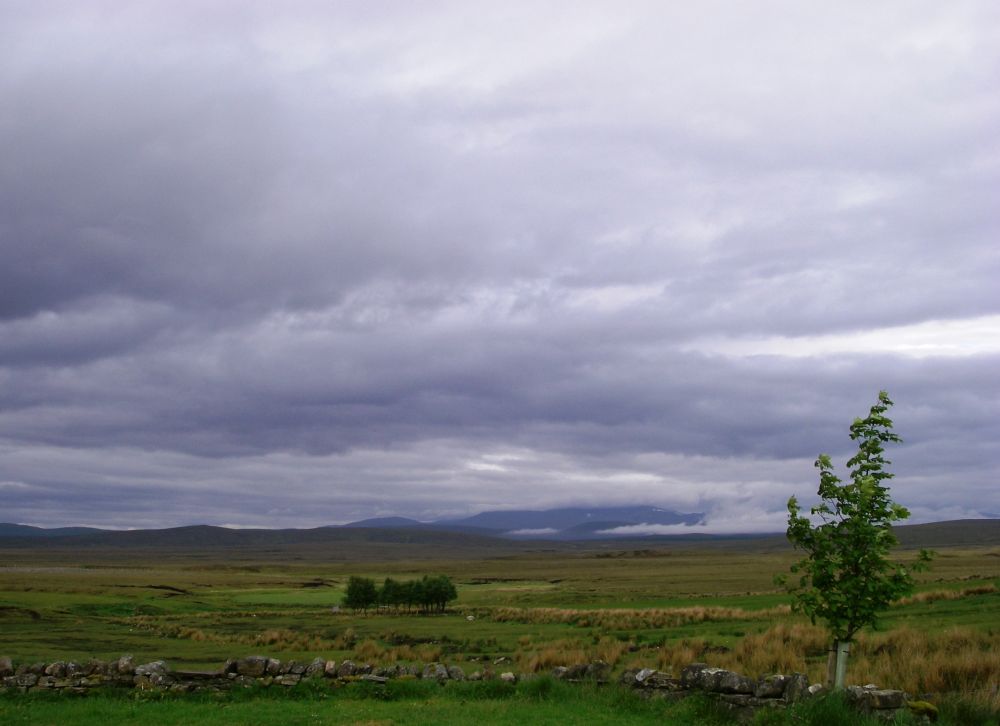
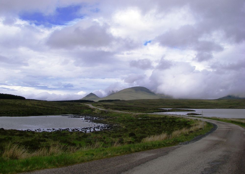
Our route today was due north along the A836 and we didn’t know what to expect. We were pleasantly surprised when, after a junction, it became a single-track road with very little traffic. It passed through open forest, over moorland, by lochs and beside little burns, quite delightful.
Some of the few cars that passed us had dour-faced ladies in the passenger seat, but drivers mostly gave us a friendly wave. A camper van had stopped by the roadside and we were invited in for cups of tea accompanied by toast and pate, most welcome. Every so often the peace was disturbed by a party of the elderly bikers but there weren’t very many cyclists. Midges were a problem when we stopped so we had to keep going, although we were well-protected by Avon’s skin cream ‘Oh so Soft’. This seems to work better than any of the conventional jungle formulae.
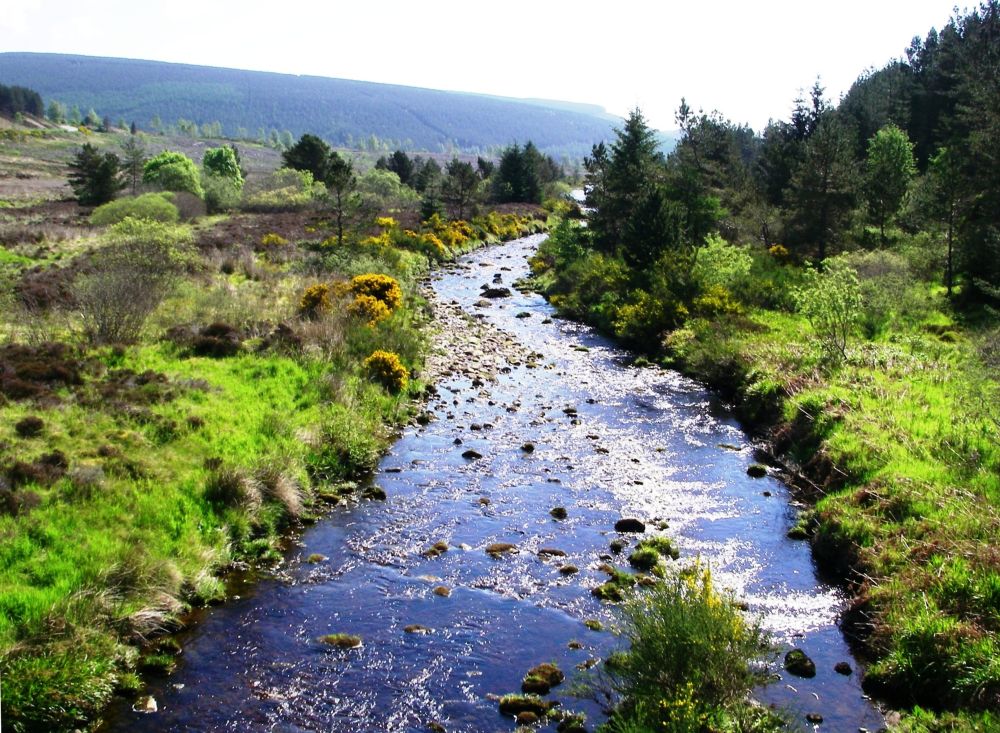
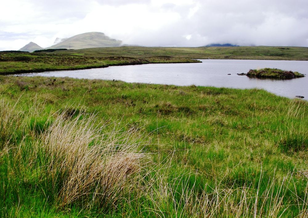
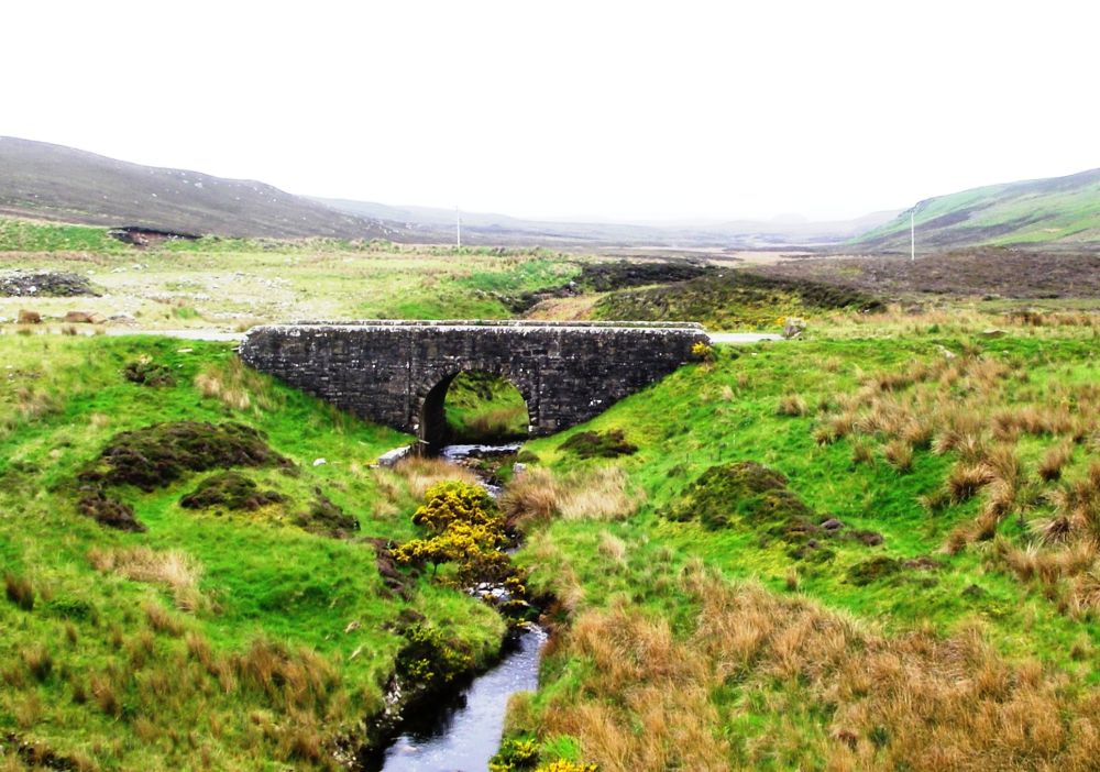
Our day’s destination was the lonely Crask Inn, situated where the mountain streams draining the high ground come together to form the River Tirry which drains into Lock Shin. It is a popular point of call for cyclists, anglers and Munro baggers. The 3157ft high Ben Klibreck is accessible from here. An extremely tough section of one of the Land’s End to John O’Groats routes starts at Fort William and crosses the road at the Crask Inn. A small number of masochistic bog-plodders carrying tents and food for several days brave this relentless route, negotiating rivers in spate and pathless rough, boggy ground, sometimes in mist and pouring rain. Our alternative seems a much better idea.
As we approached the inn three sheepdogs came down the road to greet us and escorted us back to the bar. Two fishermen who were staying at the lodge at Altnahara were talking to the landlord and they bought us drinks. The inn was not nearly as primitive as we were expecting. True, there was neither telly nor tea-making facilities, but the generator provided a perfectly adequate shower and our room was comfortable. A large grand piano took pride of place in one of the small rooms which no doubt was an important part of the entertainment of a winter evening.
But now all was peaceful. Surrounded by moorland beneath a wide-open sky, mist swirling around the distant mountains; the solitude was palpable.
Our evening meal was shared with the landlord’s brother and friend who had come for a week’s fishing at Altnahara. The beef in the lasagne was from the resident herd of Highland cattle and the rhubarb in the crumble was home grown. We learnt something about life in the outback. As well as salmon and trout fishing in the lochs there was deer-stalking, and every year a party from France came over the channel to take part in a woodcock shoot. Woodcocks are bog-loving migratory birds that overwinter in Scotland. They only break cover in the evenings or at night and their swooping, erratic flight makes them a difficult target, so it is a skilled sport.
Later we watched one of the sheepdogs leave his ball in the garden before wandering off along the deserted road to investigate any new and interesting smells he might come across.
It had rained in the night, but we woke to a bright morning. The anglers had left early, so we enjoyed a solitary breakfast of porridge followed by just-laid boiled eggs.
Our landlord set off across the bog to cut some peat accompanied by two of the dogs, but before setting off on the next leg of our journey we took some more photos of the lonely landscape. All was tranquil now, but in the summer of 2007, there had been serious flooding in the area. Cattle and sheep had taken refuge on an unstable mass of slightly higher ground. When it was swept away many of them had drowned.
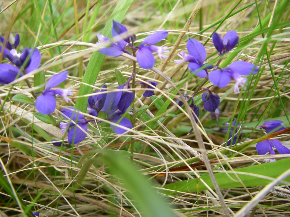
The countryside was getting more mountainous but there were still patches of golden gorse and broom here and there. In one small damp patch were six or seven different varieties of flower in bloom. Common butterwort was there but most of them we’d never seen before.
It started raining just as we reached the hotel at Altnaharra, so we had a cup of coffee and a bowl of soup for lunch while we waited for it to stop. The hotel was built in 1820 on the site of a 17th century drovers’ inn and since that time has always been popular with anglers. Situated at the western end of Loch Naver it offers some of the best trout and salmon fishing in Scotland.
The small hamlet of Altnaharra is well known for its weather station which regularly records weather extremes for the United Kingdom. The lowest ever temperature of –27.2°C was recorded here on 30th December 1995. The hamlet boasted its own school, although a few years ago there had been only one pupil. That number had now swelled to five.
Tragedy has also struck the little community. Linda Norgrove, an aid worker who was born in Altnaharra, was kidnapped by the Taliban in Afghanistan in 2010. She was killed by a US grenade in a botched rescue attempt. A foundation has been set up in her name to provide funds for education, health and child care for women and children affected by war in Afghanistan.
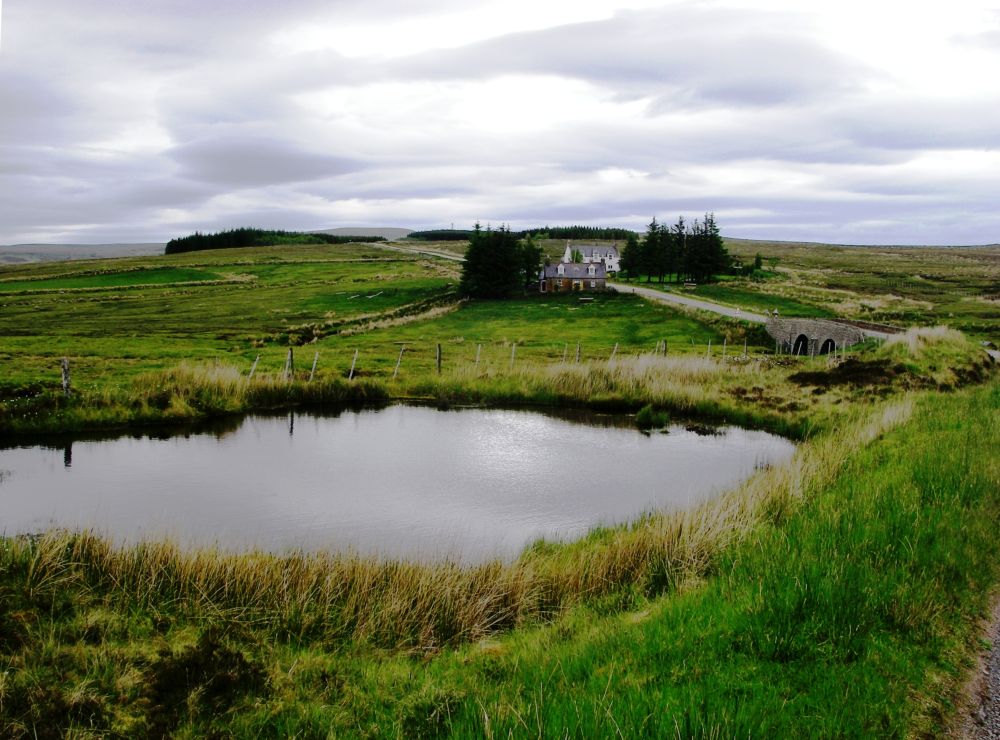
When the rain had stopped we found our digs at ‘The Bed & Breakfast’ where I dumped my rucksack and set off to complete the first three miles of the trek to Tongue as otherwise tomorrow would be a long day. I reached the loch at the top of the hill and took some photographs of Cnoc nan Cuilean with Ben Loyal in the background then went back, meeting Rosalind half way. She had stopped for a cup of tea and a short rest before following me. The rain, which was never far away, held off until we were safely back in our lodgings, then it pelted down.
Although the area was popular for deer stalking, we hadn’t seen any in the wild. However, there was a farmed herd just across the road and we watched them gallivanting across the large area allocated to them from our window.
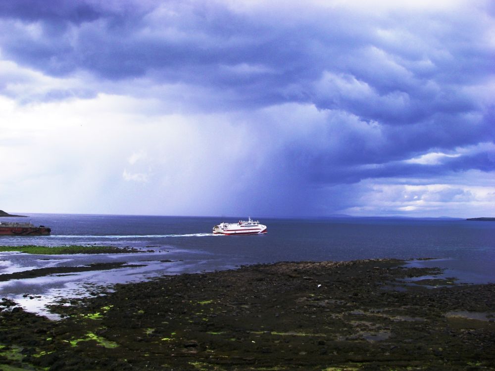
Two Dutch trout fishers joined us for breakfast next morning. One of them told us that John O’Groats had got its name from Jan de Groot, who had come over from Holland in 1496 to run the ferry to Orkney. We were planning to take the ferry to Orkney at the end of our trip.
Amanda, our landlady, gave us a lift along the road to our starting point. We had been going to catch the post bus, but its timing was erratic and couldn’t be relied on. In fact, we saw no sign of it and were very glad of Amanda’s kindness.
The Dutch anglers drove past, and we met them again bailing out their boat at the side of Loch Loyal. We also met a surfing cyclist who was trying to be ‘green’ by carrying his surfboard and other gear in a one-wheel trailer. A timber lorry passed us driven by a young woman but otherwise there wasn’t much traffic on the road.
It was a delightful walk beside lochs and between mountains with very little sign of human habitation. Much of the way we were accompanied by the sound of cuckoos. We don’t hear them very often in the south any more but in the north of Scotland they seem to be plentiful. The midges were also plentiful, so our stops were brief, but again Avon’s ‘Oh so Soft’ kept the little beasties at bay.
The air was completely still and there was a perfect reflection of Beinn Stumanadh in the water. The road passed between Loch Craggie and Cnoc Craggie before climbing gently out of the valley. There were milestones along the way and it was taking us twenty minutes between each one. Walking at a steady three miles an hour we were pleased with our progress.
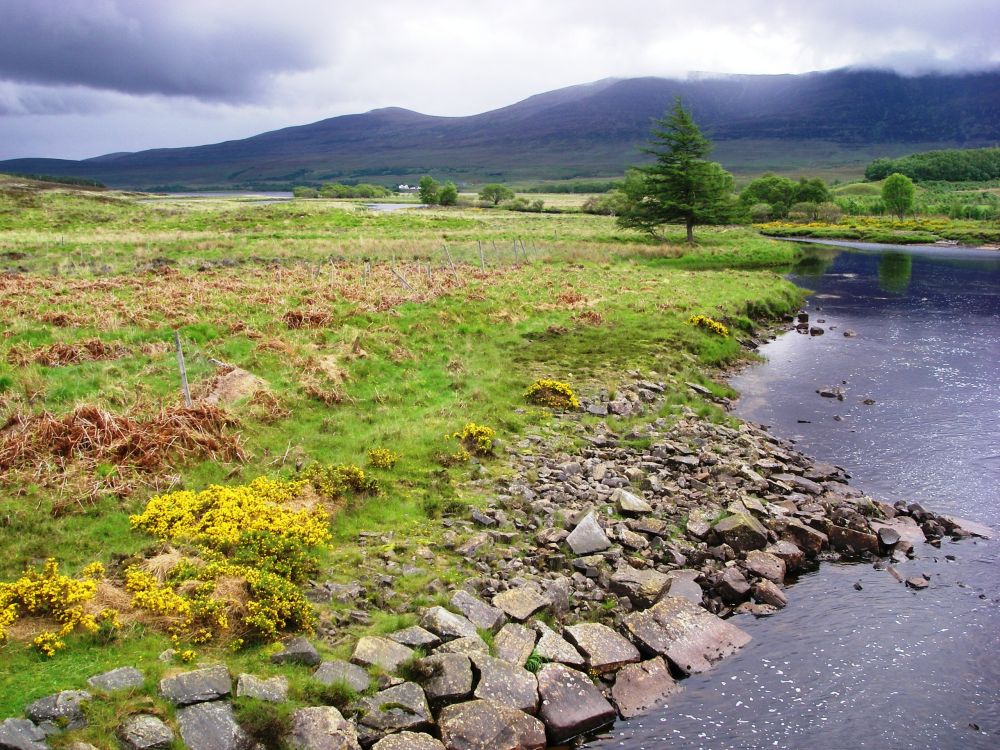
Before descending to Tongue we sat on a convenient seat overlooking the Kyle and the ruins of Castle Varrich on a cnoc overlooking the valley. Until 1517 this had been the family seat of the Mackay clan before they lost out to the Sutherlands. While we were sitting there enjoying the view two more cuckoos flew overhead. Their fanned tails in flight give them a distinctive look.
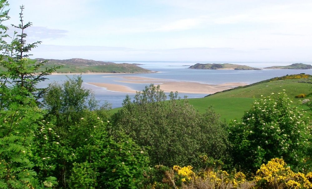
We had a cup of tea in the town before heading out to the hostel which was situated beside the estuary, taking the shady lane, which went past the back entrance to Tongue House. This became the home of the Mackay family after they were ousted from the castle. As the hostel was shut we walked to and over the causeway just as it started to rain. Rosalind had wanted me to see Ben Loyal in all its glory, but the cloud had come down and obscured it.
It was raining quite hard as we returned to the hostel where we had a rest before tackling our frozen microwave meals. They were not appetising; tasteless soup followed by an equally tasteless lasagne with no veg.
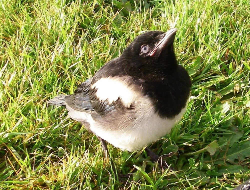
After washing up we had a walk in the garden where two campers were erecting their tents. To our surprise a young magpie hopped over to us and started to peck at Rosalind’s shoe. Further investigation revealed that his name was Larry and he had been made an orphan when the tree where he was nesting had been felled. Full of remorse, the young man who had perpetrated this heinous crime was rearing him by hand. Come holiday time he solved the problem of what to do with the baby bird by making him a nest in his cycle pannier!
Next morning our packed breakfast was duly handed out to us at 8 am and we each saved a roll and some ham for lunch. Larry was outside on a makeshift twig perch. ’Daddy’ gave him some water from a bottle before coming into the kitchen for his breakfast. Larry didn’t like being left alone and hopped over to the kitchen door, but he wasn’t allowed in. Will he keep in touch with ‘Daddy’ after he has fledged? We shall never know.
The sun was shining as we left the hostel and Ben Loyal had taken its hat off, resplendent in its majesty. The tide was out in the estuary exposing the Kyle of Tongue oyster beds. The oysters harvested here are slow growing because of the coldness of the water, which gives them a better flavour. A car drove through the main entrance to Tongue House as we passed, and we noted the crow-step gables common to the houses on the Mackay estate. I doubt whether crows ever use the gables as steps.
The road had become busier, with a vehicle passing every five minutes, not every half hour as before. We were glad we hadn’t taken a ‘short cut’ across Ben Tongue. It would have added hours to our journey. The sound of the cuckoo was constantly with us as we passed several lochs and lochans. An angler was standing thigh-deep in a reedy stretch of water hoping for a catch while his collie dog was waiting patiently on the bank.
There was one long, steep climb and we stopped at the top for a rest and to enjoy the view. We could see Ben Loyal’s jagged outline silhouetted against the skyline, little Cnoc Craggie, and Ben Hope, the most northerly of the Munros, in the background. After a little while we saw the glint of a vehicle against the dark shape of Cnoc Craggie then again further down the hill. It must have been on the road we travelled yesterday.
After the viewpoint, we had a pleasant amble down into the valley, where signs for Betty Hill kept appearing although it was still four miles away. Rosalind immediately wanted a cup of tea ‘now’ but it was a futile wish and she harrumphed behind me as we crossed the River Naver and toiled up the hill the other side.
The mood improved after we sat on a low wall, ate a mini Mars bar each and had a drink of water. The village duly came and went, and we finally found our café near Farr Bay. After our teas and a large slice of cake we looked around the local museum which was in the graveyard of St Columba’s church. The main themes were the Mackay family and the highland clearances at the beginning of the 19th century.
Possibly the most brutal of the clearances had occurred around Strath Naver, the valley formed by the River Naver on its way from Loch Naver at Altnaharra to the coast at Betty Hill. On the instructions of the Duke and Duchess of Sutherland the crofts were set alight, sometimes with people still inside them, and the land levelled for more profitable sheep farming. Families were left huddled together with nowhere to go. Many died of cold or starvation.
People evicted from the land owned by the Mackay clan fared a little better. Some were offered mean crofts on the infertile coastal plain while others emigrated to foreign shores to survive as best they could. All things are relative.
After having a look around the churchyard where many ancestors of the Mackay family are buried, we continued to the Farr Bay Inn which was just up the road. In the bar, we met a father and son who had taken twelve days to cycle from Land’s End and hoped to reach John O’Groats the next day. It would take us several more days.
At dinner, we were joined by a young architect from Boston. She had spent two months exploring the Islands and Highlands of Scotland on her bike, sometimes wild camping and sometimes staying in more luxurious accommodation. She had another month of freedom before flying home. Cycling in the States was not an option. The countryside was too monotonous, the cars drove too fast and the people weren’t friendly.
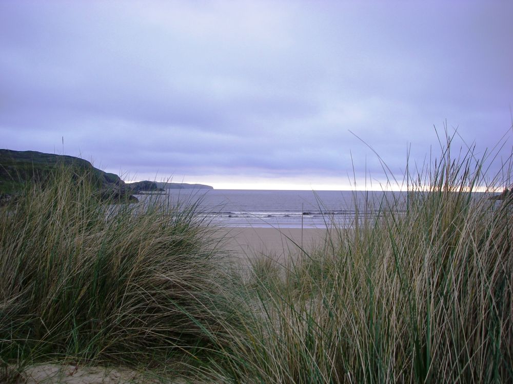
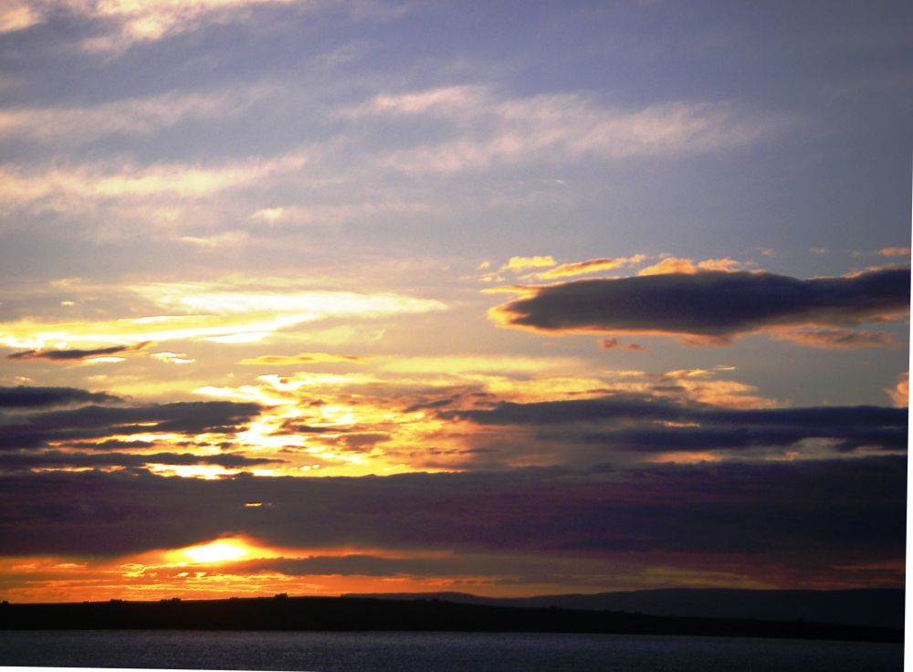
After our meal, we walked through the sand dunes to the beach. The soft dry sand was silvery in colour, the sky golden as the sun was just beginning to set, although this far north there are very few hours of darkness in early summer.
I woke up early in the morning and looked out of the window. The mist was thick outside, and it was raining heavily. The cyclists left the sanctuary of the inn first then our American friend went to have a look at the beach. It was after 10 am before we finally departed, enveloped in our festival capes to keep the worst of the rain off our waterproofs.
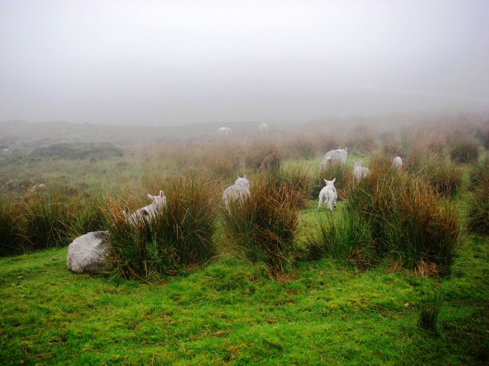
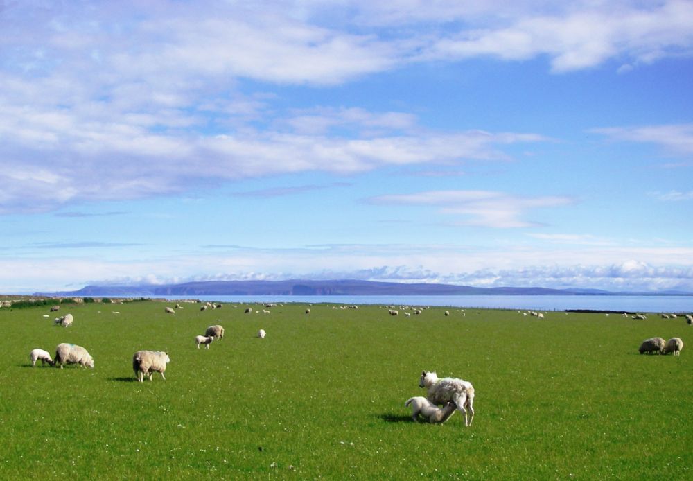
It was quite windy, and we had the rain in our faces as we climbed up onto the moor where the mist was even thicker. Our American friend cycled past with a wave and soon disappeared into the murk. At the top, there was a marker depicting all the mountains that could be seen – or not. A curlew was trilling overhead and sheep with their lambs were wandering across the road. I thought one would be hit as it made to cross in front of a speeding car. Luckily it stopped in time (the sheep, not the car).
Two buses a day were in operation between Betty Hill and Thurso, so we took refuge in a bus shelter for an early lunch. By the time we had finished eating the rain had eased, so we arrived at the Strathy Inn comparatively dry. Later we tried to find our way down to the beach but couldn’t find the path. The mist was getting thicker again and the cliffs, then the beach, faded from sight. We returned to the inn, had our showers then went downstairs for some excellent pub grub. The mist cleared, so afterwards I went out for a short walk. The beach and cliffs had reappeared, and a bright red kite was flying high.
There was good visibility when we left the inn after the best breakfast of this holiday so far. We had much better views as we climbed up onto the moor, passing Strathy Church which had been designed by Thomas Telford. There was a viewpoint at the top and a little Madam Curie memorial garden which had been planted with daffodils. Rosalind had a few minutes of quiet reflection as she remembered her niece, Sally, who had died just after we finished our walk across the Somerset Levels two years previously.
The countryside got scrubbier as we approached Melvich. The cuckoos were still announcing their presence, but we were unimpressed with our surroundings. It was impossible to take a good photo as there were power lines and telegraph poles in every shot. Notices had been posted protesting about a proposed new wind farm in the area. Forests were being cut down in preparation. The young lady with her lorry load of timber had passed us several more times. Will the outlook be better or worse when the new wind farm is in operation? Probably the latter.
The mist closed in again as we went our dreary way through non-descript countryside. There were a few small copses and some colourful gardens at Reay, but although the lanes were pretty, lined with cow parsley and interspersed with golden gorse bushes, the wind farm, silos and various industrial estates that we passed were not.
The centre of Thurso was dire. It may have been more pleasant on the coast but that wasn’t on our route. The riverside walk promised better things although the tree cover was so dense we could hardly see the water. We had a quick lunch, nearly got eaten by midges, then made our escape through a housing estate.
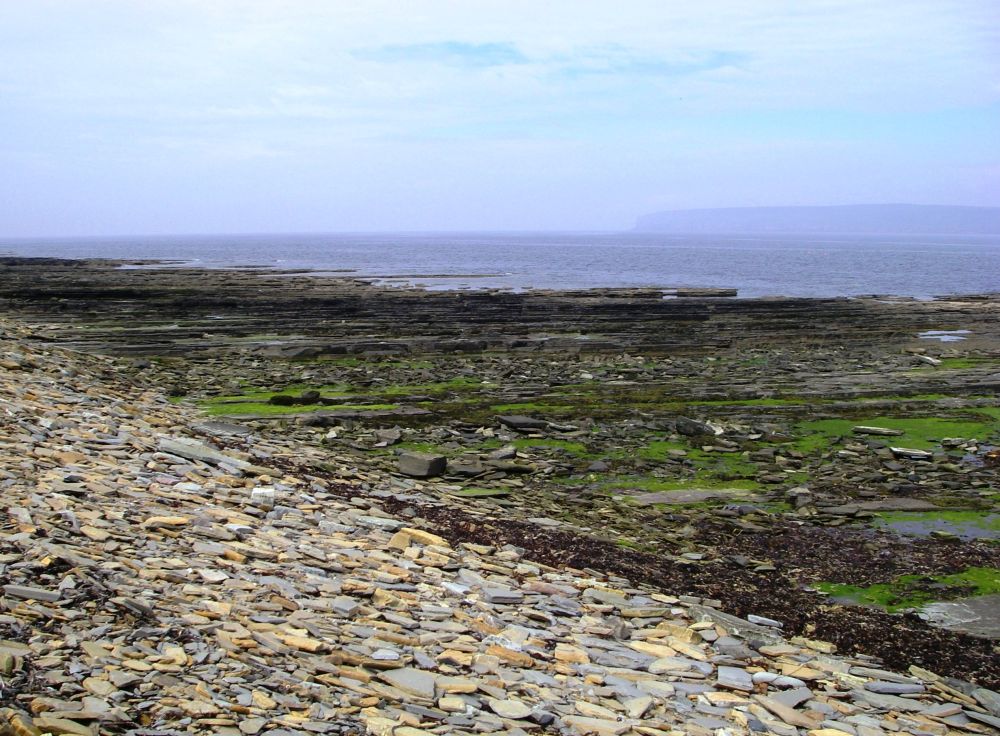
As we approached Castleton the outlook brightened, and we could resume our walk ‘the Pretty Way’. The sun came out as we took the road down to the harbour and the area of beach where flagstones had been ‘harvested’ between 1750 and 1850. These had been in demand all over the country, paving the Strand, the London Docks as well as the concourse of Euston Station. The little harbour had three boats in it and perhaps there was room for three more.
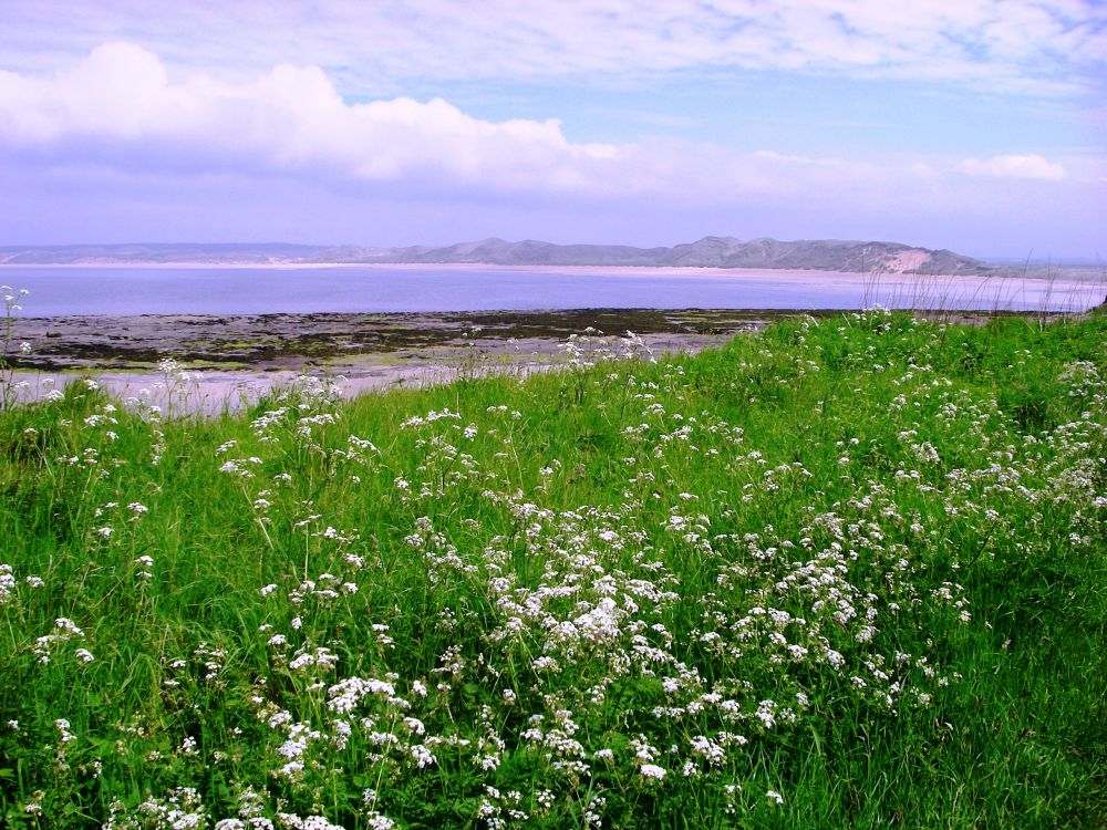
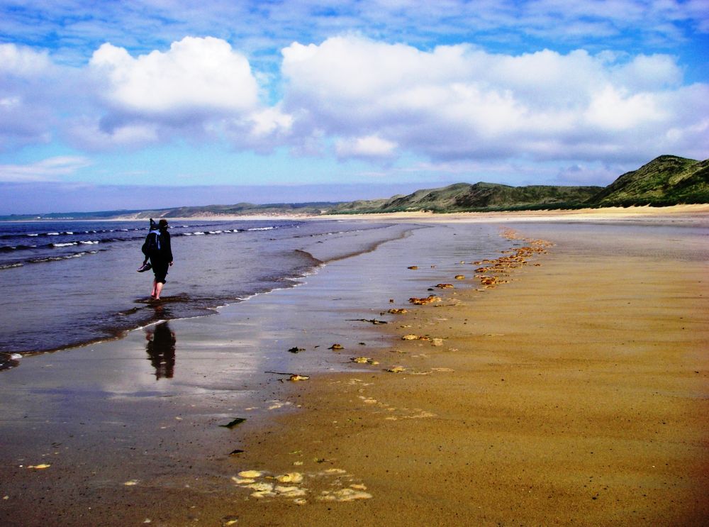
It was now a lovely afternoon. The beach was a three-mile-long expanse of sand with few people about. We took our boots off to paddle across the streams and walk along the water’s edge, being careful not to tread on the numerous purple-blue jelly fish. The huge sand dunes were being eroded by the sea, so we were careful to sit in a safe spot to have a snack and dry our feet.
Leaving the beach, we continued to Dunnet, where seeing a sign to Mary Ann’s Cottage we went to have a look. Mary Ann Calder had remained a crofter after her husband died until 1990. When she left to go into a home the villagers acquired the cottage ‘with a little help from a friend’, the queen mother, and with a £20,000 ‘loan’ purporting to come from a relative in America a trust had been set up to preserve it.
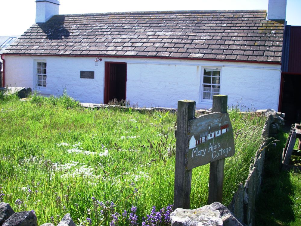
Mary Ann seems to have been completely self-sufficient. There was a quaint pig house at the back, stables, a hen house, a dairy and beehives. Ropes and fishing nets were made; there were facilities for spinning and weaving and even a tool for making rope slippers. In the stables was a bucket with a seat on top and a channel for the waste products. For relaxation after a long day there were two comfortable rocking chairs, one each side of the hearth, where a swing kettle supplied a continuous supply of hot water.
We had our evening meal at the hotel on the main road. Rosalind managed a large piece of haddock with chips and I had roast beef with Yorkshire pudding. There is a shortage of green vegetables this far north in the early summer. A mixture of carrot and swede is popular, as is red cabbage.
Our lodgings for the night were in an annex connected to the old post office at Brough. There was no lock on the outside door, a shared loo across the corridor and a lot of comings and goings from the caravans outside. Still, it was adequate, and the beds were comfy which was of great importance after a very long day.
In the morning, we were given the key to our room which made us feel more secure. Our breakfast was served in the tea-room and ‘information centre’ where the information was all about a proposed North Highland Way which was to be a long-distance walk from Cape Wrath to John O’Groats. We had our photos taken for the website ‘The first ladies of the North Highland Way’. Tessa, our landlady, was very enthusiastic about the idea and had also created gold, silver and bronze health walks, giving us the routes to try out.
The ‘bronze’ walk took us to the harbour down a treacherous, steep and overgrown slippery slope. On the slipway seals were basking without a care in the world. After watching them doing nothing for a while, we left the harbour by the access road, deciding not to attempt the presumably more difficult ‘silver’ and ‘gold’ walks.
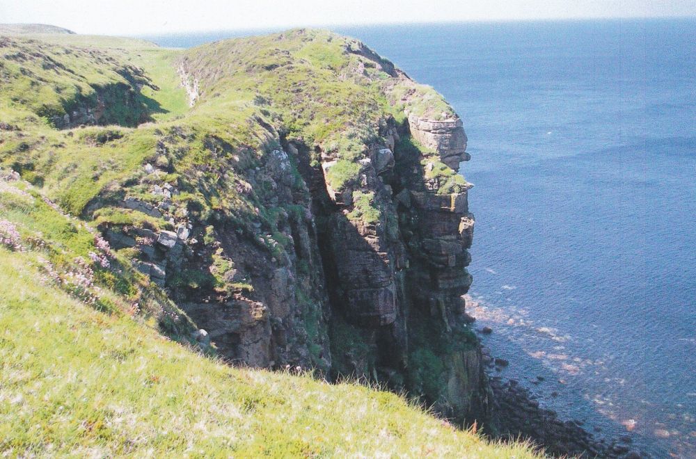
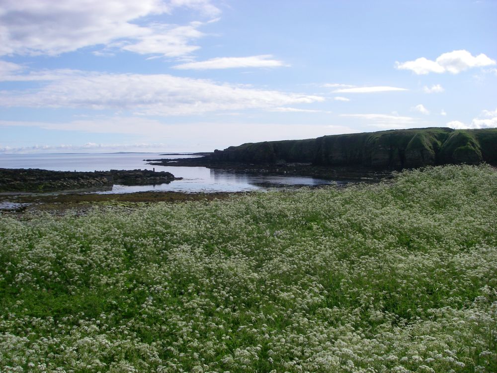
We made a circuit of a small piece of land belonging to the Woodland Trust which consisted of a small thicket and a lochan before setting out along the road to Dunnet Head, the most northerly point on the mainland. The cloud lifted, and it became a lovely day. Several varieties of orchid were now intermingled with the usual gorse and broom along the way.
A walker coming back from the Head stopped to tell us where best to see the puffins. Following her directions, we found a place on top of the very steep cliffs to watch the flying displays from the assorted seabirds. The puffins were much smaller than the others and black-backed. Occasionally one flew close enough for us to see a white flash and the orange on the beak. A pair of binoculars would have been useful.
We walked along the cliff top in a westerly direction, seeing more puffins on the way. This would be on the route of the proposed North Highland Way, very rough underfoot and quite boggy. The flora included blue alliums, numerous orchids, silver-leafed plants with yellow flowers and heather just coming into flower. All the vegetation was low-growing, suggesting harsh weather conditions, but not today. Bumblebees were abundant, and we also saw several varieties of butterfly. Rosalind, who was walking in trainers, soon got wet feet so reluctantly we made our way back along the cliff tops and down the road.
The well which used to supply the water for the lighthouse was at the foot of Burifa Hill which we climbed for a last look at the panorama. Then it was full steam ahead for a cuppa and cheese scones in the tea-room. After a rest and spruce up we went back to the tea-room for our evening meal of soup followed by baked potatoes with cheese and beans.
The wind was quite strong when we went out for our evening walk along ‘The North Highland Way’ There had been a cliff fall so we were told to go inland a little, cross the farmer’s fields and to duck under the electric fence which was turned off. This we did, then squeezed through another fence and came to a halt in front of a newly erected barrier of distinctly unfriendly barbed-wire. There was no way through and no alternative but to retreat. If Tessa wants a viable North Highland Way, she’d better make a start by getting the local farmer onside.
Instead, we walked along the lanes. The Orkney Isles had been shrouded in mist at Dunnet Head but now we could see them clearly. A crow was being attacked by a pair of curlews. First one dive-bombed it, then the other. Interlopers have no chance against these territorial birds.
As there was a front coming in we hurried back to our annex, which now felt much more like home.
There had been heavy rain overnight, but we awoke to bright sunshine. Tina and Brian were away so Susie, who ran the café, served us breakfast before we were on the road again. Two rabbits were playing in a field and butterflies flitted to and fro between the flowers that lined the banks.
At Ham, seals were basking, and oyster catchers were nesting on the cliffs. Every so often one would fly overhead to scold us. The marshy ground around the loch was full of yellow irises, just coming into flower.
As we passed a school next to a house in the middle of no-where a little boy of about three climbed onto the gate. He informed us that his grandparents had just left and that he went to the nursery school next door. He had spent the previous night in his parent’s bed because the Tarzan film he’d been watching had been so scary. I think he would have talked all day, but we still had a long way to go so we said our ‘goodbyes’.
Our next encounter was with an elderly sheepdog padding down the lane towards us, followed by a motorist waiting patiently to get by. She told us that the dog often took himself for a walk and was heading back towards his farm. The sheepdog changed his mind when he saw us and accompanied us up the lane. After a while he couldn’t keep up and watched us for a bit before turning around to make his way home.
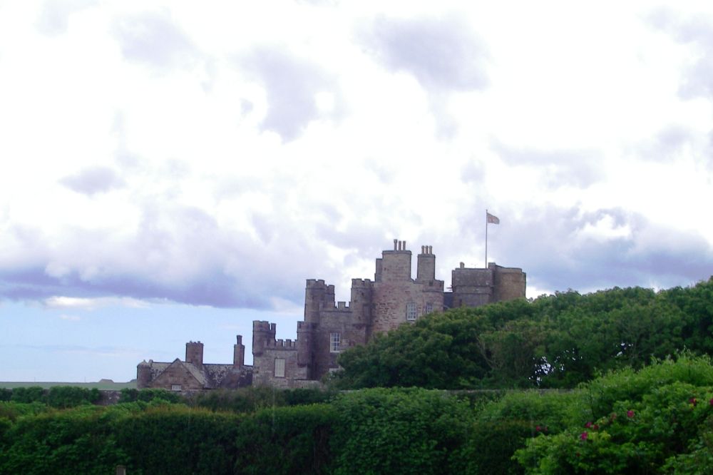
At Scarfskerry we had a short break where we watched the comings and goings of a large variety of birdlife on the crags, then continued to Harrow, where we found the narrow lane leading off along the cliffs to the back entrance of the Castle of Mey, the Queen Mother’s former retreat. A cup of tea in the café was welcome, but we didn’t find the staff as friendly as they could have been.
Outside in the walled garden a young gardener was happy to talk to us. In its heyday, the grounds had boasted five gardeners. Now there were only two, but there was just as much work! Perhaps the café was also short-staffed which would have accounted for the grumpiness.
Rosalind had badly wanted to see the roses in the walled garden as last time she had been to the Castle of Mey the weather had been atrocious. Unfortunately, it was too early in the season and the roses weren’t yet in bloom. The gardens were lovely though, and there was the hum of bees as they collected the nectar from the other flowers.
The clouds had gathered and there were a few drops of rain as we left, following a coastal track. Then for a short time we were bombarded by hailstones as we were caught by the edge of a thunderstorm, but not for long. The sky over Dunnet Head was black, but although the storms continued all around us we were under a blue sky for the rest of the way.
Just before Gills Bay, we joined the main road where we watched the car ferry set out for Orkney before braving the traffic as we tackled the final few miles. Rosalind had the bit between her teeth and outpaced me. I had to keep trotting so she didn’t get too far ahead.
Canisbay church was on the main road, the churchyard full of ornate gravestones looking like giant chess pieces. The headstone of Jan de Groat, the Orkney ferryman, had been discovered under the floor of the church and was now in the churchyard. The queen mum had attended this church when she was at the Castle of Mey and Charles and Camilla had kept up the tradition.
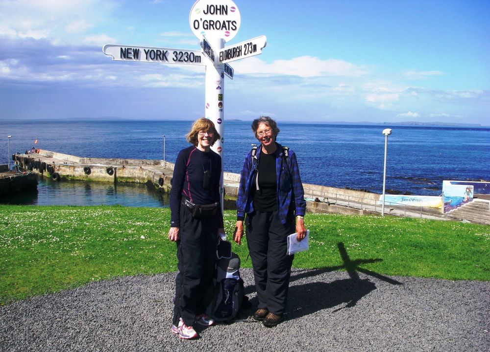
The road was now busy, and we frequently had to step aside for fast-moving traffic, but we made good time and were in John O’Groats soon after three pm. We braved the public bar at the Seaview Hotel where we had business with the proprietor, Andrew. He confirmed that Rosalind and Verney’s friend George, who had a cottage at Duncansby, had given the hotel a cheque for £20 towards a celebratory meal for us both.
The only thing left to do was to amble down to the coast and the ‘tourist’ signpost indicating the distances to Land’s End and other places and ask someone to take our photograph. The original signpost was privately owned and charging an exorbitant price for the privilege.
Job done, we trundled up the road to the Anchorage at Duncansby, passing some very pregnant cows. Gayle, our landlady, had seen us coming and was waiting outside to welcome us to her beautiful home. When we were ready she drove us back down to the hotel where we had fresh haddock from the Pentland Firth accompanied by a glass of celebratory wine. Perhaps it was a little early to be celebrating as we had sections of Land’s End to John O’Groats the Pretty Way still to do, but the end was in sight.
Andrew drove us back to the Anchorage and as usual when I combine wine with a long walk I zonked out. It was a beautiful evening and I recovered sufficiently to walk down towards the beach to photograph the sunset. The curlews were calling to each other, swallows were dashing to and fro and a haughty cow stared at me as if I’d no right to be there, her calf frisking around her. I slept well that night.
We may have completed the formalities at John O’Groats, but we hadn’t finished this stage of the journey just yet, let alone the whole route. We still had a trip to the Orkney Isles to come and to round off our journey we needed to go to Duncansbury Head, the most easterly outpost, to see the famous stacks.
Next day Rosalind was up at six am and had made me a cup of tea before she realised how early it was. The tea was cold before I woke up. After breakfast Gayle dropped her children off at the bus stop and took us down to the office to pick up our tickets for the ferry to the Orkney Isles.
It was a lovely morning again and the crossing was smooth. Stewart, our tour leader, told us all about the Churchill Barriers and the half-submerged boats, protection for Scapa Flow after a German U-boat had sunk the Royal Oak at the beginning of WW2.
As we passed through St Mary’s he recalled when, in 1952, the fishermen turned chicken farmers had lost everything when chickens, coups and all were blown out to sea in a devastating hurricane. 86,000 birds were lost.
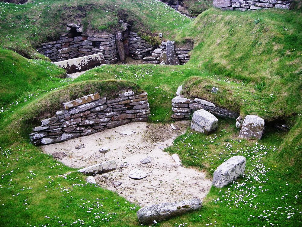
We spent some time in Kirkwell then sat by the harbour at Stromness for lunch before continuing to Skara Brae stone-age village. In 1850 a severe storm had stripped the sand and earth from the settlement revealing eight dwellings. Thought to be occupied between 3180 BC and 2500 BC the village was very well preserved and much has been gleaned about the lives of the inhabitants.
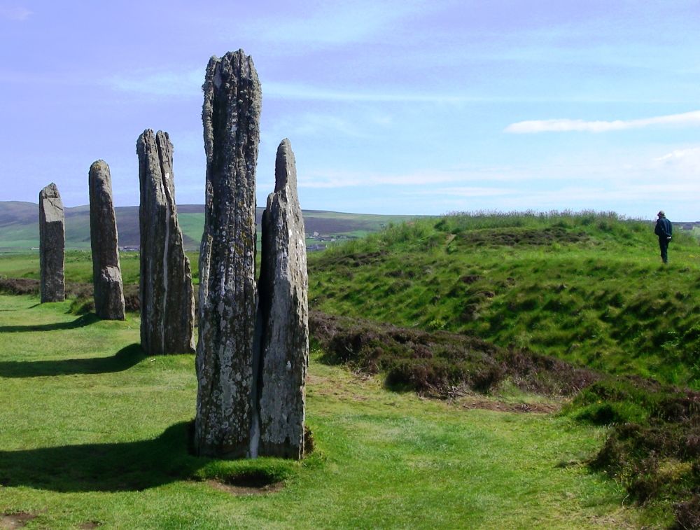
The Standing Stones of Stenness and the Ring of Brodgar were interesting examples of Neolithic henges. It has been suggested that the Ring of Brodgar had been used as an observatory to track the movements of the stars and planets.
Back in Kirkwell we had time to explore the ruins of the Bishops’ Palaces, old and new, and to have a look around the Viking Cathedral of St. Magnus. Here we met up with the two students who had spent last night at The Anchorage with us. They were going to stay on the island another two days.
Our last stop was at the Italian Chapel. When the Italian prisoners-of-war working on the Churchill Barriers requested a place of worship they were given two Nissan huts. Using their own initiative and materials found locally they converted the huts into a beautiful chapel. Some came back for their sweethearts after the war and every August a group comes over from Italy bringing surviving veterans with them.
Since Viking times until 1468 the Orkney Isles had been under the jurisdiction of Norway. Then Christian I of Norway pledged Orkney and Shetland as security for a considerable dowry demanded for the marriage of his daughter Margaret to James III of Scotland. The money was never paid, and the islands came under Scottish rule.
The Orcadians have maintained their strong ties with Norway. In 2007 a new flag, yellow and blue on a red background, was designed to symbolise their joint Scottish and Norwegian heritage.
Gayle was waiting to meet the ferry at John O’Groats to give us a lift back to the Anchorage. Her husband, Dave, was a fisherman who had ‘caught’ the anchor in one of his nets which was now displayed in the front garden.
Back in our luxurious apartment we relaxed then made do with a picnic. Outside it started to drizzle.
There was no view in the morning. Sea mist was obscuring everything. We piled into the car with Gayle and the two children, Jack and Abbey. At the end of the road Gayle turned left instead of right to take us to Duncansby Head, much to Jack’s puzzlement. School would have to wait.
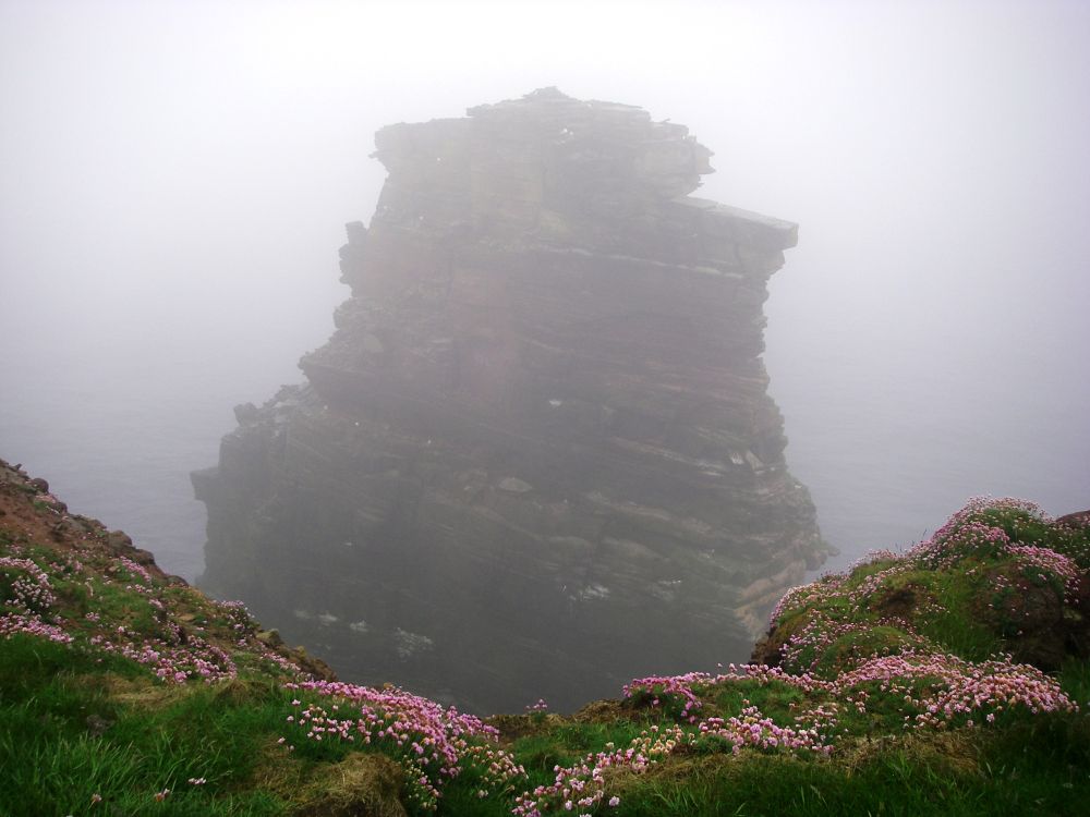
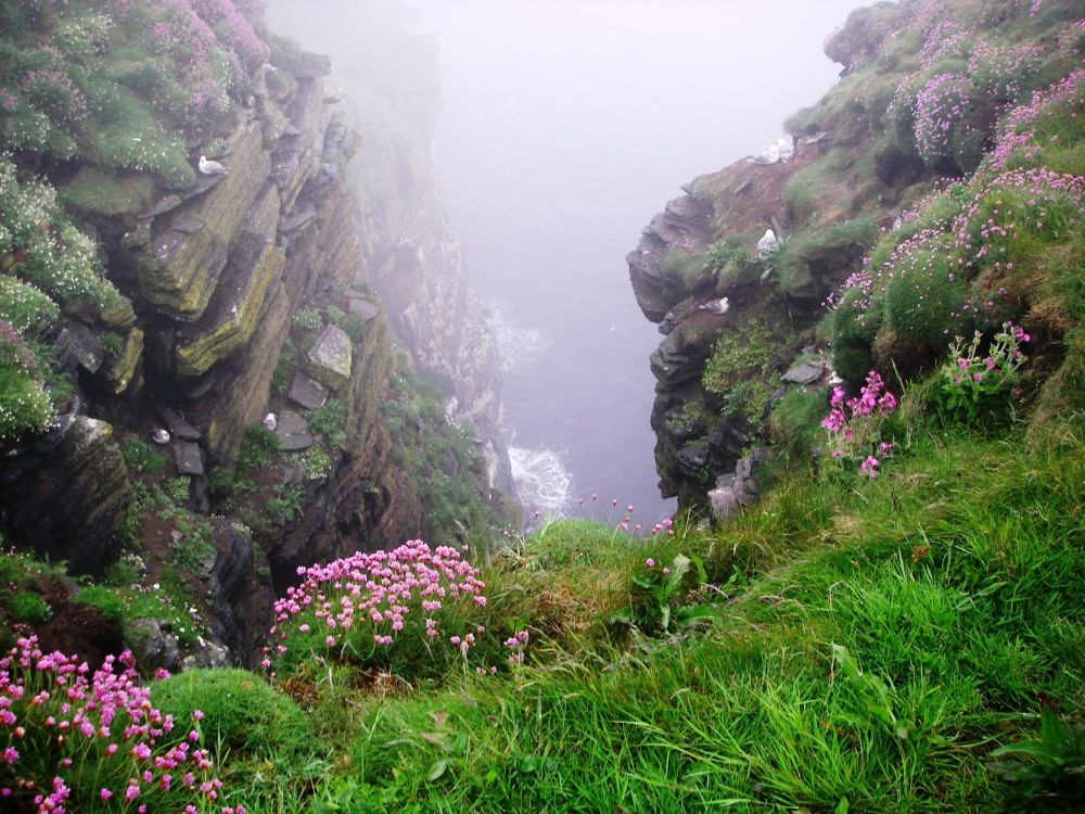
The mist was even thicker at the Head, but the path was well-used, and we could follow it easily. The cliffs were so high that we couldn’t see the sea at the bottom but there were kittiwakes in every nook and cranny. They mostly seemed to be young birds and every so often one of them would practise flying, rather clumsily. There were also black-backed gulls as well as one or two puffins. The stacks remained invisible as we continued down the path until it began to peter out.
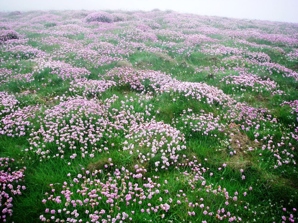
We turned back, and suddenly saw a massive, ghostly shape emerging from the mist, then another – the famous stacks. The large cave was now also just visible and around it huddled together were hundreds of razorbills, looking rather like small penguins. Pink sea thrift covered the cliff tops.
The lighthouse was also visible as we regained the road, the mist gradually lifting. Two oyster-catchers screamed at us to divert our attention from their nest. Rosalind suggested that we should take the path to pretty Sannick Bay which we did, trying not to disturb the sheep with their lambs too much. Being full of bright ideas today, Rosalind then suggested that we should walk back to John O’Groats as we had plenty of time (Gayle had offered to give us a lift).
Picking up our rucksacks from the house we thanked Gayle for all her help then completed the last mile and a half back to the village. The sun was now shining brightly as we enjoyed a cup of hot chocolate before popping into the information centre to check the time of the coach to Inverness. It was a good thing we did because it left from the crossroads, not the village. The information I had that the stop was ‘opposite the John O’Groats knitwear shop wasn’t helpful. The knitwear shop had moved from the crossroads to the village!
Back we went to the crossroads and were disconcerted to see a coach destined for Dunbeath pass on the other side of the road. Had we got it all wrong? Rosalind, always calm in an emergency while I panicked, checked at the post office across the road. She was assured that the coach was meeting the ferry at Gills and would be back. To our relief it was, twenty minutes late, which meant we had to change at Wick as well as Dunbeath. At both places the coach for the next stage of the journey was waiting for us.
Although the dreaded A9 passed through some pretty countryside and was often in sight of the sea it wouldn’t have been a pleasant walking route. Two End to Enders were braving it though, the only other walkers we’d seen on our 150-mile marathon. Our route, the Pretty Way, had been much longer but delightful.
It started to rain heavily and there was a flash and clap of thunder almost overhead. Soon we started to see signs for Lairg and Bonar Bridge, and then passed through Tain and along the Cromarty Firth. The nature reserve at Alness Point was gone in a flash, then we crossed the Firth Bridge to rain-soaked Tore and the Kessock Bridge into Inverness, to complete the round trip, arriving on time. Top marks to Stagecoach.
I enquired at the lost property office about my walking poles but the only ones there were blue, not red. So be it. I hadn’t needed them.
Back at Castle View I had the luxury of a hot bath before we went to the Italian restaurant next door. Rosalind treated me to a pasta meal to say, ‘thank you’ for arranging the trip. Everything had worked to plan apart from the mix-up at Bonar Bridge and even that had turned out for the best.
Roswenda had pulled out all the stops to give us the best weather possible. Will she still be our fairy godmother on the Pennine Bridleway between Buxton and Hebden Bridge next year? We hope so.
In September Scotland voted NO to Independence. The lady from Kincardine will not have to move to England just yet.
Summary
December 2017
The whole, rambling route from Land’s End to John O’Groats has now been completed over a year before schedule, but not as we had anticipated. This was the last section to be completed before Rosalind became ill and had to limit her activities. The last four more moderate sections I have had to tackle on my own.
Luckily, a Zimmer Frame was not required. Of course, it would have been of no practical use across ploughed fields and negotiating awkward stiles.
According to the signpost at Land’s End, John O’Groats was a mere 874 miles away. Going the Pretty Way, we covered approximately 1,400 miles, of which over 700 miles were outstanding – most of the coastal path between Land’s End and Minehead, the Quantocks and Mendips, parts of the Cotswold Way, the Derbyshire Dales, the Pennine Way between Hebden Bridge and Keld, the coast to coast path between Keld and Rosthwaite, the Cumbria Way to High Pike, crossing the Lammamuir hills, most of the West Highland Way and the north of Scotland. There were spectacular views – from high points on the coastal path, from Beacon Batch in the Mendips, from the top of Malham Tarn and Great Shunner Fell on the Pennine Way, from the high peaks in the Lake District, all along the West Highland Way, approaching the lonely Crask Inn in Sunderland, from the craggy heights of Dunnett Head and many, many more.
Another 500-600 miles afforded very pleasant walking – some sections of the Somerset Levels, Winchcombe to Kinver Edge, Hadrian’s Wall, the Pennine Way to Dere Street, St Cuthbert’s Way, Gifford to Edinburgh, Edinburgh to Bishopsbrigg, the Great Glen Way and most of cycle route No.1 from Inverness to Melvich.
Some sections were hard-going because of the mud, notably parts of Somerset and the Limestone Link between the Mendips and Bath. Very few sections were mundane – some of the agricultural land in the Midlands, parts of the Pennine Bridleway, the road to Morebattle, the cycle route between Reay and Castleton and the last few miles to John O’Groats. There were two dangerous sections – crossing the A420 after a blind bend on the Cotswold Way and the 2 mile rat-run between the canal at Bishopsbriggs and the A879, my worst error in route-finding.
We were extremely lucky with the weather. Yes, we did have a few soakings, but considering the distance we covered they were very few. We were particularly lucky to have mostly fine weather in the Lake District, on the Pennine Way and in the western highlands of Scotland, areas with a high level of rainfall.
Most unexpected was how little the hustle and bustle of modern life encroached on our walk. The overall impression was one of wide-open spaces and nature going about its normal business. Although it is generally believed that our island is over-crowded, we found that it was easy to leave ‘civilisation’ behind.
Rosalind continued to enjoy life until she died peacefully, at home, in September 2022. Her memory lives on in many people’s hearts.
Inverness to Tongue:
Tongue to John O'Groats: