
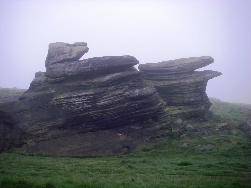
Back in the spring of 1995 Rosalind and I did a circular walk centred on Buxton. On our outward journey we crossed Axe Edge Moor, the source of the River Dove, and the Roaches where we were ‘met by a howling gale with rain and sleet lashing our faces’. I was blown off my feet a couple of times as we staggered from one rock shelter to the next. But – “There were good views!” Roswenda must have been engaged elsewhere, or perhaps she hadn’t been invented yet.
I will focus on our return journey to add the next piece to our Land’s End to John O’Groats jigsaw puzzle. As the crow flies it is 15 miles from Dovedale to Buxton. The Pretty Way, visiting fifteen of the Derbyshire Dales, plus two fictitious ones, took us on a perambulation of 40 miles!
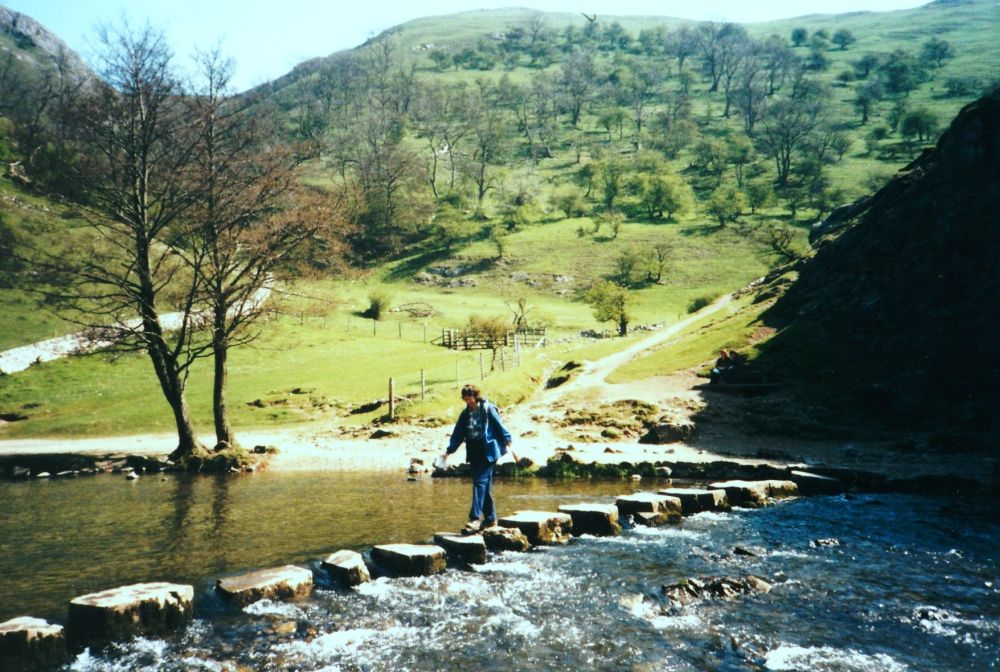
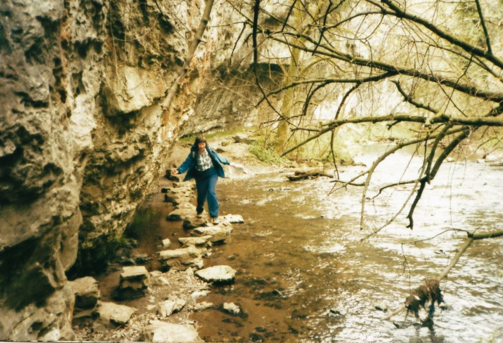
The top of Thorpe Cloud was our starting point for this leg of the walk. Students were huddled in small groups all over the hillside studying the geology of the 350-million-year-old carboniferous rocks. We knew nothing about rocks but appreciated the panorama from the well-worn summit before descending to the valley. Rosalind took my photograph crossing the famous stepping stones over the River Dove before we set off along scenic Dovedale. Later in the season this popular tourist attraction would be swarming with people, but at present it was relatively quiet.
We wandered along the water’s edge, climbing up to Lovers’ Leap to look across to the rock formation called the Twelve Apostles before descending to the riverside again. A little further on a path led up to Reynard’s Cave, a huge natural arch high up in the chalk cliffs.
Carved out of the limestone by the River Dove and sheltered from the elements, Dovedale with its many natural cavities has a long history of human activity. 13,500 years ago, hunters used the caves as shelters; Buxton Museum has Bronze Age artefacts from Reynard’s Cave, and going forward to 2014, a ‘treasure trove’ of coins from the late Iron Age plus three Roman ones were found there.
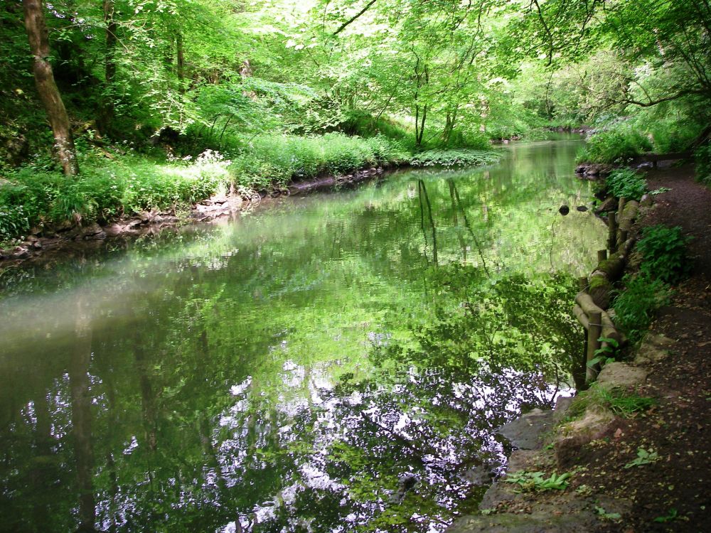
At the end of the valley we went up to the little hamlet of Milldale. Here we shared our lunch with some friendly ducks before descending to Mill Dale and continuing along Wolfescoat Dale, then Beresford Dale. We were still beside the enchanting River Dove, which bubbled over the rocks in eddies and swirls, leaving dark pools of deeper water undisturbed. Fishermen were patiently waiting for the trout to bite, but the fish were lying low as we passed.
Coming out of the green valley, a clever right and left took us straight to Hartingdon Hall hostel, a 17th century manor house which over the years has been considerably extended. It is said that Bonnie Prince Charlie stayed at Hartington Hall during the Jacobite uprising in 1745.
The warden had lost our bookings but there were two beds left, fortuitously in ‘King Charles’s Room’. It was quite a cramped room for a king. We shared it with an Australian woman accompanied by her daughter. The mother talked too much to the daughter’s obvious embarrassment.
After dinner we walked around the village but there was nothing to report so we went back to the hostel to have an early night.
Next morning, we made a dog-leg journey to Youlgrave, heading up the Tissington Trail into a very strong north wind, then south-east down the High Peak Trail, still exposed to the wind. Rosalind was glad she hadn’t parcelled home all her warm clothes which she had considered doing a few days ago (the weather had turned warm after our ordeal on The Roaches). Green Dale (our name) was more sheltered as were Long Dale and Gratton Dale, the latter less craggy, a green valley between rolling tree-clad hills.
Coming into Youlgrave Dale we nearly went the wrong way but realised our error. Locals working on their allotments gave us directions to our lodgings at the Old Bakery and recommended The George as being a good place to eat. Our accommodation was very comfy, and we enjoyed the luxury of a hot bath before proceeding to The George for a tasty meal and to renew the acquaintance of our allotment friends.
Next day. On our way back into the dale after a super breakfast we passed the allotments again, opposite some pretty cottages with well-tended gardens. Some of our new friends were already hard at work on their little rectangles of land. Back at the river we saw an angler catch two trout. The wildlife was plentiful. In Lathkill Dale we saw a willow warbler, yellow and grey wagtails, a coot’s nest, and a female hen harrier. The river bank was pitted with holes just above the waterline and a vole swam along beneath them until he reached home at hole number 32 and disappeared into the labyrinth.
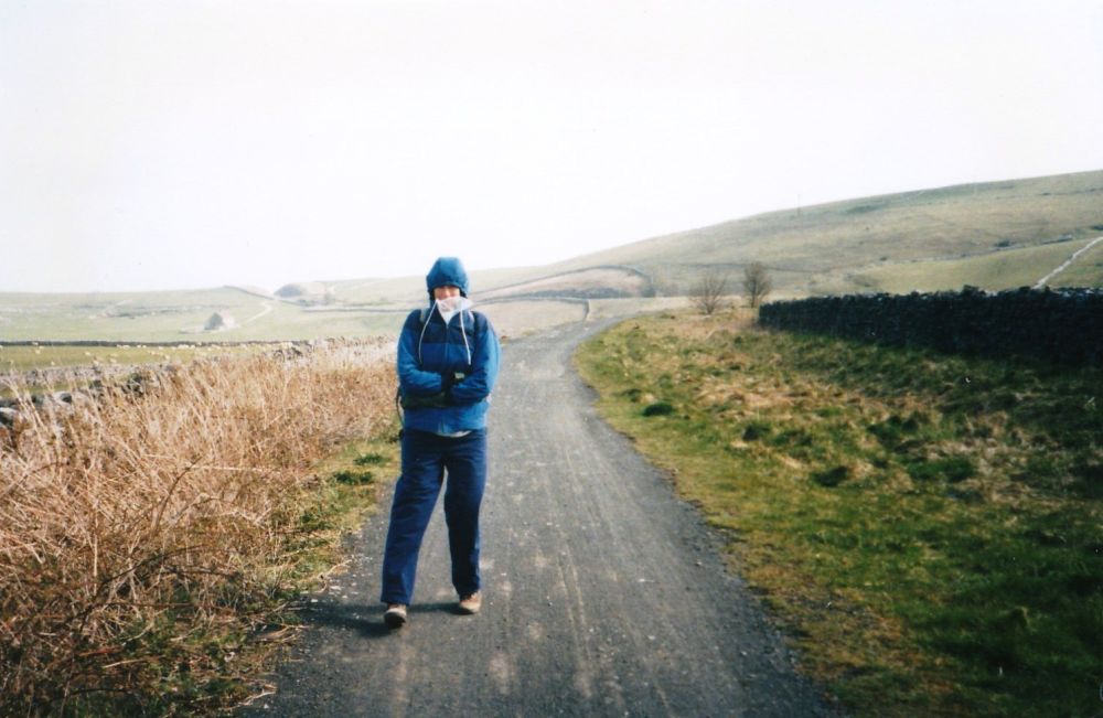
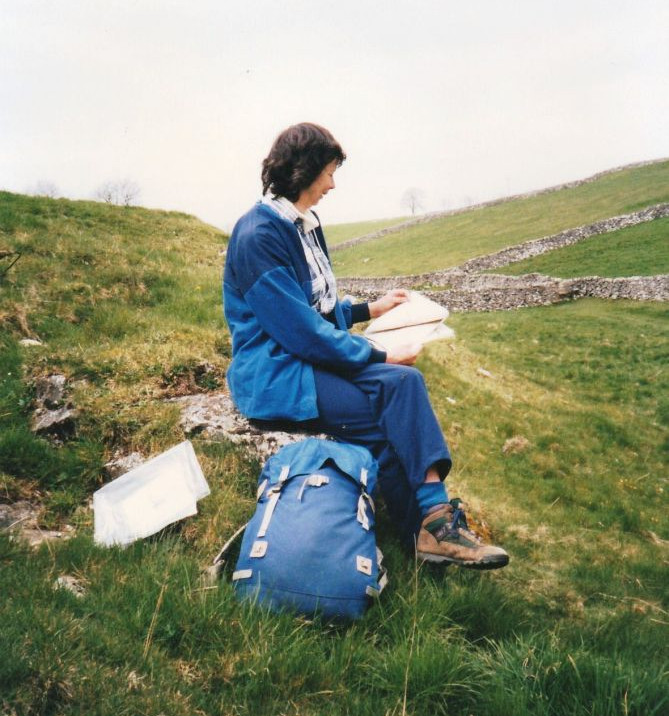
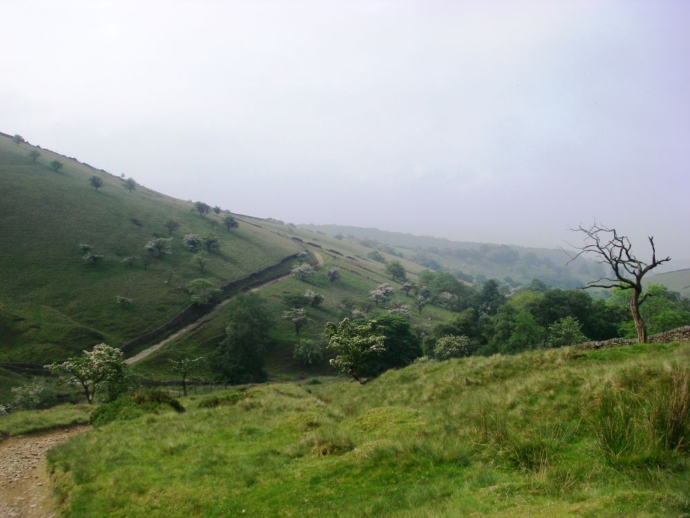
After the disused quarry we bypassed Fern Dale and the Limestone Way through Monyash. Straight on across the road was a much more important dale, BAGSHAW DALE where Rosalind took my photo. It was a very small dale, interspersed with lots of dry stone walls and not much else, but mine own! The rucksack in the picture is an original (slightly modified) Jo Brown, bought for snow and ice expeditions in the Austrian Alps thirty years previously. It would be another fifteen years before I tracked down a light and roomy replacement sack which would do the job better.
Leaving MY dale, we climbed over the hill through numerous walled fields then down the other side into Deepdale, where the banks were clothed with cowslips, then on to Dank Dale (our name), the steep sides covered with dripping ivy and lichens.
Back on the main path Rosalind exclaimed “how boring” in a very loud voice, well within earshot of people picnicking in the car park beside their cars.
We had categorised the roads we had to cross in order of their ferocity. Motorways were blue dragons; ‘A’ roads were red and quieter roads green. The A6 was therefore a red dragon and we scurried quickly over it to safety in Monsal Dale where trout were jumping in the River Wye.
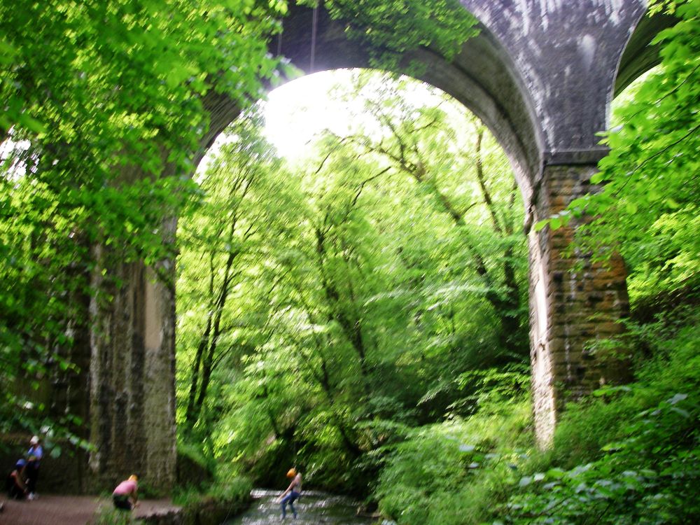
We crossed the river over the Headstone Viaduct on the Monsal Trail, which follows an old railway line linking Manchester to London. The line was closed, not by Dr Beeching, but by Barbara Castle in 1968. The poet John Ruskin was most unhappy about the construction of the viaduct. “The valley is gone – and now every fool in Buxton can be in Bakewell in half an hour and every fool at Bakewell in Buxton’.
Dropping back into the valley we passed through scenic little Water-cum-Jolly Dale then into Millers’ Dale where Litton Mill produced textiles during the Industrial Revolution using Richard Arkwright’s water frame and slave labour. Arkwright invented many gadgets which led to improvements in efficiency in the mills, keeping his costs down by engaging whole families to work for next to nothing. Children as young as seven made up a large proportion of his workforce.
It was a steep climb up the spur of the hill to Ravenstor Youth Hostel which was in a prominent position commanding spectacular views. A noisy school party had the run of the country house which was set in sixty acres of grounds. At dinner Bunter of the Remove had his chips stolen, much to the hilarity of his peer group. Afterwards we went for a walk along the dale, returning to the hostel via the even steeper direct path up the flank of the escarpment.
Next morning, having explored the dale the previous evening, we walked along the Monsal Trail for a couple of miles before dropping down into Chee Dale. At one point there were stepping stones around a rock face which were submerged after heavy rain. Today they were well above water, so we had no problems. Wye Dale was next along the way where we crossed the ‘red dragon’ again into Deep Dale where a working quarry had quite spoilt the beauty of the valley. It was rough going past a cave and along a remote pony track before climbing out of the gorge.
We had our lunch on the bank at the top amongst gorse bushes in golden bloom before walking through parkland to Buxton to catch the train home.
It is now 2016 and much has changed since we were last in the Buxton area. Rosalind and I have almost completed our Land’s End to John O’Groats project, concentrating on the most difficult sections first. But now, with a mere 250 miles to go, I am on my own. Two years ago, just after we had triumphantly walked from Inverness to John O’Groats, Rosalind was diagnosed with myeloma and it gradually became apparent that she wouldn’t be able to carry a rucksack or walk long distances any more. However, she will be with me in spirit and there is always the mobile phone to keep in touch.
My troubles started in Reading. Dave drove me to the riverside; my arthritic hip started playing up as soon as I started walking along the tow-path to the station. Would this adventure be over before it had begun? I hoped not.
The journey to Derbyshire was straight-forward. I had a snack lunch at Birmingham New St before catching a train to Chesterfield. The bus to Blackwell was waiting outside the station and went through all the little villages before dropping me off at the crossroads at Blackwell. It was a lovely day but very hot as I walked to my B&B at Priestcliffe. My room had a king-sized bed and a patio door leading out to a very pretty cottage garden. Many different varieties of bird were enjoying the nuts and seeds provided for them.
After making myself at home I walked across the fields for my evening meal at the Queens’s Arms in Taddington. I had a very tasty cottage pie accompanied by six vegetables. Yummy. Replete, I strolled back across the fields enjoying the lovely views. There was no mobile phone reception, so I couldn’t contact Dave or Rosalind.
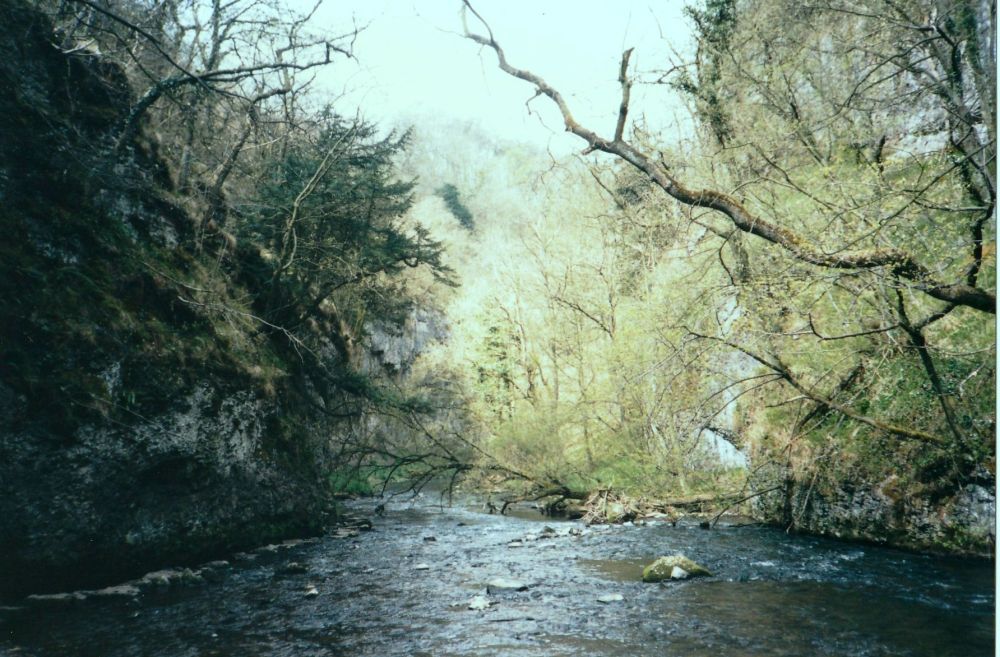
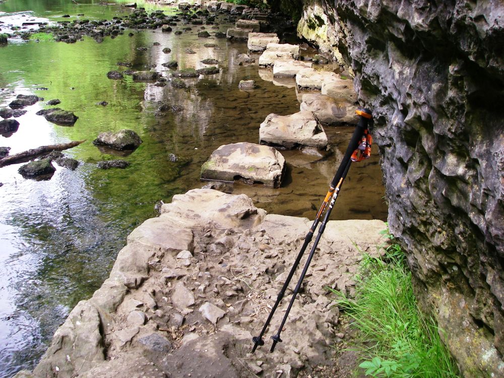
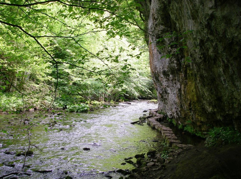
After an excellent breakfast, I retraced my steps to Blackwell then joined the Pennine Bridleway which soon descended steeply into Chee Dale. It was another hot day and my pace was very slow because of the heat and the discomfort my hip was causing.
The stepping stones I had last crossed twenty-one years ago had been raised and were much firmer, but even so I nearly lost my footing. The path was much rougher than I remembered with a second lot of stepping stones, but on checking I realised that last time we had come along the Monsal Trail on the disused railway track and not been in this part of the dale. It was very pretty, with the fresh green leaves of the trees casting a dappled shade which was reflected perfectly in the slow-flowing water.
The leek-coloured hawkweed which was thought to be extinct has recently been discovered in the rocky limestone nearby. Native to Britain, it had previously only been recorded at four sites in the Peak District.
A little further on a group of youngsters was abseiling off one of the railway arches carrying the Monsal Trail over the River Wye. It was a long way down.
As I had been told that there was no path along Monk’s Dale I took the Limestone Way instead. This climbed pleasantly along the ridge before dropping steeply into Peter Dale where I had to walk through a herd of cows with their calves. They didn’t take much notice of me.
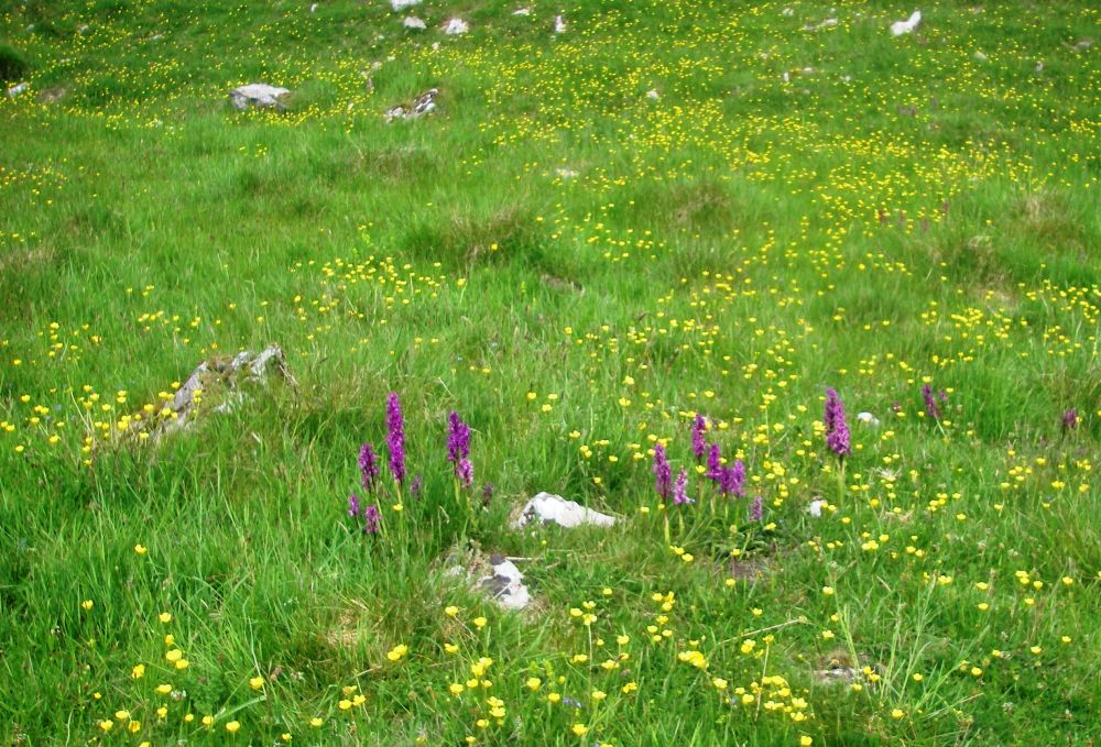
Across a minor road was Hay Dale, a nature reserve where there were many wild flowers in bloom including orchids. It was a haven for bees and butterflies. Soon I joined the Pennine Bridleway again on a minor road leading to Peak Forest. I had only two bottles of water with me which wasn’t enough. My throat felt very parched. Luckily as I approached the village a man working in the front garden of his cottage refilled the water bottles for me.
In Perry Dale, I stopped for a rest and a Mars bar. As the old saying goes, ‘a Mars bar a day keeps exhaustion at bay’. As there was mobile phone reception I phoned Dave and Rosalind to report on progress. They were the only phone calls that I would make.
My upmarket B&B, Rushop Hall, was halfway up a steep hill. As I toiled up a cyclist passed me on his way down. I had met no other travellers on the Pennine Bridleway, certainly no horse riders. I was given a warm welcome at Rushop Hall where a delicious evening meal of asparagus followed by salmon was served in the ‘no car café’. This was very popular with local cyclists who were obviously very keen on brown sauce and tomato ketchup.
As stabling for horses was provided in the grounds I asked how many horses and riders had completed the Pennine Bridleway. My hostess said that she had done it, but a high level of competence was required. Not many riders had enough confidence.
I had the luxury of another king-sized bed and the fact that I couldn’t get the television to work didn’t matter at all as there was also a radio. I slept well.
After another delicious breakfast which was served at the ‘no car café’ I was provided with a packed lunch and was soon on my way. At the top of the hill a track led down to the next valley. The cyclist who had passed me yesterday came up behind me and stopped for a chat. He had spent the night at the camp site at Peak Forest and called in at the ‘no car café’ for his breakfast. I must have only just missed him.
It was a hot day again with a lot of humidity in the air. An odd shower was expected in the afternoon which would provide some relief.
The undulating route across The Roych was very pleasant, going up to over 400 metres in places before dropping back down into the valleys, but it was very hard going for horses.
I had some trouble finding my way through Hayfield but soon picked up the route again. There were rumbles of thunder as I made my way up Lantern Pike, but I was on the way down before it started to rain heavily.
Thinking I was at the edge of the storm and that it would soon pass I sheltered beneath my festival cape beside a stone wall, but soon found myself sitting in a stream gushing down the fell-side. I was surrounded by an angry black gloom. There was no alternative but to plod on. As the ground levelled out then started to rise slightly, the stream became a river of muddy brown water, now rushing along the path towards me. I waded against the flow for about a mile; every so often some evil-looking whirlpools formed in hollows by the side, sucking and glugging. I was glad when the path veered off away from the cascade to join a road. I squelched on to Charlesworth in lighter rain. It was still very humid and by the time I reached the award-winning tea room and guest house where I was staying my trousers were dry. Not so my boots and socks.
I felt like a fish out of water sitting in the corner of the tea-room with my complimentary pot of tea and Bakewell tart. The lady of the house was reluctant to acknowledge my presence at first, but her husband was a walker and sympathetic to my plight. He brought me a towel to dry my feet and after the tea-sipping ladies in their summer finery had departed, my boots and socks were taken away to dry. I was then shown to my room, not en suite but with an adjoining bathroom complete with bath! I made the most of this luxurious facility. I took my phone out of my rucksack to see if there was a signal but found it was completely kaput. Although in a polythene bag it had not survived the deluge. I was cut off from the outside world.
Being genuinely not hungry I forsook my evening meal and ‘chilled out’ for the rest of the evening.
I didn’t take any photographs on this section of the journey. I wonder why?
It promised to be another hot, humid day. I filled three water bottles, bought cards at the post office, wrote to Dave and Rosalind about my predicament, posted the cards and was on my way by 9.30 am. The route going towards Hollingworth was confusing, little used with few waymarks. There was the occasional Pennine Bridleway sign, but no horses could have got over those stiles! Not until later did I realise that it was an alternative walkers’ ‘bridleway’.
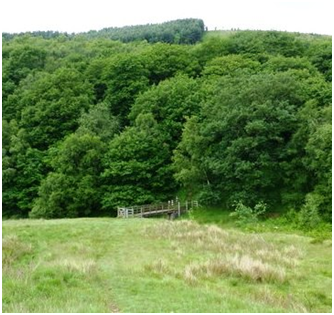
Negotiating Hollingworth was difficult and I had more trouble on the next section. In Swallow’s Wood nature reserve diversion signs took me to Devil’s Bridge, well away from the route on the map, and dumped me in the middle of nowhere (see picture), the only path heading in the wrong direction. Luckily, I was caught up by a hiker (the only other person ever to use the alternative path?) who had a GPS. He confirmed that the only way to go was in the wrong direction back to the ‘real’ Pennine Bridleway. This added a further mile to the distance. I learned later that the long-proposed Longdendale bypass which was to go through Swallow’s Wood had been approved in 2014 and work was expected to commence soon. The diversion must have been something to do with that.
Back on route I soon came to the reservoirs in Stalybridge Country Park where there were a few people about. Two elderly men out on a ramble invited me to share a bench with them. While I enjoyed my mid-afternoon Mars bar they confirmed that the route over Harridge Pike was preferable to the Pennine Bridleway as it was straight-forward and shorter. It was a good route, and I was soon trudging along Moor Edge Rd then through the village of Greenfield, finding it hard going in the heat. I finally reached the Wagon Inn at Upper Mill at 5.30 pm.
This was my most expensive night and certainly not the best. None of the posh facilities worked. The shower was lukewarm, water gushed out of the taps and the kettle wouldn’t switch off. The room was unbearably hot, but when I opened the window the noise from the ventilation shaft outside was ear-blasting. The pub was very popular though, and the meal was good.
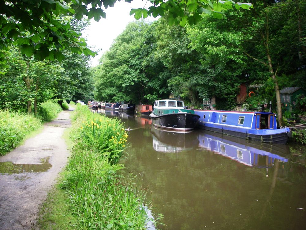
It was dull next morning and not quite so warm. I walked along the Huddersfield Canal as far as Diggle, passing some of the old mills where wool and cotton were spun during the Industrial Revolution. A few people were about walking their dogs and one or two canal boats were moored along the banks.
I had a major problem regaining the Pennine Bridleway. There was a bridleway sign where I was expecting the route to leave the road but then there was a detour up a steep bank across rough ground. A woman in a caravan at the top said that a channel for the path had been dug too deep and that everything had collapsed. However, I crossed the main road into a minor road as indicated on the map, but when I checked my compass I was ninety degrees adrift. I decided to walk down the main road until I reached the correct path (right decision), but it seemed much too far so I turned back (wrong decision). Rosalind would have had a clearer head and more patience, not making that mistake. I finally got back on route having faffed about for over three quarters of an hour, time which I couldn’t afford to waste.
The route was better defined passing Bleak Hey Nook then crossing the Castleshaw reservoirs. I took a short cut down Ox Hey Lane through Denshaw, an ancient village dating back to the Stone Age, which is situated at the junction of five major roads. This shaved a mile off my journey.
Back on course, I passed two more reservoirs then climbed the pass between Turf Hill and Binns Pasture. The Pennine Bridleway then made a big loop, passing under the motorway and coming to Hollingworth Lake. I wanted to take a direct route along a footpath leading to a bridge over the motorway. Luckily before leaving the bridleway I could see that there was no public access to the bridge, so I had to take the long detour.
The thunderstorm hit me suddenly as I was passing under the motorway, so I used the shelter of the bridge to put on my festival cape. This time the water washing over the path was much shallower and wasn’t a problem. I continued along the edge of the moors and finally reached the main road leading down to the Moorcock Inn, a welcome sight. I got there at 5.30 pm, having hobbled fourteen miles.
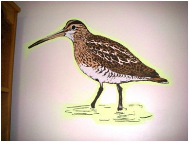
The name of my single room was ‘snipe’ with a picture of the bird on the wall. There was everything that I needed and was cosy and comfortable. The newspaper I had bought at Charlesworth helped to dry out my boots and I washed my socks which dried overnight. As it was Friday I had fish and chips for my evening meal.
Being the weekend, breakfast next morning wasn’t served until 9 am. The locals were already congregating in the bar for a drinking session. I ordered a bacon butty and smuggled half of it out for my lunch. There was an even larger party in the bar when I left at 9.45 am.
It was warm in the valley but up on the Pennine Way it was cold with a north wind in my face and a thick mist. I walked along the wide path beneath the dam walls of the Blackstone Edge, Light Hazzles and Warland Reservoirs, built, along with Hollingworth Lake, in the late 19th and early 20th centuries to provide water for the Rochdale Canal.
Figures kept appearing and disappearing into the mist; a family of cyclists, a walking group, more cyclists, a young man in shirt sleeves, walking briskly with the essential bottle of water clutched in his hand, then another walker who warned me to take care as it was rocky ahead. If I got into trouble I was to blow my whistle and he would come to rescue me.
The next section of the path had been paved as it crossed peaty heather moor. Every so often one of the paving stones would give way under my boot with a glugging slurp, so care had to be taken.
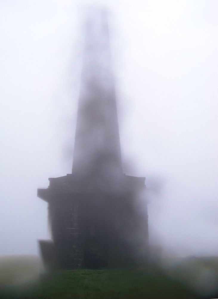
The mile or so leading to the top of Stoodley Pike was very rough. A family with three children, the youngest about three years old, was struggling between the rocks, dad manfully pulling the empty pushchair. The eldest boy, aged about eight or nine, informed me that when they got to the monument on the top they were going to have a lunch of chicken and crisps, an irresistible bribe.
Sadly, it was too misty to appreciate the majesty of the monument, built in 1814 to commemorate the defeat of Napoleon. In fact, I couldn’t see it at all until I was standing directly beneath it. This was supposed to be the highlight of the walk.
On the way down, I left the Pennine Way briefly, joining the Pennine Bridleway again before continuing towards my B&B down Kilnshaw Lane. Young lambs in the fields were very tame and gambolled across to the field boundary to say ‘hello’.
Just before Old Chamber there was an ‘Honesty Box’ – a little hut with a bench, tea and coffee-making facilities, cartons of eggs, Victoria sponge cake, ice cream and other goodies. I had just put the kettle on when a woman who had overtaken me on the path came in to get some eggs. Her name was Maria and she was staying at 8 Old Chamber to look after the dogs and the B&B while her friend, Julie was away. I turned the kettle off, took some cake along with a tub of ice cream, left the money and followed Maria to my digs.
I was shown to my room which had a king-size bed with a sitting area. Basic provisions had been provided. I made myself a meal of cheese and ham together with my spoils from the Honesty Box and had a very lazy time watching all three Euro 16 football matches and the Queen’s 90th birthday celebrations, the changing of the guard and the royal family, including George and Charlotte, on the balcony watching the fly-past of the red arrows.
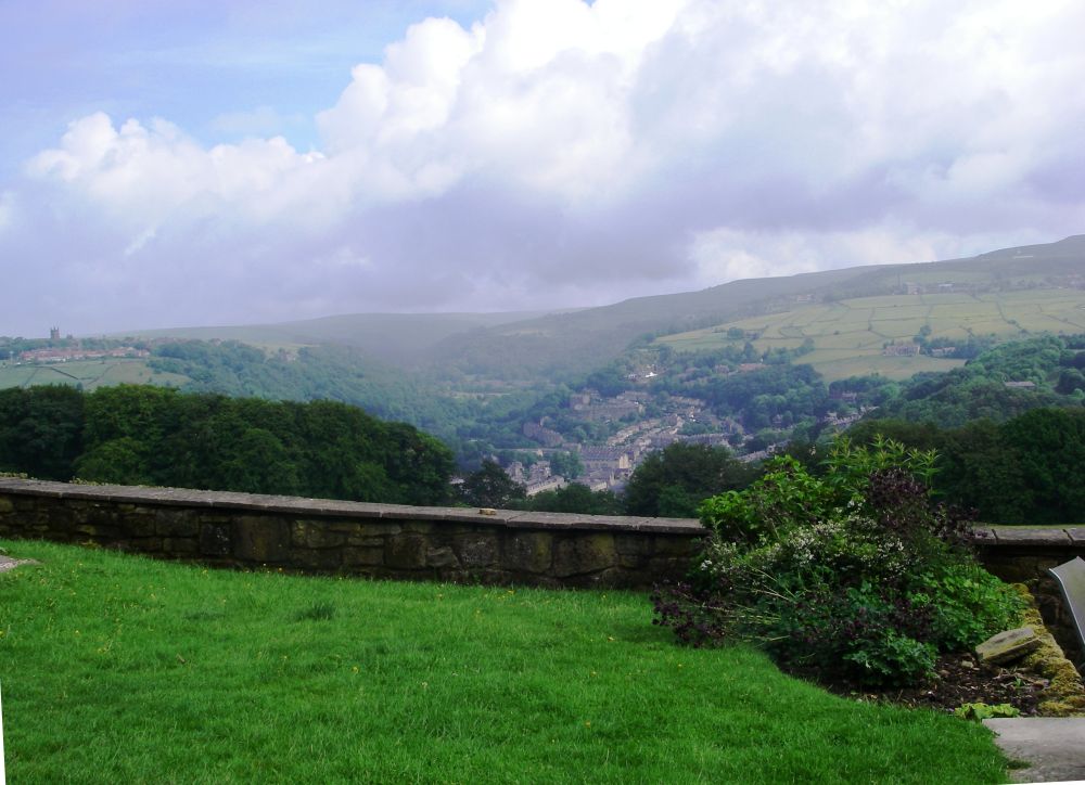
After a leisurely continental breakfast, I took my leave of Maria and the dogs. The mist had cleared to reveal a lovely view across Hebden Bridge to Heptonstall and the Hebden Water valley.
I walked down the cobbled lane then made a detour across the railway to the Rochdale Canal which I walked along to reach the station. The train was packed with youngsters off to the Parklife Festival in Manchester.
It rained heavily as I made my way from Victoria Station to Piccadilly, the weather having the last laugh. I had my lunch before catching the train to Reading. It was very full; I was lucky to get a seat. I thought there would be problems when we were delayed at Oxford because a lorry had hit a bridge, but the hold-up was for only a few minutes. Dave and our little dog Tyson met me on the platform of Reading Station. It was good to see them.
Against all the odds, I had done it! The problem with my hip cleared up within two days of getting home.