
As we didn’t take any photographs between Combe Hay and Wotton-under-Edge at the time, some have been added later.
February 2007
Batheaston to Old Sodbury
The weather forecast was for heavy showers and the train passed through several on the way to Bath. However, it wasn’t raining when Rosalind and Verney met me at the station. We drove to Batheaston for the start of the day’s walk. Tomorrow’s section would be Combe Hay to Batheaston.
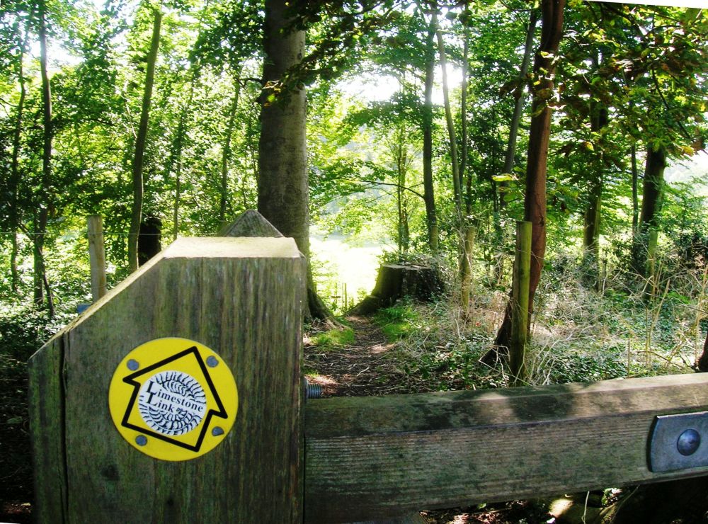
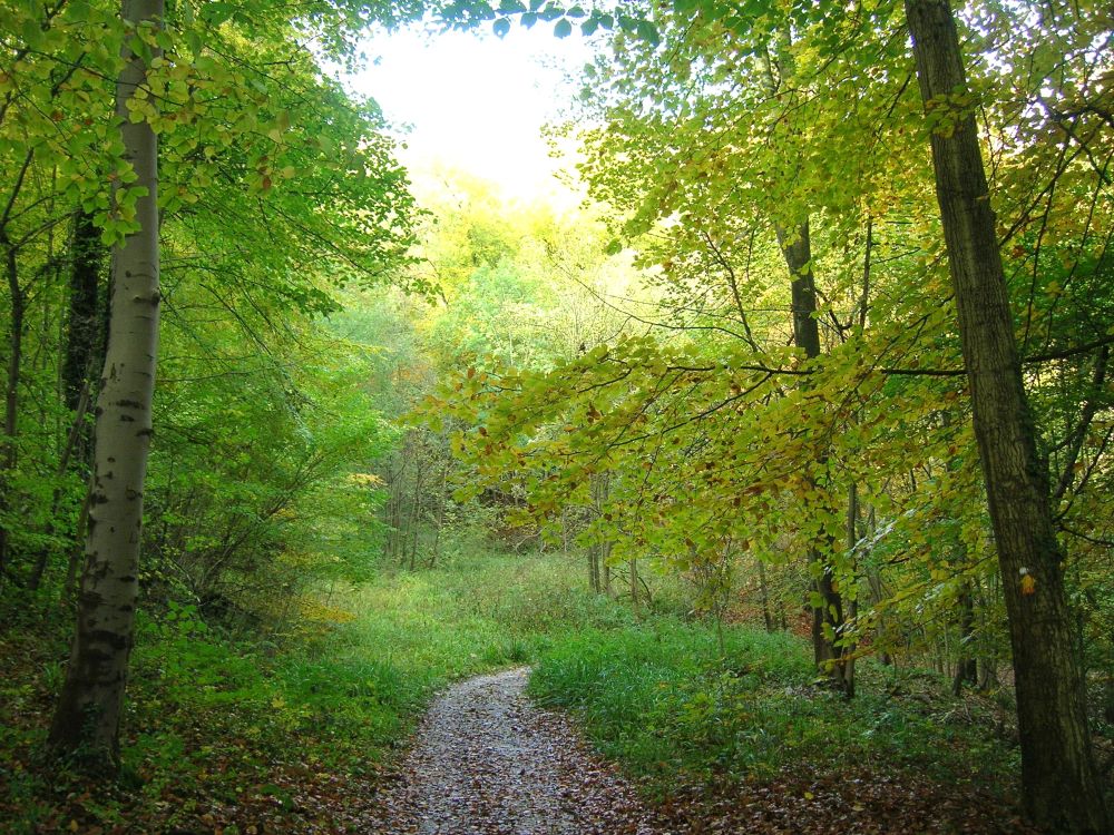
It was very muddy along the Limestone Link and the start of the Cotswold Way, but at least it wasn’t raining. Maybe one day we will walk the Limestone Link after a period of dry weather and not be battling with the mud (and worse) most of the way.
We had a narrow escape as we crossed the A420 on a blind bend, having to run to avoid being hit by a speeding lorry. This section of the walk needs to be re-routed before there is a serious accident.
After crossing the motorway, the Cotswold Way passes through the old village of Tomarton. In Saxon times it marked the boundary between Mercia and Wessex.
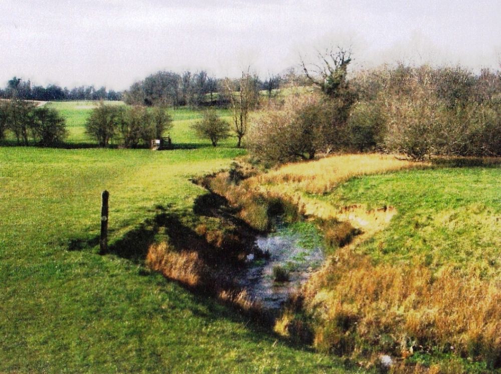
On the other side of another busy road, the A46, are Dodington House and Park. The gardens were originally laid out by Capability Brown in the second half of the 18th century. James Dyson of vacuum cleaner fame acquired the property in 2003. The path goes through the middle of the park, crosses the watercress stream and descends to the lake before going out of the grounds and on to Old Sodbury, another village dating back to Saxon times.
The name has nothing to do with grumpy old men. It was originally recorded as Soppanbyrig, which means Soppa’s fort, perhaps referring to the fort just north-east of the village. The mainline railway to Cardiff emerges here from the long tunnel under the Cotswold Hills. Nothing can be seen of it except for the large turret-like outlet for one of the ventilation shafts poking out of the hill.
It had been a very pretty walk despite the mud, and the sun came out just before it set, casting a golden glow across the sky. Verney picked us up and we returned to Wotton-under-Edge, well content with our day.
Combe Hay to Batheaston
After breakfast Verney drove us to Combe Hay for our walk along the Limestone Link to Batheaston. We couldn’t decide whether we should be on the dismantled railway or not and faffed about for about an hour before we finally got going.
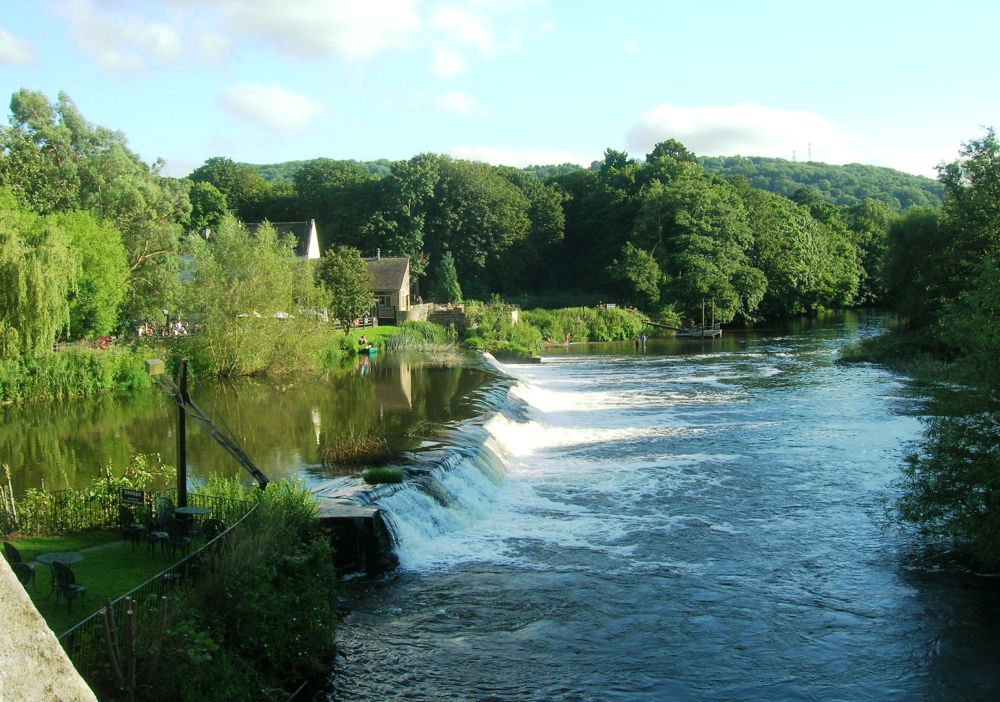
Although the weather forecast wasn’t good, it wasn’t raining and there wasn’t as much mud. We passed through a very pretty valley within a mile of the outskirts of Bath. A peregrine falcon was hovering overhead looking for prey, and there were a few splashes of colour from very early spring flowers.
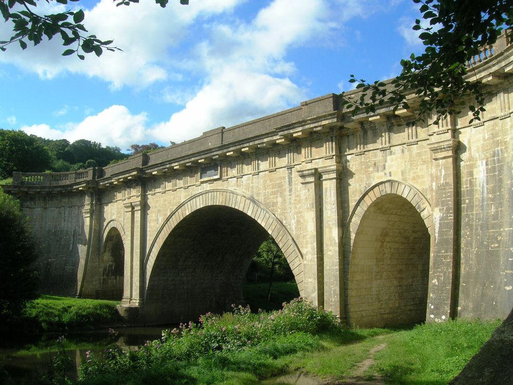
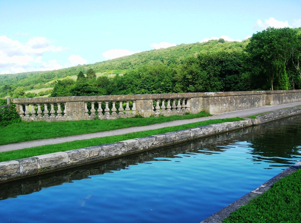
We joined the Kennet and Avon Canal at the Dundas Viaduct which carries the canal over the River Avon and the main line railway from Bath to Westbury.
The 57-mile-long canal was completed at the beginning of the 19th century, following the course of the River Avon to Newbury then joining up with the River Kennet before finally flowing into the River Thames at Reading. The canal fell into disrepair when The Great Western Railway was built, and it wasn’t until the second half of the 20th century that it was restored by the Kennet and Avon Canal Company, re-opening in 1984. Charles Dundas was the first chairman of that company.
We continued along the canal towpath and on reaching Batheaston we had a cup of coffee while waiting for Verney. When he arrived, we had an early meal in the pub. The rain started as we were driving to the station for my train home.
May 2003
Stonehouse to Old Sodbury
The morning was bright and sunny, but the weather forecast wasn’t optimistic. I caught the train to Stonehouse where I was met by Rosalind and Verney. Rosalind and I then walked along the Cotswold Way to Wotton-Under Edge, a distance of at least fourteen miles. At the end of the month we were going to do St Cuthbert’s Way in the Scottish Borders; we wanted to make sure we were fit enough.
The weather became dampish, but we had very little of the forecast rain. It was a lovely walk. The paths were well-maintained, passing through woods which were full of wild garlic. Rosalind kept meeting people she knew every time we came to a village. She is a very active member of the local operatic society and has a lot of friends. It was about 6.45 pm when we reached Rosalind and Verney’s home in Wotton-under Edge, where we enjoyed a cup of tea, good food and had an early night.
Next day Verney was in disgrace. He had forgotten to get any bread, so we bought sandwiches in the Co-op before setting off up the road. We didn’t have a map for this section which was a mistake as the way-marking was erratic and our guide book years out of date. The weather got worse instead of better as we ploughed through significant quantities of mud in the rain.
It wasn’t all bad, though. We saw highland cattle, more pretty villages, and banks of wild garlic lined the path in the woodland sections.
After Alderley we passed through a deep gulley where mature trees were teetering on the brink. One had progressed several yards down the bank, in an upright position, roots exposed, still growing!
The weather was so murky we didn’t notice the Iron Age Fort just past Little Sodbury, although the Cotswold Way passes right over it. We hurried on and were soon in Old Sodbury. We had had enough rain for one day and were pleased to see Verney, who took us back to Wotton-under-Edge for warm scones with butter and a change of clothes.
No photographs were taken, but these two were added later.
The traffic was horrendous on the way to Bristol Parkway Station. I was thirty minutes late for my train home and had to catch the next one.
(The central section of the last walk repeated.)
April 2013
Coaley Peak to Wotton-under-Edge
My husband, Dave and I were going to have a ‘tree house experience’ in Mid Wales and were breaking the journey at Wotton-Under-Edge. It was the only time that Rosalind and I could squeeze in a walk before attempting some of the Pennine Way in May. We would repeat the section of the Cotswold way between Coaley Peak and Wotton-under-Edge, taking a camera with us this time.
I arrived by train in time to enjoy home-made lemon drizzle cake followed by an evening walk with Rosalind and Verney before returning for a latish meal.
Next morning there was a very strong wind. After breakfast Verney drove us to Coaley Peak. The wind was blowing so hard that Rosalind couldn’t open the car door! We made our escape eventually, battling into the wind until we entered woodland where it was more sheltered. The weather improved throughout the day; the walking became a pleasure.
It was a steep climb to Cam Long Down where there were primroses on the banks and anemones in the woods. The high-level tracks traversing the hillside were firm underfoot and afforded extensive views over the valley.
We descended to Dursley where we enjoyed good soup and freshly baked rolls at the Old Spot Inn before climbing steadily through Cookshoot Wood to Stinchcombe Hill. There were fine views all around as we circumnavigated the golf course. The next village down in the valley was North Nibley where we sat on a bench in the little square to eat our flapjack and orange. The children had just come out of school and were going about their business unsupervised. Some were taking a dog for a walk; quite young ones were playing in the playground and others were just chatting in groups. It made a welcome change to see free-range children enjoying themselves.
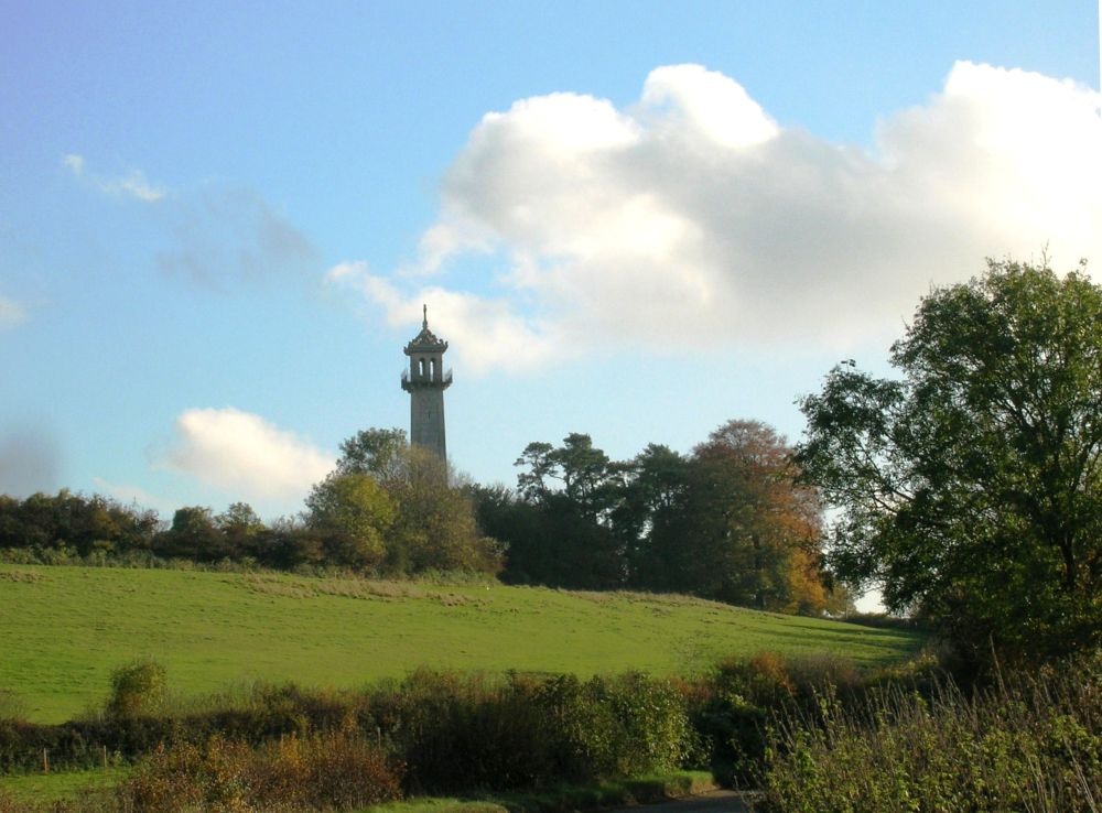
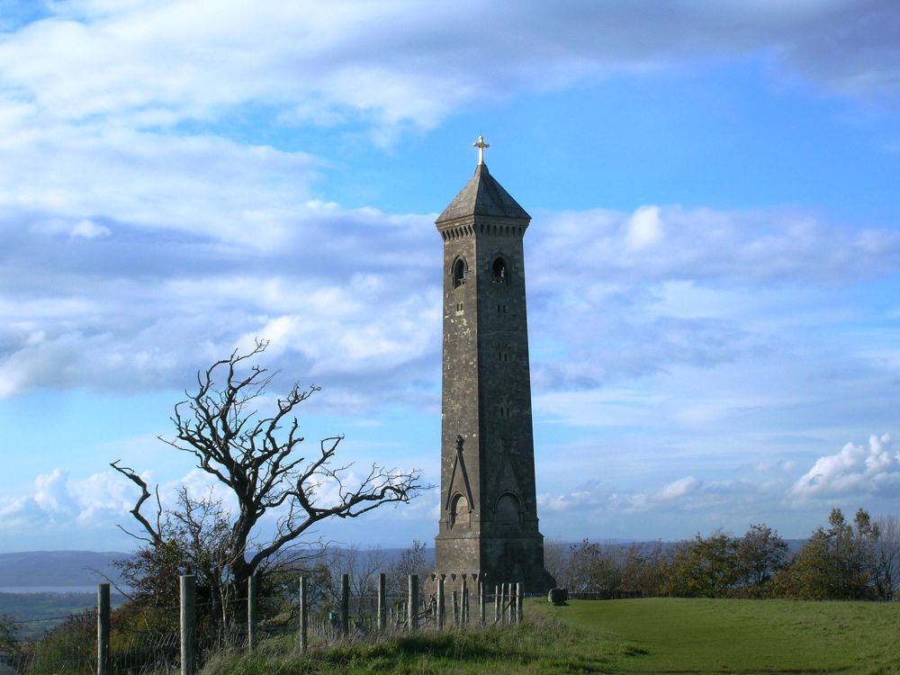
There had been major land and tree slides on the steep banks overshadowing the path leading up to the Tyndale Monument. Work was in progress to clear the debris. We proceeded with care as advised. Many of the standing trees looked unstable and some were creaking in the wind.
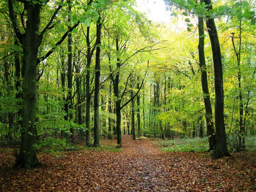
Westridge Wood is an area of ancient woodland, mostly beech, carpeted with a wide variety of wild flowers. The wood was bathed in dappled sunshine as we threaded our way between the trees before emerging at the top of Wotton Hill.
Back at Rosalind and Verney’s house Dave joined us for dinner having driven from Reading. We had a pleasant evening putting the world to rights. Next day Dave and I drove off to our tree-house.
The next walk was the one that nearly didn’t happen. Rosalind had had a complete system breakdown caused by a malfunctioning thyroid gland and had only recently been given a clean bill of health. Sixteen days ago, I had been awaiting a hip transplant having been diagnosed as having severe osteo-arthritis. I couldn’t walk across the park without a stick. A second opinion from a handsome young consultant and a fortnight of intensive training and exercises changed all that, so it was all systems go.
October 2010
Birdlip to Stonehouse
It was a bright, clear morning. Rosalind served porridge for breakfast to set us up for the day. After I had dug up some of her celandine for my wild garden we drove to Birdlip with Verney. After coffee in the Royal George we set off down the hill, soon joining the Cotswold Way. It was easy, very pleasant walking through the autumnal beech woods.
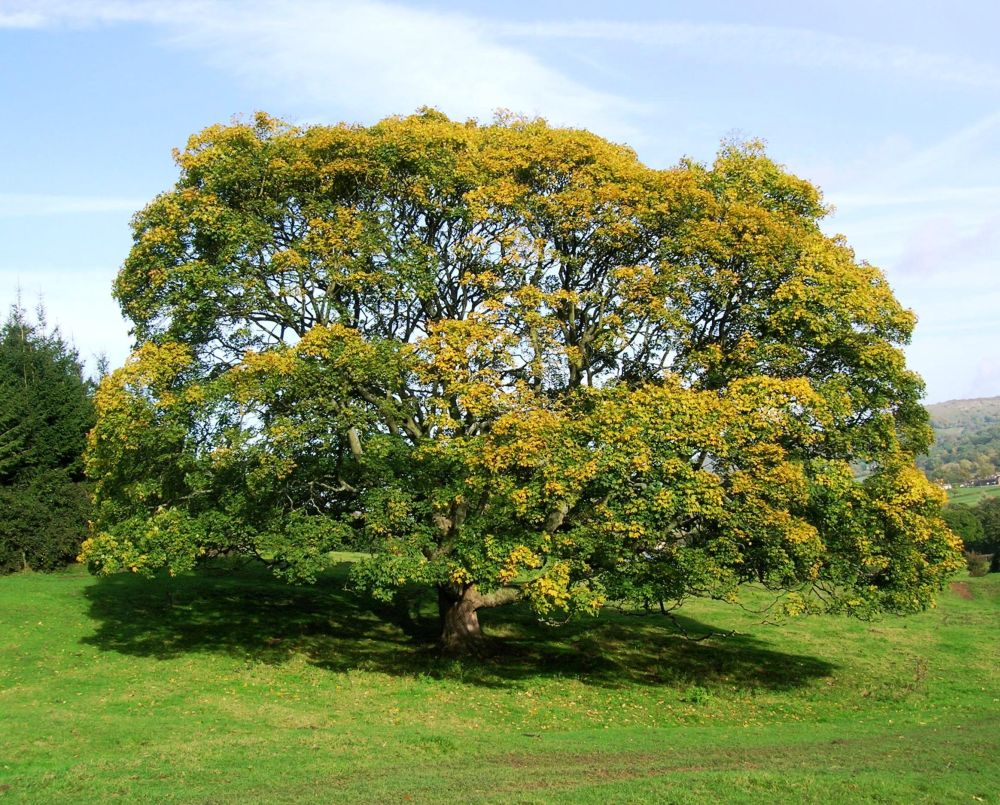
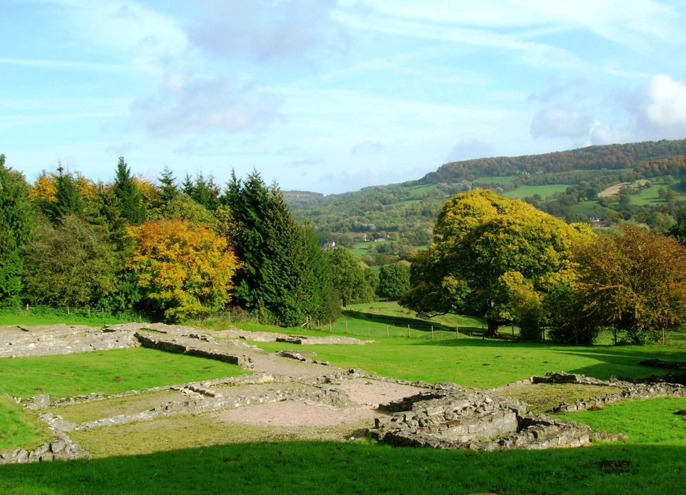
We branched off to visit Great Witcombe Roman Villa but couldn’t find it. Climbing back up the hill we stopped to have lunch by a glorious ancient oak tree. Looking behind us, we saw the Roman ruins which we’d walked straight past. The humps we were sitting on and other lumpy bits were also part of the ancient ruins.
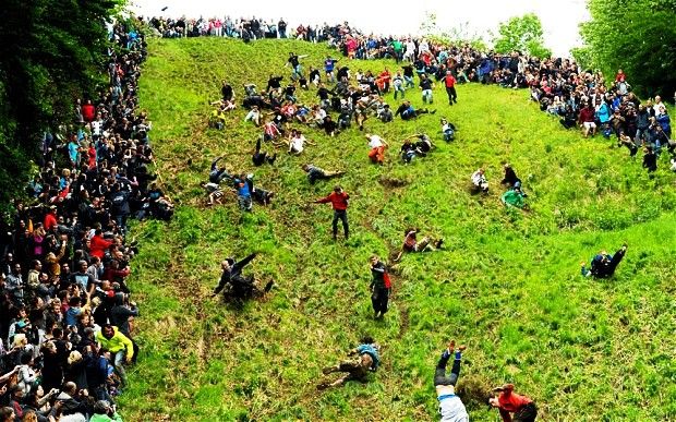
After re-joining the Cotswold Way, we came to Cooper’s Hill, famous for its cheese-rolling ceremony. This bizarre event takes place every spring bank holiday and is believed to date from the 15th century. Originally, a nine-pound round of double Gloucester cheese was rolled down the steep hill and contestants tried to catch it before it reached the bottom. To start with, it was just the villagers from Brockworth who took part but people from all over the world became interested.
It is a dangerous sport, and in 1993 four people were seriously injured. This year when safety concerns were raised, official backing was withdrawn, but the cheese-rolling proceeded as normal. In subsequent years the event would be as popular as ever, although in 2013 a foam replica of the cheese would be substituted for health and safety reasons.
After crossing the bottom of the hill, we climbed to the top to get a better feel of how steep it was. Yes, we could see why the authorities were concerned about health and safety. Incidentally, the view from the top of the hill was excellent.
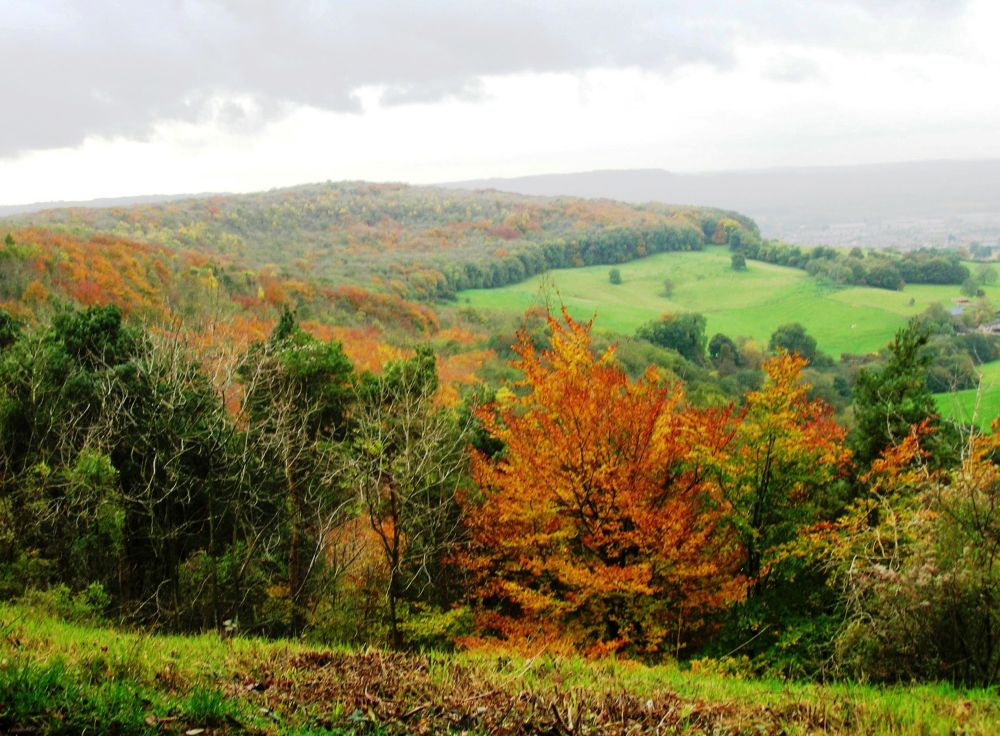
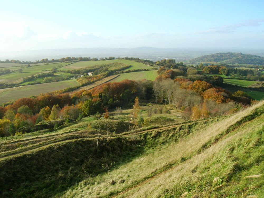
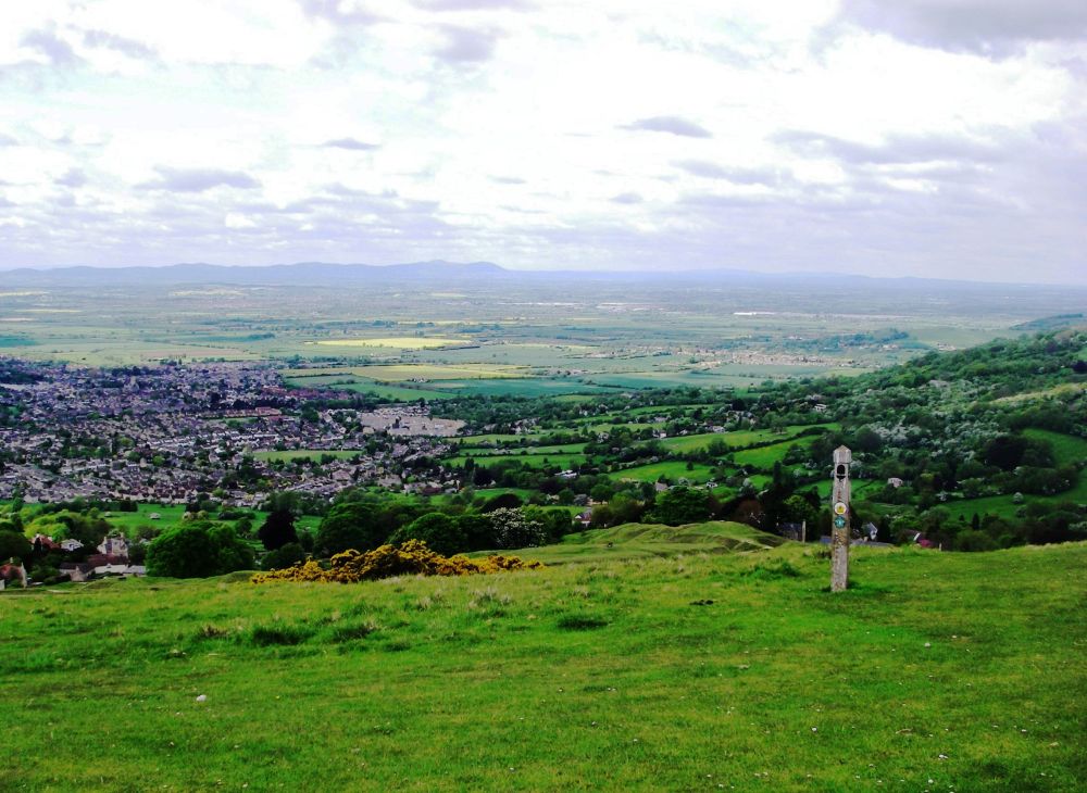
We scrunched through the fallen leaves of yet more beech woods, resplendent in their autumn colours, before coming to Painswick Beacon, the site of another hill fort. There were sweeping views across the Severn Valley around to Crinkley Hill. Some Romanian lads were also enjoying the open vista and we said ‘cheese’ while they took our photo and vice versa.
Descending to the old market town of Painswick, we had a massive piece of apple pie each in the Rococo gardens before continuing to our lodgings for the night. The building had been a shop in the 17th century and the two pillars incorporated into the front had probably been part of the medieval open-fronted market. It was full of treasures, ‘clutter’ according to the accommodation inspector. I was especially taken with a collection of purses, elaborately embroidered with minute expensive beads, hundreds of years old.
Our hostess recommended the restaurant across the road for our evening meal where we enjoyed some excellent shoulder of lamb. Afterwards we explored the old town. The buildings are of the distinctive local off-white stone, with many dating back to the time when Painswick was a centre for the cloth weaving trade.
We returned to our digs and retired to bed in our comfortable ‘cluttered’ room.
Over breakfast next morning we heard a lot more about the dreadful accommodation inspectors. If the ‘clutter’ wasn’t removed they were threatening a demotion to a two-star rating. Stars aren’t awarded for individuality.
It was raining as we left. After stocking up with pork pies and nuts at the village shop we set off across muddy fields. The rain stopped as we finally left the sludge behind, climbing out of the valley into the woods again, our trouser legs covered in mud.
By nattering as we tackled a steep hill we missed the path to Haresfield Beacon and got disorientated, thinking the next high point we came to was the Beacon. Whatever, the views were spectacular wherever we were on the escarpment. A small white Scottie dog had also got lost, passing us going in the wrong direction. The owner was standing at a path junction, whistling, so we were able to tell him which way the dog had gone.
We descended through the colourful woods, puzzling about the missing view-point, and passed Neolithic long and round barrows which we couldn’t find on the map. When we came out of the woods and saw Stroud below us much sooner than anticipated, we realised we were much further on than we thought and were amazed at how quickly we had been covering the ground. Coming to a convenient log we sat on it to kill some time and I took the opportunity to write my diary. Continuing to Stonehouse I caught an earlier train to Reading than anticipated.
Rosalind had phoned her long-suffering husband to ask him for a lift home. I left her sitting on the station platform.
May 2010
Winchcombe to Birdlip
I stayed with Rosalind and Verney overnight. We made an early start, Verney driving us to Winchcombe. This would be as far as we went on the Cotswold Way, as the next section of our trek would start heading ‘up north’ on the Wychavon Way.
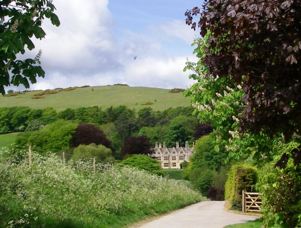
The clock struck ten as we turned onto the Cotswold Way. The route had been updated, in places deviating considerably from our out-of-date map and Rosalind’s old route book. We took a photograph of imposing Poslip Hall, situated below Cleeve Common, before we crossed the common, stopping for refreshment at the golf club.
Rosalind moved my rucksack, commenting that it was heavier than hers. Usually my rucksack is the lighter of the two. I told her that as we were only out for two days I had a few extras on board, including a small handbag. We continued our walk, enjoying the far-reaching views to the Malvern Hills with the Black Mountains beyond. It was a very hot day, so we took our time, stopping for a rest in a cowslip field in Happy Valley before wandering along the crags and through the flower-filled woods and meadows.
Our B&B was down in the valley near the Dowdeswell Reservoir. This is used as flood storage for the River Chelt, hopefully to protect the town of Cheltenham from flooding. However, in 2007 Cheltenham did flood, not from the River Chelt, but from the many little streams which flow into it in the town.
Our hostess was very chatty and moaned consistently, but her husband and the three dogs were good company. The poor puppy was always in trouble.
We had our meal in the Reservoir Inn where we compared notes with two Dutch walkers who had completed several long-distance paths in the UK. I nearly lost one of my super lightweight slip-ons while trying to cross the busy main road in a hurry, but I made it safely back. We watched ‘Have I got news for you’ and ‘Outnumbered’ from our beds before dozing off.
Next day was even hotter. We left at about 9 am and were soon climbing steeply. Lineover Wood was carpeted with wild garlic as well as bluebells. We enjoyed far-reaching views from the tops of Ravensgate Hill then Wistley Hill. A field near Leckhampton was covered with dandelion clocks.
The next hamlet on the Cotswold Way is Seven Springs, the location of the source of the River Churn. A plaque above the spring suggests that it is also the true source of the River Thames. There is a strong argument for this. It is fourteen miles further from the mouth of the Thames than the official source at Thameshead. The river from Thameshead to Cricklade often dries up in the summer whereas the Churn doesn’t. The extra distance would make the Thames the longest river in the British Isles.
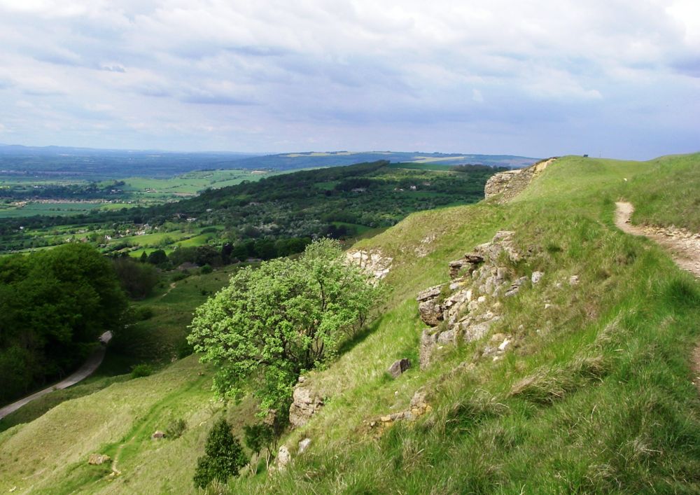
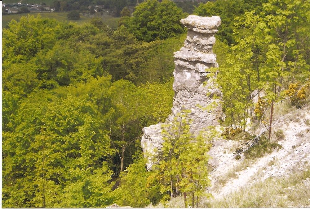
The Cotswold Way took us up and out of the valley again, meandering through the woods and past stony outcrops. We took a photo of the Devil’s Chimney, perched above a disused quarry and probably left there by quarry workers. According to legend, the Devil lives deep underground, using the chimney to let free the smoke from the fires of hell.
There was more wild garlic in the beech woods on Crinkley Hill. From here we could see right across to Painswick Beacon where we would be in October.
We continued to Birdlip Peak Before descending to the Air Balloon pub, so named because balloon trips into the unknown took off from here from the late 18th century onwards. Also taking our lives in our hands, we negotiated the main road into the woods, soon reaching Birdlip. Verney met us there and we had a meal in the gardens of the Royal George before he drove us to Stonehouse where I caught my train back to Reading.
When unpacking my rucksack, I noticed that the small handbag I had taken with me was unusually heavy. Further investigation revealed that the stitching had broken and over time about £23 in loose change had fallen through into the lining! No wonder Rosalind had commented on the weight of my rucksack.
Having completed the Cotswold Way to Winchcombe, we will now concentrate on more challenging sections of the Land’s End to John O’Groats walk. We aren’t getting any younger!